
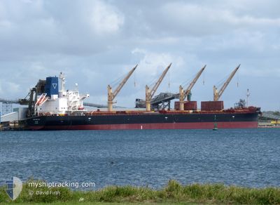
ARCH SEALTIEL
Cargo
Current Trip
| Time Travelled | 4 days |
|---|---|
| Remaining Time | --- |
| Distance Travelled | 1155.92 nm |
| Remaining Distance | --- |
| AVG Speed | 11.7 Knots |
| MAX Speed | 12.9 Knots |
| AVG Wind | 11.7 knots |
| MAX Wind | 20.9 knots |
| MIN Temp | 28.4°C / 83.12°F |
| MAX Temp | 34.6°C / 94.28°F |
| Dybgang | 10.8 m |
| Position Modtaget | 4 d siden |
Current Position
| Longitude | 57.00981° |
|---|---|
| Latitude | 24.67855° |
| Status | Under way using engine |
| Fart | 12.1 Knots |
| Kurs | 114.9° |
| Område | Gulf of Oman |
| Station | T-AIS |
| Position Modtaget | 4 d siden |
Info
Information
The current position of ARCH SEALTIEL is in Gulf of Oman with coordinates 24.67855° / 57.00981° as reported on 2024-05-30 17:35 by AIS to our vessel tracker app. The vessel's current speed is 12.1 Knots and is heading at the port of ESPERANCE. The estimated time of arrival as calculated by MyShipTracking vessel tracking app is 2024-06-18 20:00 LT
The vessel ARCH SEALTIEL (IMO: 9805661, MMSI: 538009838) is a Cargo It's sailing under the flag of [MH] Marshall Is.
In this page you can find informations about the vessels current position, last detected port calls, and current voyage information. If the vessels is not in coverage by AIS you will find the latest position.
The current position of ARCH SEALTIEL is detected by our AIS receivers and we are not responsible for the reliability of the data. The last position was recorded while the vessel was in Coverage by the Ais receivers of our vessel tracking app.
The current draught of ARCH SEALTIEL as reported by AIS is 10.8 meters
Weather
| Temperature | 29.2°C / 84.56°F |
|---|---|
| Wind Speed | 10 knots |
| Direction | 276° W |
| Pressure | 1010.8 hPa |
| Humidity | 77.9 % |
| Cloud Coverage | 87 % |
Featured Company
Last Port Calls
| Port | Arrival | Departure | Time In Port |
|---|---|---|---|
| 2024-05-27 01:29 | 2024-05-30 19:10 | 3 d | |
| 2024-05-22 15:10 | 2024-05-24 00:25 | 1 d | |
| 2024-05-15 17:17 | 2024-05-19 22:25 | 4 d | |
| 2024-05-04 00:14 | 2024-05-10 14:30 | 6 d | |
| 2024-04-27 16:14 | 2024-04-29 06:50 | 1 d | |
| 2024-04-13 17:45 | 2024-04-14 19:56 | 1 d |
Last Trips
| Origin | Departure | Destination | Arrival | Distance | |
|---|---|---|---|---|---|
| 2024-05-24 00:25 | 2024-05-27 01:29 | 240.27 nm | |||
| 2024-05-19 22:25 | 2024-05-22 15:10 | 106.84 nm | |||
| 2024-05-10 14:30 | 2024-05-15 17:17 | 1385.20 nm | |||
| 2024-04-29 06:50 | 2024-05-04 00:14 | 251.35 nm | |||
| 2024-04-14 19:56 | 2024-04-27 16:14 | 3604.49 nm | |||
| 2024-03-29 00:35 | 2024-04-13 17:45 | 3867.75 nm |
Events
| Tid | Hændelsen | Detaljer | Position / Dest | Info |
|---|---|---|---|---|
| 2024-05-31 01:30 | START Sejllads |
24.36790 / 57.74452
AUEPR
|
Fart: 5 kn Kurs: 133° |
|
| 2024-05-31 00:58 | STOP Sejllads |
24.37460 / 57.74186
AUEPR
|
Fart: 0.3 kn Kurs: 176° |
|
| 2024-05-30 17:42 | Status er ændret | Default Under way using engine |
24.66855 / 57.03323
AUEPR
|
Fart: 12.1 kn Kurs: 114.9° |
| 2024-05-30 17:35 | Udenfor Dækning |
24.67855 / 57.00981
Gulf of Oman
AUEPR
|
Fart: 12.1 kn Kurs: 114.9° |
|
| 2024-05-30 16:27 | Dybgangen er ændret | 10.8 6.9 |
24.70987 / 56.77949
AUEPR
|
Fart: 12.3 kn Kurs: 64° |
| 2024-05-30 16:27 | Destination er ændret | AUEPR OMSOH |
24.70987 / 56.77949
AUEPR
|
Fart: 12.3 kn Kurs: 64° |
| 2024-05-30 16:27 | ETA er ændret | 2024/06/18 12:00 2024/05/25 12:00 |
24.70987 / 56.77949
AUEPR
|
Fart: 12.3 kn Kurs: 64° |
| 2024-05-30 16:19 | Status er ændret | Under way using engine Default |
24.69650 / 56.75042
OMSOH
|
Fart: 12.4 kn Kurs: 72° |
| 2024-05-30 16:13 | Indenfor Dækning |
24.69811 / 56.75377
Gulf of Oman
|
Fart: 12.3 kn Kurs: 63.5° |
|
| 2024-05-30 15:10 | Afsejlet fra sidste havn |
|
24.53393 / 56.62858
OMSOH
|
Fart: 8.4 kn Kurs: 359° |