
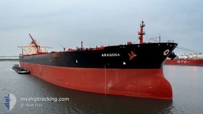
ARAGONA
Tanker
Current Trip
| Time Travelled | 12 days |
|---|---|
| Remaining Time | --- |
| Distance Travelled | 3050.15 nm |
| Remaining Distance | --- |
| AVG Speed | 9.7 Knots |
| MAX Speed | 15.2 Knots |
| AVG Wind | 13 knots |
| MAX Wind | 27 knots |
| MIN Temp | 9.5°C / 49.1°F |
| MAX Temp | 22.5°C / 72.5°F |
| Draught | 11 m |
| Position Received | 3 h, 43 m ago |
Current Position
| Longitude | -55.91374° |
|---|---|
| Latitude | 31.39099° |
| Status | Under way using engine |
| Speed | 10.3 Knots |
| Course | 251° |
| Area | North Atlantic Ocean |
| Station | T-AIS |
| Position Received | 3 h, 43 m ago |
Info
Information
The current position of ARAGONA is in North Atlantic Ocean with coordinates 31.39099° / -55.91374° as reported on 2024-05-11 17:44 by AIS to our vessel tracker app. The vessel's current speed is 10.3 Knots and is heading at the port of CORPUS CHRISTI. The estimated time of arrival as calculated by MyShipTracking vessel tracking app is 2024-05-20 19:00 LT
The vessel ARAGONA (IMO: 9513115, MMSI: 241162000) is a Tanker It's sailing under the flag of [GR] Greece.
In this page you can find informations about the vessels current position, last detected port calls, and current voyage information. If the vessels is not in coverage by AIS you will find the latest position.
The current position of ARAGONA is detected by our AIS receivers and we are not responsible for the reliability of the data. The last position was recorded while the vessel was in Coverage by the Ais receivers of our vessel tracking app.
The current draught of ARAGONA as reported by AIS is 11 meters
Weather
| Temperature | 22.5°C / 72.5°F |
|---|---|
| Wind Speed | 15 knots |
| Direction | 172° S |
| Pressure | 1015.1 hPa |
| Humidity | 87.3 % |
| Cloud Coverage | 38 % |
Featured Company
Most Visited Ports (Last year)
| Port | Arrivals | |
|---|---|---|
| 4 | ||
| 3 | ||
| 2 | ||
| 1 | ||
| 1 |
Events
| Time | Event | Details | Position / Dest | Info |
|---|---|---|---|---|
| 2024-05-11 17:49 | Status Changed | Default Under way using engine |
31.38500 / -55.92833
USCRP
|
Speed: 10.3 kn Course: 251° |
| 2024-05-11 17:44 | OUT of Coverage |
31.39099 / -55.91374
North Atlantic Ocean
USCRP
|
Speed: 10.3 kn Course: 251° |
|
| 2024-05-11 17:42 | Change Sea Area | High seas of the North Atlantic Ocean Portuguese (Azores) part of the North Atlantic Ocean |
31.39354 / -55.90516
North Atlantic Ocean
USCRP
|
Speed: 10.3 kn Course: 250.3° |
| 2024-05-11 17:41 | Status Changed | Under way using engine Default |
31.39480 / -55.90096
USCRP
|
Speed: 10 kn Course: 250° |
| 2024-05-11 17:41 | IN Coverage |
31.39354 / -55.90516
North Atlantic Ocean
USCRP
|
Speed: 10.3 kn Course: 250.3° |
|
| 2024-05-06 03:45 | Status Changed | Default Under way using engine |
38.85526 / -30.64463
USCRP
|
Speed: 8.8 kn Course: 240.9° |
| 2024-05-06 03:36 | OUT of Coverage |
38.86543 / -30.62049
North Atlantic Ocean
USCRP
|
Speed: 8.8 kn Course: 240.9° |
|
| 2024-05-06 03:25 | Status Changed | Under way using engine Default |
38.87812 / -30.59098
USCRP
|
Speed: 9 kn Course: 239° |
| 2024-05-06 03:22 | Status Changed | Default Under way using engine |
38.88267 / -30.58135
USCRP
|
Speed: 9.1 kn Course: 239.8° |
| 2024-05-06 03:13 | Status Changed | Under way using engine Default |
38.89450 / -30.55580
USCRP
|
Speed: 8.9 kn Course: 238° |