
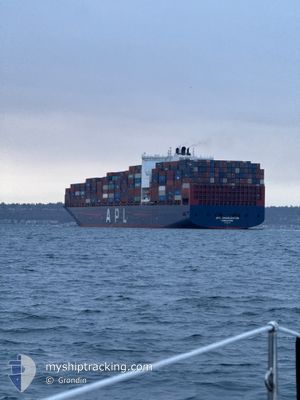
APL CHARLESTON
Container Ship
Current Trip
KRKAN
| Time Travelled | 4 days |
|---|---|
| Remaining Time | --- |
| Distance Travelled | 784.77 nm |
| Remaining Distance | --- |
| AVG Speed | 13.8 Knots |
| MAX Speed | 19.2 Knots |
| AVG Wind | 15.5 knots |
| MAX Wind | 32.5 knots |
| MIN Temp | 8.3°C / 46.94°F |
| MAX Temp | 18°C / 64.4°F |
| Draught | 12.8 m |
| Position Received | 16 d ago |
Current Position
| Longitude | --- |
|---|---|
| Latitude | --- |
| Status | Under way using engine |
| Speed | 10.2 Knots |
| Course | 211.8° |
| Area | Japan Sea |
| Station | T-AIS |
| Position Received | 16 d ago |
Info
Information
The current position of APL CHARLESTON is in Japan Sea with coordinates 34.71975° / 129.17904° as reported on 2025-02-02 15:21 by AIS to our vessel tracker app. The vessel's current speed is 10.2 Knots
The vessel APL CHARLESTON (IMO: 9597551, MMSI: 566958000) is a Container Ship that was built in 2013 ( 12 years old ). It's sailing under the flag of [SG] Singapore.
In this page you can find informations about the vessels current position, last detected port calls, and current voyage information. If the vessels is not in coverage by AIS you will find the latest position.
The current position of APL CHARLESTON is detected by our AIS receivers and we are not responsible for the reliability of the data. The last position was recorded while the vessel was in Coverage by the Ais receivers of our vessel tracking app.
The current draught of APL CHARLESTON as reported by AIS is 12.8 meters
Weather
| Temperature | 8.3°C / 46.94°F |
|---|---|
| Wind Speed | 10 knots |
| Direction | 63° ENE |
| Pressure | 1028.8 hPa |
| Humidity | 61.3 % |
| Cloud Coverage | 90 % |
Featured Company
Last Port Calls
| Port | Arrival | Departure | Time In Port |
|---|---|---|---|
| 2025-02-13 17:37 | 2025-02-14 04:40 | 11 h | |
| 2025-02-02 22:57 | 2025-02-03 11:13 | 12 h | |
| 2025-01-15 13:34 | 2025-01-19 10:11 | 3 d | |
| 2025-01-11 22:01 | 2025-01-15 03:49 | 3 d | |
| 2024-12-26 05:54 | 2024-12-27 19:48 | 1 d | |
| 2024-12-12 14:28 | 2024-12-13 09:13 | 18 h |
Most Visited Ports (Last year)
| Port | Arrivals | |
|---|---|---|
| 4 | ||
| 4 | ||
| 3 | ||
| 3 | ||
| 2 | ||
| 2 |
Last Trips
| Origin | Departure | Destination | Arrival | Distance | |
|---|---|---|---|---|---|
| 2025-02-03 20:13 | 2025-02-14 01:37 | 3008.97 nm | |||
| 2025-01-19 02:11 | 2025-02-03 07:57 | 4820.33 nm | |||
| 2025-01-14 19:49 | 2025-01-15 05:34 | 160.96 nm | |||
| 2024-12-28 04:48 | 2025-01-11 14:01 | 4831.73 nm | |||
| 2024-12-13 18:13 | 2024-12-26 14:54 | 2099.61 nm | |||
| 2024-11-30 03:41 | 2024-12-12 23:28 | 4770.08 nm |
Events
| Time | Event | Details | Position / Dest | Info |
|---|---|---|---|---|
| 2025-02-17 09:46 | START Moving | 4.51 nm, North West of ZHANGZHOU |
24.44861 / 117.98016
KRKAN
|
Speed: 3.6 kn Course: 112° |
| 2025-02-16 08:53 | STOP Moving | 4.63 nm, North West of ZHANGZHOU |
24.45266 / 117.98003
KRKAN
|
Speed: 0.3 kn Course: 283° |
| 2025-02-16 05:49 | START Moving |
24.11877 / 118.32508
KRKAN
|
Speed: 4.7 kn Course: 356° |
|
| 2025-02-15 02:37 | STOP Moving |
24.12080 / 118.32670
KRKAN
|
Speed: 0.1 kn Course: 169° |
|
| 2025-02-14 04:49 | START Moving | 1.42 nm, East of YANTIAN |
22.56381 / 114.29088
KRKAN
|
Speed: 4.5 kn Course: 89° |
| 2025-02-14 04:40 | PORT DEPARTURE |
|
22.56306 / 114.28793
KRKAN
|
Speed: 2.1 kn Course: 291° |
| 2025-02-13 17:37 | STOP Moving |
22.56624 / 114.28545
[CN] YANTIAN
|
Speed: 0.3 kn Course: 271° |
|
| 2025-02-13 17:37 | PORT ARRIVAL |
|
22.56624 / 114.28545
[CN] YANTIAN
|
Speed: 0.8 kn Course: 272° |
| 2025-02-09 13:08 | START Moving | 3.52 nm, South West of CAI MEP |
10.49015 / 106.99729
KRKAN
|
Speed: 6.3 kn Course: 185° |
| 2025-02-09 08:10 | STOP Moving | 3.21 nm, South West of CAI MEP |
10.49412 / 107.00073
KRKAN
|
Speed: Course: 1° |