
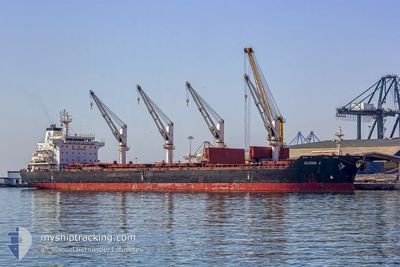
APHRODITE M
Bulk Carrier
Current Trip
NGPHC
| Time Travelled | 18 days |
|---|---|
| Remaining Time | --- |
| Distance Travelled | 2988.96 nm |
| Remaining Distance | --- |
| AVG Speed | 9.5 Knots |
| MAX Speed | 12.6 Knots |
| AVG Wind | 12.8 knots |
| MAX Wind | 31 knots |
| MIN Temp | 16.3°C / 61.34°F |
| MAX Temp | 28.7°C / 83.66°F |
| Draught | 9.1 m |
| Position Received | 16 d ago |
Current Position
| Longitude | --- |
|---|---|
| Latitude | --- |
| Status | Under way using engine |
| Speed | 11.3 Knots |
| Course | 197.5° |
| Area | North Atlantic Ocean |
| Station | T-AIS |
| Position Received | 16 d ago |
Info
Information
The current position of APHRODITE M is in North Atlantic Ocean with coordinates 27.87014° / -16.41814° as reported on 2025-01-31 17:34 by AIS to our vessel tracker app. The vessel's current speed is 11.3 Knots
The vessel APHRODITE M (IMO: 9450832, MMSI: 538003690) is a Bulk Carrier that was built in 2011 ( 14 years old ). It's sailing under the flag of [MH] Marshall Is.
In this page you can find informations about the vessels current position, last detected port calls, and current voyage information. If the vessels is not in coverage by AIS you will find the latest position.
The current position of APHRODITE M is detected by our AIS receivers and we are not responsible for the reliability of the data. The last position was recorded while the vessel was in Coverage by the Ais receivers of our vessel tracking app.
The current draught of APHRODITE M as reported by AIS is 9.1 meters
Weather
| Temperature | 28.5°C / 83.3°F |
|---|---|
| Wind Speed | 9 knots |
| Direction | 208° SSW |
| Pressure | 1008.1 hPa |
| Humidity | 72.3 % |
| Cloud Coverage | 100 % |
Featured Company
Events
| Time | Event | Details | Position / Dest | Info |
|---|---|---|---|---|
| 2025-02-15 10:56 | STOP Moving |
2.70579 / 1.42738
NGPHC
|
Speed: 0.3 kn Course: 204° |
|
| 2025-02-15 07:35 | START Moving |
2.81650 / 1.65409
NGPHC
|
Speed: 4.2 kn Course: 233° |
|
| 2025-02-13 13:47 | STOP Moving |
2.69965 / 1.51142
NGPHC
|
Speed: 0.3 kn Course: 279° |
|
| 2025-02-13 08:10 | START Moving |
2.82221 / 1.73377
NGPHC
|
Speed: 8.9 kn Course: 243° |
|
| 2025-02-12 10:40 | STOP Moving |
2.69565 / 1.64768
NGPHC
|
Speed: 0.3 kn Course: 231° |
|
| 2025-02-12 09:28 | START Moving |
2.69961 / 1.64074
NGPHC
|
Speed: 3.2 kn Course: 140° |
|
| 2025-02-12 08:18 | STOP Moving |
2.69374 / 1.63069
NGPHC
|
Speed: 0.3 kn Course: 182° |
|
| 2025-02-12 05:57 | START Moving |
2.87221 / 1.61979
NGPHC
|
Speed: 4 kn Course: 219° |
|
| 2025-02-10 09:59 | STOP Moving |
2.70811 / 1.51090
NGPHC
|
Speed: 0.3 kn Course: 222° |
|
| 2025-02-10 08:13 | START Moving |
2.84428 / 1.45660
NGPHC
|
Speed: 3.8 kn Course: 163° |