

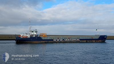
ANITA
General Cargo

Current Trip
| Time Travelled | 51 mins |
|---|---|
| Remaining Time | 13 h, 15 mins |
| Distance Travelled | 7.94 nm |
| Remaining Distance | 149.84 nm |
| AVG Speed | 11.3 Knots |
| MAX Speed | 11.4 Knots |
| AVG Wind | 6.7 knots |
| MAX Wind | 7.2 knots |
| MIN Temp | 6.9°C / 44.42°F |
| MAX Temp | 7.1°C / 44.78°F |
| Draught | 3.3 m |
| Position Received | Now |
Current Position
| Longitude | --- |
|---|---|
| Latitude | --- |
| Status | Under way using engine |
| Speed | 11.4 Knots |
| Course | 128.5° |
| Area | North Sea |
| Station | T-AIS |
| Position Received | Now |
Information
The current position of ANITA is in North Sea with coordinates 54.75321° / -1.10736° as reported on 2025-03-25 23:21 by AIS to our vessel tracker app. The vessel's current speed is 11.4 Knots and is heading at the port of BOSTON. The estimated time of arrival as calculated by MyShipTracking vessel tracking app is 2025-03-26 12:37 LT
The vessel ANITA (IMO: 9479577, MMSI: 244615976) is a General Cargo that was built in 2013 ( 12 years old ). It's sailing under the flag of [NL] Netherlands.
In this page you can find informations about the vessels current position, last detected port calls, and current voyage information. If the vessels is not in coverage by AIS you will find the latest position.
The current position of ANITA is detected by our AIS receivers and we are not responsible for the reliability of the data. The last position was recorded while the vessel was in Coverage by the Ais receivers of our vessel tracking app.
The current draught of ANITA as reported by AIS is 3.3 meters
Weather
| Temperature | 7.6°C / 45.68°F |
|---|---|
| Wind Speed | 8 knots |
| Direction | 227° SW |
| Pressure | 1023.9 hPa |
| Humidity | 86.7 % |
| Cloud Coverage | 23 % |


Featured Company
Last Port Calls
| Port | Arrival | Departure | Time In Port |
|---|---|---|---|
| 2025-03-24 10:51 | 2025-03-25 22:31 | 1 d | |
| 2025-03-20 05:59 | 2025-03-21 20:10 | 1 d | |
| 2025-03-16 14:20 | 2025-03-19 12:06 | 2 d | |
| 2025-03-13 17:38 | 2025-03-13 20:43 | 3 h | |
| 2025-03-09 21:27 | 2025-03-10 04:56 | 7 h | |
| 2025-03-06 21:55 | 2025-03-07 23:46 | 1 d | |
| 2025-03-05 15:19 | 2025-03-05 21:11 | 5 h | |
| 2025-03-03 06:31 | 2025-03-03 21:23 | 14 h | |
| 2025-02-27 16:27 | 2025-03-01 23:00 | 2 d | |
| 2025-02-22 11:43 | 2025-02-25 04:13 | 2 d |
Last Trips
| Origin | Departure | Destination | Arrival | Distance | |
|---|---|---|---|---|---|
| 2025-03-21 20:10 | 2025-03-24 10:51 | 307.64 nm | |||
| 2025-03-19 12:06 | 2025-03-20 05:59 | 137.53 nm | |||
| 2025-03-13 20:43 | 2025-03-16 14:20 | 259.91 nm | |||
| 2025-03-10 04:56 | 2025-03-13 17:38 | 34.87 nm | |||
| 2025-03-07 23:46 | 2025-03-09 21:27 | 388.14 nm | |||
| 2025-03-05 21:11 | 2025-03-06 21:55 | 208.43 nm | |||
| 2025-03-03 21:23 | 2025-03-05 15:19 | 142.28 nm | |||
| 2025-03-01 23:00 | 2025-03-03 06:31 | 290.10 nm | |||
| 2025-02-25 04:13 | 2025-02-27 16:27 | 163.10 nm | |||
| 2025-02-21 20:06 | 2025-02-22 11:43 | 155.76 nm |
Events
| Time | Event | Details | Position / Dest | Info |
|---|---|---|---|---|
| 2025-03-25 23:07 | Draught Changed | 3.3 4.2 |
54.78122 / -1.16822
BOSTON/U.K.
|
Speed: 11.3 kn Course: 126.9° |
| 2025-03-25 23:07 | Destination Changed | BOSTON/U.K. SEAHAM/U.K. |
54.78122 / -1.16822
BOSTON/U.K.
|
Speed: 11.3 kn Course: 126.9° |
| 2025-03-25 23:07 | ETA Changed | 2025/03/26 14:00 2025/03/24 10:00 |
54.78122 / -1.16822
BOSTON/U.K.
|
Speed: 11.3 kn Course: 126.9° |
| 2025-03-25 22:44 | Status Changed | Under way using engine Default |
54.82319 / -1.27120
SEAHAM/U.K.
|
Speed: 10.9 kn Course: 127° |
| 2025-03-25 22:40 | Status Changed | Default Under way using engine |
54.83035 / -1.28850
SEAHAM/U.K.
|
Speed: 4.8 kn Course: 119° |
| 2025-03-25 22:33 | Status Changed | Under way using engine Default |
54.83873 / -1.31264
SEAHAM/U.K.
|
Speed: 4.4 kn Course: 66° |
| 2025-03-25 22:32 | Status Changed | Default Under way using engine |
54.83857 / -1.31519
SEAHAM/U.K.
|
Speed: 4.1 kn Course: 43° |
| 2025-03-25 22:31 | Status Changed | Under way using engine Default |
54.83805 / -1.31608
SEAHAM/U.K.
|
Speed: 3.4 kn Course: 87° |
| 2025-03-25 22:31 | PORT DEPARTURE |
|
54.83805 / -1.31608
SEAHAM/U.K.
|
Speed: 3.4 kn Course: 87° |
| 2025-03-25 22:28 | START Moving |
54.83725 / -1.32222
[GB] SEAHAM
|
Speed: 3.4 kn Course: 87° |