
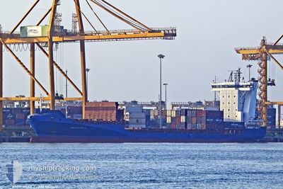
ANDROMEDA J
Container Ship
Current Trip
| Time Travelled | 2 days |
|---|---|
| Remaining Time | 17 h, 50 mins |
| Distance Travelled | 367.58 nm |
| Remaining Distance | 249.07 nm |
| AVG Speed | 11 Knots |
| MAX Speed | 16.2 Knots |
| AVG Wind | 14.1 knots |
| MAX Wind | 18.7 knots |
| MIN Temp | 8.5°C / 47.3°F |
| MAX Temp | 12.1°C / 53.78°F |
| Draught | 7.1 m |
| Position Received | 25 m ago |
Current Position
| Longitude | --- |
|---|---|
| Latitude | --- |
| Status | Under way using engine |
| Speed | 12.3 Knots |
| Course | 261.8° |
| Area | English Channel |
| Station | T-AIS |
| Position Received | 25 m ago |
Info
Information
The current position of ANDROMEDA J is in English Channel with coordinates 50.07785° / -4.09987° as reported on 2025-12-13 10:36 by AIS to our vessel tracker app. The vessel's current speed is 12.3 Knots and is heading at the port of DUBLIN. The estimated time of arrival as calculated by MyShipTracking vessel tracking app is 2025-12-14 04:51 LT
The vessel ANDROMEDA J (IMO: 9355422, MMSI: 209850000) is a Container Ship that was built in 2006 ( 19 years old ). It's sailing under the flag of [CY] Cyprus.
In this page you can find informations about the vessels current position, last detected port calls, and current voyage information. If the vessels is not in coverage by AIS you will find the latest position.
The current position of ANDROMEDA J is detected by our AIS receivers and we are not responsible for the reliability of the data. The last position was recorded while the vessel was in Coverage by the Ais receivers of our vessel tracking app.
The current draught of ANDROMEDA J as reported by AIS is 7.1 meters
Weather
| Temperature | 11.5°C / 52.7°F |
|---|---|
| Wind Speed | 11 knots |
| Direction | 223° SW |
| Pressure | 1028.4 hPa |
| Humidity | 69.4 % |
| Cloud Coverage | 26 % |
Featured Company
Last Port Calls
| Port | Arrival | Departure | Time In Port |
|---|---|---|---|
| 2025-12-09 18:06 | 2025-12-10 18:50 | 1 d | |
| 2025-12-09 16:55 | 2025-12-09 17:49 | 54 m | |
| 2025-12-07 06:59 | 2025-12-07 20:32 | 13 h | |
| 2025-12-04 10:05 | 2025-12-04 13:35 | 3 h | |
| 2025-12-04 09:48 | 2025-12-04 09:56 | 7 m | |
| 2025-11-29 21:53 | 2025-12-02 22:01 | 3 d | |
| 2025-11-27 02:48 | 2025-11-27 14:29 | 11 h | |
| 2025-11-25 11:19 | 2025-11-26 04:22 | 17 h | |
| 2025-11-25 10:42 | 2025-11-25 10:50 | 8 m | |
| 2025-11-21 12:57 | 2025-11-23 00:01 | 1 d |
Last Trips
| Origin | Departure | Destination | Arrival | Distance | |
|---|---|---|---|---|---|
| 2025-12-09 17:49 | 2025-12-09 18:06 | 0.56 nm | |||
| 2025-12-07 20:32 | 2025-12-09 16:55 | 638.58 nm | |||
| 2025-12-04 13:35 | 2025-12-07 06:59 | 297.43 nm | |||
| 2025-12-04 09:56 | 2025-12-04 10:05 | 2.00 nm | |||
| 2025-12-02 22:01 | 2025-12-04 09:48 | 557.95 nm | |||
| 2025-11-27 14:29 | 2025-11-29 21:53 | 589.38 nm | |||
| 2025-11-26 04:22 | 2025-11-27 02:48 | 171.43 nm | |||
| 2025-11-25 10:50 | 2025-11-25 11:19 | 2.92 nm | |||
| 2025-11-23 00:01 | 2025-11-25 10:42 | 537.39 nm | |||
| 2025-11-19 20:01 | 2025-11-21 12:57 | 586.63 nm |
Events
| Time | Event | Details | Position / Dest | Info |
|---|---|---|---|---|
| 2025-12-13 10:43 | Status Changed | Default Under way using engine |
50.07343 / -4.13701
IEDUB
|
Speed: 12.3 kn Course: 261.8° |
| 2025-12-13 10:24 | Status Changed | Under way using engine Default |
50.08472 / -4.03677
IEDUB
|
Speed: 12 kn Course: 260° |
| 2025-12-13 10:15 | Status Changed | Default Under way using engine |
50.08976 / -3.99091
IEDUB
|
Speed: 12.5 kn Course: 258.7° |
| 2025-12-13 10:07 | Status Changed | Under way using engine Default |
50.09434 / -3.94858
IEDUB
|
Speed: 12.7 kn Course: 259° |
| 2025-12-13 09:59 | IN Coverage |
50.09352 / -3.95592
English Channel
IEDUB
|
Speed: 12.5 kn Course: 258.7° |
|
| 2025-12-13 05:03 | Status Changed | Default Under way using engine |
50.30838 / -2.20602
IEDUB
|
Speed: 12 kn Course: 261.1° |
| 2025-12-13 04:58 | Status Changed | Under way using engine Default |
50.31214 / -2.17820
IEDUB
|
Speed: 12 kn Course: 257° |
| 2025-12-13 04:58 | OUT of Coverage |
50.31214 / -2.17820
English Channel
IEDUB
|
Speed: 12 kn Course: 261.1° |
|
| 2025-12-13 04:51 | Status Changed | Default Under way using engine |
50.31670 / -2.14474
IEDUB
|
Speed: 12.2 kn Course: 259.2° |
| 2025-12-13 04:36 | Status Changed | Under way using engine Default |
50.32708 / -2.06929
IEDUB
|
Speed: 11.9 kn Course: 253° |