

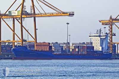
ANDROMEDA J
Container Ship

Current Trip
| Time Travelled | 18 h, 3 mins |
|---|---|
| Remaining Time | 20 h, 21 mins |
| Distance Travelled | 288.93 nm |
| Remaining Distance | 360.12 nm |
| AVG Speed | 15.7 Knots |
| MAX Speed | 18.5 Knots |
| AVG Wind | 13.8 knots |
| MAX Wind | 19 knots |
| MIN Temp | 7.8°C / 46.04°F |
| MAX Temp | 9.8°C / 49.64°F |
| Dybgang | 6.3 m |
| Position Modtaget | Nu |
Current Position
| Longitude | --- |
|---|---|
| Latitude | --- |
| Status | Under way using engine |
| Fart | 16.7 Knots |
| Kurs | 77.6° |
| Område | English Channel |
| Station | T-AIS |
| Position Modtaget | Nu |
Information
The current position of ANDROMEDA J is in English Channel with coordinates 50.01668° / -4.20167° as reported on 2025-03-29 08:18 by AIS to our vessel tracker app. The vessel's current speed is 16.7 Knots and is heading at the port of ROTTERDAM. The estimated time of arrival as calculated by MyShipTracking vessel tracking app is 2025-03-30 06:40 LT
The vessel ANDROMEDA J (IMO: 9355422, MMSI: 209850000) is a Container Ship that was built in 2006 ( 19 år gamle ). It's sailing under the flag of [CY] Cyprus.
In this page you can find informations about the vessels current position, last detected port calls, and current voyage information. If the vessels is not in coverage by AIS you will find the latest position.
The current position of ANDROMEDA J is detected by our AIS receivers and we are not responsible for the reliability of the data. The last position was recorded while the vessel was in Coverage by the Ais receivers of our vessel tracking app.
The current draught of ANDROMEDA J as reported by AIS is 6.3 meters
Weather
| Temperature | 9°C / 48.2°F |
|---|---|
| Wind Speed | 8 knots |
| Direction | 295° WNW |
| Pressure | 1024.5 hPa |
| Humidity | 68.4 % |
| Cloud Coverage | 53 % |


Featured Company
Last Port Calls
| Port | Arrival | Departure | Time In Port |
|---|---|---|---|
| 2025-03-28 00:01 | 2025-03-28 14:16 | 14 h | |
| 2025-03-25 16:08 | 2025-03-26 01:52 | 9 h | |
| 2025-03-25 15:09 | 2025-03-25 15:52 | 42 m | |
| 2025-03-23 06:38 | 2025-03-23 20:20 | 13 h | |
| 2025-03-21 11:51 | 2025-03-21 12:26 | 34 m | |
| 2025-03-20 20:31 | 2025-03-21 11:51 | 15 h | |
| 2025-03-20 18:54 | 2025-03-20 20:14 | 1 h | |
| 2025-03-18 11:34 | 2025-03-18 23:18 | 11 h | |
| 2025-03-16 19:02 | 2025-03-16 19:39 | 37 m | |
| 2025-03-16 08:22 | 2025-03-16 19:01 | 10 h |
Last Trips
| Origin | Departure | Destination | Arrival | Distance | |
|---|---|---|---|---|---|
| 2025-03-26 01:52 | 2025-03-28 00:01 | 639.62 nm | |||
| 2025-03-25 15:52 | 2025-03-25 16:08 | 0.61 nm | |||
| 2025-03-23 20:20 | 2025-03-25 15:09 | 644.63 nm | |||
| 2025-03-21 12:26 | 2025-03-23 06:38 | 644.71 nm | |||
| 2025-03-20 20:14 | 2025-03-21 11:51 | 1.71 nm | |||
| 2025-03-20 20:14 | 2025-03-20 20:31 | 0.56 nm | |||
| 2025-03-18 23:18 | 2025-03-20 18:54 | 643.99 nm | |||
| 2025-03-16 19:39 | 2025-03-18 11:34 | 627.79 nm | |||
| 2025-03-16 08:07 | 2025-03-16 19:02 | 1.66 nm | |||
| 2025-03-16 08:07 | 2025-03-16 08:22 | 0.59 nm |
Events
| Tid | Hændelsen | Detaljer | Position / Dest | Info |
|---|---|---|---|---|
| 2025-03-29 05:56 | Status er ændret | Under way using engine Default |
49.89422 / -5.24463
NLRTM
|
Fart: 18 kn Kurs: 95° |
| 2025-03-29 05:48 | Status er ændret | Default Under way using engine |
49.89623 / -5.30642
NLRTM
|
Fart: 17.8 kn Kurs: 95.8° |
| 2025-03-29 05:42 | Status er ændret | Under way using engine Default |
49.89795 / -5.35422
NLRTM
|
Fart: 18 kn Kurs: 92° |
| 2025-03-29 05:40 | Status er ændret | Default Under way using engine |
49.89838 / -5.36798
NLRTM
|
Fart: 17.3 kn Kurs: 92.3° |
| 2025-03-29 05:29 | Status er ændret | Under way using engine Default |
49.90066 / -5.45365
NLRTM
|
Fart: 17.9 kn Kurs: 95° |
| 2025-03-29 05:24 | Status er ændret | Default Under way using engine |
49.90125 / -5.49097
NLRTM
|
Fart: 18.2 kn Kurs: 91.3° |
| 2025-03-29 05:13 | Ændre havområde | United Kingdom part of the English Channel United Kingdom part of the Celtic Sea |
49.90165 / -5.57126
English Channel
NLRTM
|
Fart: 17.5 kn Kurs: 91.1° |
| 2025-03-29 05:10 | Status er ændret | Under way using engine Default |
49.90172 / -5.59577
NLRTM
|
Fart: 17.8 kn Kurs: 94° |
| 2025-03-29 04:52 | Indenfor Dækning |
49.90172 / -5.59577
Celtic Sea
NLRTM
|
Fart: 17.9 kn Kurs: 90.8° |
|
| 2025-03-29 02:52 | Udenfor Dækning |
50.26673 / -6.01457
Celtic Sea
NLRTM
|
Fart: 14.1 kn Kurs: 196.3° |