
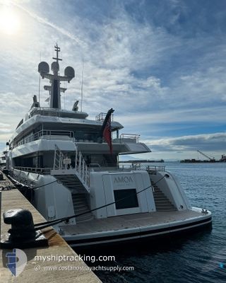
AMOA
Pleasure Craft
Current Trip
| Time Travelled | 5 days |
|---|---|
| Remaining Time | 6 days |
| Distance Travelled | 16.34 nm |
| Remaining Distance | 3234.94 nm |
| AVG Speed | 10.2 Knots |
| MAX Speed | 11.9 Knots |
| AVG Wind | 10 knots |
| MAX Wind | 13 knots |
| MIN Temp | 26.6°C / 79.88°F |
| MAX Temp | 26.7°C / 80.06°F |
| Draught | 3.7 m |
| Position Received | 5 d ago |
Current Position
| Longitude | -62.87944° |
|---|---|
| Latitude | 18.00647° |
| Status | Under way using engine |
| Speed | 10.9 Knots |
| Course | 69.9° |
| Area | Caribbean Sea |
| Station | T-AIS |
| Position Received | 5 d ago |
Info
Information
The current position of AMOA is in Caribbean Sea with coordinates 18.00647° / -62.87944° as reported on 2024-04-27 18:56 by AIS to our vessel tracker app. The vessel's current speed is 10.9 Knots and is heading at the port of GIBRALTAR. The estimated time of arrival as calculated by MyShipTracking vessel tracking app is 2024-05-09 21:19 LT
The vessel AMOA (IMO: 9856036, MMSI: 319271300) is a Pleasure Craft It's sailing under the flag of [KY] Cayman Is.
In this page you can find informations about the vessels current position, last detected port calls, and current voyage information. If the vessels is not in coverage by AIS you will find the latest position.
The current position of AMOA is detected by our AIS receivers and we are not responsible for the reliability of the data. The last position was recorded while the vessel was in Coverage by the Ais receivers of our vessel tracking app.
The current draught of AMOA as reported by AIS is 3.7 meters
Weather
| Temperature | 26.7°C / 80.06°F |
|---|---|
| Wind Speed | 8 knots |
| Direction | 58° ENE |
| Pressure | 1013.3 hPa |
| Humidity | 71.1 % |
| Cloud Coverage | 98 % |
Featured Company
Last Port Calls
| Port | Arrival | Departure | Time In Port |
|---|---|---|---|
| 2024-04-21 13:37 | 2024-04-27 14:35 | 6 d | |
| 2024-04-18 23:02 | 2024-04-19 18:30 | 19 h | |
| 2024-04-16 22:16 | 2024-04-18 12:36 | 1 d | |
| 2024-04-14 22:22 | 2024-04-16 12:39 | 1 d | |
| 2024-04-10 21:12 | 2024-04-13 12:37 | 2 d | |
| 2024-03-05 13:21 | 2024-04-09 12:55 | ||
| 2024-03-05 12:36 |
Last Trips
| Origin | Departure | Destination | Arrival | Distance | |
|---|---|---|---|---|---|
| 2024-04-19 14:30 | 2024-04-21 09:37 | 59.52 nm | |||
| 2024-04-18 08:36 | 2024-04-18 19:02 | 25.60 nm | |||
| 2024-04-16 08:39 | 2024-04-16 18:16 | 23.87 nm | |||
| 2024-04-13 08:37 | 2024-04-14 18:22 | 37.06 nm | |||
| 2024-04-09 08:55 | 2024-04-10 17:12 | 24.76 nm | |||
| 2024-03-05 08:36 | 2024-03-05 09:21 | 1.88 nm |
Events
| Time | Event | Details | Position / Dest | Info |
|---|---|---|---|---|
| 2024-04-27 18:56 | OUT of Coverage |
18.00647 / -62.87944
Caribbean Sea
|
Speed: 10.9 kn Course: 69.9° |
|
| 2024-04-27 18:23 | Change Sea Area | Saint-Martin part of the Caribbean Sea Sint-Maarten part of the Caribbean Sea |
17.98320 / -62.98185
Caribbean Sea
|
Speed: 11 kn Course: 77.3° |
| 2024-04-27 18:08 | Destination Changed | GIBRALTAR ST MAARTEN |
17.97275 / -63.03068
GIBRALTAR
|
Speed: 10.9 kn Course: 77.9° |
| 2024-04-27 17:43 | Status Changed | Under way using engine Moored |
17.99982 / -63.10100
ST MAARTEN
|
Speed: 11.9 kn Course: 162.7° |
| 2024-04-27 17:31 | START Moving | 0.92 nm, South West of ST MAARTEN |
18.02605 / -63.10283
ST MAARTEN
|
Speed: 3.7 kn Course: 190° |
| 2024-04-27 14:50 | STOP Moving | 0.79 nm, South West of ST MAARTEN |
18.02830 / -63.10205
ST MAARTEN
|
Speed: 0.3 kn Course: 169° |
| 2024-04-27 14:36 | START Moving | 0.29 nm, South West of ST MAARTEN |
18.03479 / -63.09636
ST MAARTEN
|
Speed: 3.6 kn Course: 236° |
| 2024-04-27 14:35 | PORT DEPARTURE |
|
18.03479 / -63.09636
ST MAARTEN
|
Speed: 1.6 kn Course: 243° |