
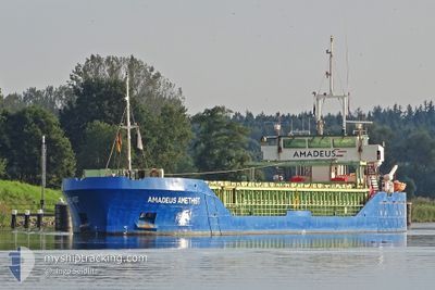
AMADEUS AMETHIST
General Cargo
Current Trip
| Time Travelled | 17 h, 44 mins |
|---|---|
| Remaining Time | --- |
| Distance Travelled | 113.91 nm |
| Remaining Distance | --- |
| AVG Speed | 7.2 Knots |
| MAX Speed | 9.8 Knots |
| AVG Wind | 7.9 knots |
| MAX Wind | 16 knots |
| MIN Temp | 8.4°C / 47.12°F |
| MAX Temp | 14.3°C / 57.74°F |
| Draught | 4 m |
| Position Received | 1 m ago |
Current Position
| Longitude | 9.14473° |
|---|---|
| Latitude | 53.89300° |
| Status | Under way using engine |
| Speed | |
| Course | 229° |
| Area | North Sea |
| Station | T-AIS |
| Position Received | 1 m ago |
Info
Information
The current position of AMADEUS AMETHIST is in North Sea with coordinates 53.89300° / 9.14473° as reported on 2024-04-28 08:55 by AIS to our vessel tracker app. The vessel's current speed is 0 Knots and is heading at the port of GENK. The estimated time of arrival as calculated by MyShipTracking vessel tracking app is 2024-04-30 12:00 LT
The vessel AMADEUS AMETHIST (IMO: 9223435, MMSI: 244870673) is a General Cargo that was built in 2000 ( 24 years old ). It's sailing under the flag of [NL] Netherlands.
In this page you can find informations about the vessels current position, last detected port calls, and current voyage information. If the vessels is not in coverage by AIS you will find the latest position.
The current position of AMADEUS AMETHIST is detected by our AIS receivers and we are not responsible for the reliability of the data. The last position was recorded while the vessel was in Coverage by the Ais receivers of our vessel tracking app.
The current draught of AMADEUS AMETHIST as reported by AIS is 4 meters
Weather
| Temperature | 14.7°C / 58.46°F |
|---|---|
| Wind Speed | 12 knots |
| Direction | 149° SSE |
| Pressure | 1008.2 hPa |
| Humidity | 75.8 % |
| Cloud Coverage | 100 % |
Featured Company
Last Port Calls
| Port | Arrival | Departure | Time In Port |
|---|---|---|---|
| 2024-04-26 13:37 | 2024-04-27 15:13 | 1 d | |
| 2024-04-24 09:32 | 2024-04-25 12:46 | 1 d | |
| 2024-04-19 15:22 | 2024-04-20 11:44 | 20 h | |
| 2024-04-18 18:42 | 2024-04-18 23:31 | 4 h | |
| 2024-04-16 19:19 | 2024-04-16 21:27 | 2 h | |
| 2024-04-06 20:14 | 2024-04-06 20:18 | 3 m | |
| 2024-04-03 23:33 | 2024-04-05 00:29 | 1 d | |
| 2024-04-02 04:29 | 2024-04-02 07:28 | 2 h | |
| 2024-03-24 07:37 | 2024-03-26 14:48 | 2 d | |
| 2024-03-19 13:15 | 2024-03-20 14:05 | 1 d |
Most Visited Ports (Last year)
| Port | Arrivals | |
|---|---|---|
| 12 | ||
| 6 | ||
| 6 | ||
| 4 | ||
| 4 | ||
| 3 |
Last Trips
| Origin | Departure | Destination | Arrival | Distance | |
|---|---|---|---|---|---|
| 2024-04-25 14:46 | 2024-04-26 15:37 | 247.24 nm | |||
| 2024-04-20 13:44 | 2024-04-24 11:32 | 648.85 nm | |||
| 2024-04-19 01:31 | 2024-04-19 17:22 | 130.91 nm | |||
| 2024-04-16 23:27 | 2024-04-18 20:42 | 89.27 nm | |||
| 2024-04-06 22:18 | 2024-04-16 21:19 | 1636.47 nm | |||
| 2024-04-05 02:29 | 2024-04-06 22:14 | 389.03 nm | |||
| 2024-04-02 09:28 | 2024-04-04 01:33 | 87.05 nm | |||
| 2024-03-26 15:48 | 2024-04-02 06:29 | 1325.40 nm | |||
| 2024-03-20 15:05 | 2024-03-24 08:37 | 647.90 nm | |||
| 2024-03-18 19:17 | 2024-03-19 14:15 | 169.19 nm |
Events
| Time | Event | Details | Position / Dest | Info |
|---|---|---|---|---|
| 2024-04-28 08:24 | STOP Moving | 0.8 nm, South West of BRUNSBUETTEL |
53.89305 / 9.14470
BEGNK
|
Speed: 0.2 kn Course: 227° |
| 2024-04-28 08:22 | Detected in Sea | German part of the North Sea |
53.89322 / 9.14498
North Sea
BEGNK
|
Speed: 0.8 kn Course: 228.6° |
| 2024-04-28 01:04 | START Moving | 7.25 nm, West of KIEL |
54.34205 / 9.95381
BEGNK
|
Speed: 3.5 kn Course: 256° |
| 2024-04-28 00:28 | STOP Moving | 7.14 nm, West of KIEL |
54.34216 / 9.95699
BEGNK
|
Speed: 0.3 kn Course: 267° |
| 2024-04-27 23:15 | START Moving | 1.43 nm, South West of STICKENHΟRN SPORT |
54.36666 / 10.13796
BEGNK
|
Speed: 4.1 kn Course: 286° |
| 2024-04-27 22:45 | STOP Moving | 1.38 nm, South West of STICKENHΟRN SPORT |
54.36611 / 10.14096
BEGNK
|
Speed: 0.3 kn Course: 283° |
| 2024-04-27 22:29 | START Moving | 0.73 nm, South of STICKENHΟRN SPORT |
54.37078 / 10.16572
BEGNK
|
Speed: 4.4 kn Course: 227° |
| 2024-04-27 22:06 | ETA Changed | 2024/04/30 12:00 2024/04/30 16:00 |
54.37224 / 10.16823
BEGNK
|
Speed: 0.1 kn Course: 241° |
| 2024-04-27 22:00 | STOP Moving | 0.64 nm, South of STICKENHΟRN SPORT |
54.37221 / 10.16787
BEGNK
|
Speed: 0.3 kn Course: 237° |
| 2024-04-27 19:08 | Change Sea Area | German part of the Baltic Sea Danish part of the Baltic Sea |
54.77337 / 10.14921
Baltic Sea
BEGNK
|
Speed: 8.9 kn Course: 167.4° |