
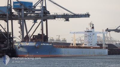
ALPHA GALLANT
Cargo
Current Trip
| Time Travelled | --- |
|---|---|
| Remaining Time | --- |
| Distance Travelled | 7033.24 nm |
| Remaining Distance | --- |
| AVG Speed | 10.7 Knots |
| MAX Speed | 14.5 Knots |
| AVG Wind | 11.2 knots |
| MAX Wind | 25.9 knots |
| MIN Temp | 17.2°C / 62.96°F |
| MAX Temp | 30°C / 86°F |
| Draught | 8.8 m |
| Position Received | 8 d ago |
Current Position
| Longitude | -13.95315° |
|---|---|
| Latitude | 9.58078° |
| Status | At anchor |
| Speed | 0.3 Knots |
| Course | 3° |
| Area | North Atlantic Ocean |
| Station | T-AIS |
| Position Received | 8 d ago |
Info
Information
The current position of ALPHA GALLANT is in North Atlantic Ocean with coordinates 9.58078° / -13.95315° as reported on 2024-04-28 18:17 by AIS to our vessel tracker app. The vessel's current speed is 0.3 Knots
The vessel ALPHA GALLANT (IMO: 9747871, MMSI: 636017334) is a Cargo It's sailing under the flag of [LR] Liberia.
In this page you can find informations about the vessels current position, last detected port calls, and current voyage information. If the vessels is not in coverage by AIS you will find the latest position.
The current position of ALPHA GALLANT is detected by our AIS receivers and we are not responsible for the reliability of the data. The last position was recorded while the vessel was in Coverage by the Ais receivers of our vessel tracking app.
The current draught of ALPHA GALLANT as reported by AIS is 8.8 meters
Weather
| Temperature | 27.8°C / 82.04°F |
|---|---|
| Wind Speed | 8 knots |
| Direction | 255° WSW |
| Pressure | 1007.9 hPa |
| Humidity | 87.7 % |
| Cloud Coverage | 96 % |
Featured Company
Last Port Calls
Most Visited Ports (Last year)
| Port | Arrivals | |
|---|---|---|
| 2 | ||
| 1 | ||
| 1 | ||
| 1 | ||
| 1 | ||
| 1 |
Last Trips
| Origin | Departure | Destination | Arrival | Distance |
|---|
Events
| Time | Event | Details | Position / Dest | Info |
|---|---|---|---|---|
| 2024-04-28 21:20 | STOP Moving | 13.09 nm, North West of KASSA |
9.60544 / -13.92256
GN CKY
|
Speed: 0.1 kn Course: 209° |
| 2024-04-28 20:21 | START Moving | 14.18 nm, North West of KASSA |
9.58604 / -13.95624
GN CKY
|
Speed: 4.7 kn Course: 27° |
| 2024-04-28 18:25 | Status Changed | Default At anchor |
9.58072 / -13.95205
GN CKY
|
Speed: 0.3 kn Course: 3° |
| 2024-04-28 18:17 | Status Changed | At anchor Under way using engine |
9.58078 / -13.95315
GN CKY
|
Speed: 1 kn Course: 11° |
| 2024-04-28 18:17 | STOP Moving | 13.87 nm, North West of KASSA |
9.58078 / -13.95315
GN CKY
|
Speed: 0.3 kn Course: 3° |
| 2024-04-28 18:17 | OUT of Coverage |
9.58078 / -13.95315
North Atlantic Ocean
|
Speed: 0.3 kn Course: 126.5° |
|
| 2024-04-28 18:12 | Status Changed | Under way using engine Default |
9.58063 / -13.95365
GN CKY
|
Speed: 2 kn Course: 16° |
| 2024-04-28 17:55 | Status Changed | Default Under way using engine |
9.57178 / -13.95906
GN CKY
|
Speed: 3.1 kn Course: 31° |
| 2024-04-28 17:29 | Status Changed | Under way using engine Default |
9.53500 / -13.97594
GN CKY
|
Speed: 6.7 kn Course: 346° |
| 2024-04-28 17:01 | Status Changed | Default Under way using engine |
9.48233 / -13.97360
GN CKY
|
Speed: 5.6 kn Course: 332.3° |