

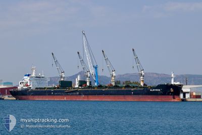
ALMYROS
Bulk Carrier

Current Trip
CHINA
| Time Travelled | 17 days |
|---|---|
| Remaining Time | --- |
| Distance Travelled | 3401.37 nm |
| Remaining Distance | --- |
| AVG Speed | 8.4 Knots |
| MAX Speed | 11.6 Knots |
| AVG Wind | 10.8 knots |
| MAX Wind | 24.9 knots |
| MIN Temp | 22°C / 71.6°F |
| MAX Temp | 28.6°C / 83.48°F |
| Draught | 13 m |
| Position Received | 6 d ago |
Current Position
| Longitude | --- |
|---|---|
| Latitude | --- |
| Status | Under way using engine |
| Speed | 9.3 Knots |
| Course | 83.4° |
| Area | Singapore Strait |
| Station | T-AIS |
| Position Received | 6 d ago |
Information
The current position of ALMYROS is in Singapore Strait with coordinates 1.25861° / 104.14732° as reported on 2025-02-12 03:50 by AIS to our vessel tracker app. The vessel's current speed is 9.3 Knots
The vessel ALMYROS (IMO: 9584138, MMSI: 248779000) is a Bulk Carrier that was built in 2010 ( 15 years old ). It's sailing under the flag of [MT] Malta.
In this page you can find informations about the vessels current position, last detected port calls, and current voyage information. If the vessels is not in coverage by AIS you will find the latest position.
The current position of ALMYROS is detected by our AIS receivers and we are not responsible for the reliability of the data. The last position was recorded while the vessel was in Coverage by the Ais receivers of our vessel tracking app.
The current draught of ALMYROS as reported by AIS is 13 meters
Weather
| Temperature | 22.1°C / 71.78°F |
|---|---|
| Wind Speed | 23 knots |
| Direction | 41° NE |
| Pressure | 1015.6 hPa |
| Humidity | 84.5 % |
| Cloud Coverage | 62 % |


Featured Company
Last Port Calls
| Port | Arrival | Departure | Time In Port |
|---|---|---|---|
| 2025-01-28 06:44 | 2025-02-01 17:50 | 4 d | |
| 2024-12-31 04:52 | 2025-01-02 04:55 | 2 d | |
| 2024-12-23 16:04 | |||
| 2024-12-06 23:23 | 2024-12-08 19:25 | 1 d |
Most Visited Ports (Last year)
| Port | Arrivals | |
|---|---|---|
| 2 | ||
| 1 | ||
| 1 | ||
| 1 | ||
| 1 | ||
| 1 |
Last Trips
| Origin | Departure | Destination | Arrival | Distance | |
|---|---|---|---|---|---|
| 2025-01-02 14:55 | 2025-01-28 12:14 | 5432.50 nm | |||
| 2024-12-24 02:04 | 2024-12-31 14:52 | 13.06 nm | |||
| 2024-09-10 01:23 | 2024-12-07 07:23 | 8511.77 nm |
Events
| Time | Event | Details | Position / Dest | Info |
|---|---|---|---|---|
| 2025-02-12 03:57 | Status Changed | Default Under way using engine |
1.26080 / 104.16624
CHINA
|
Speed: 9.3 kn Course: 83.4° |
| 2025-02-12 03:50 | OUT of Coverage |
1.25861 / 104.14732
Singapore Strait
CHINA
|
Speed: 9.3 kn Course: 83.4° |
|
| 2025-02-12 03:28 | Change Sea Area | Indonesian part of the Singapore Strait Malaysian part of the Singapore Strait |
1.26221 / 104.09636
Singapore Strait
CHINA
|
Speed: 8.6 kn Course: 139.6° |
| 2025-02-12 03:07 | Change Sea Area | Malaysian part of the Singapore Strait Singaporean part of the Singapore Strait |
1.28276 / 104.06617
Singapore Strait
CHINA
|
Speed: 7 kn Course: 81.6° |
| 2025-02-12 02:34 | START Moving | 1.33 nm, South of TANAH MERAH |
1.29101 / 104.02433
CHINA
|
Speed: 3.1 kn Course: 90° |
| 2025-02-12 02:22 | Draught Changed | 13 12.9 |
1.29028 / 104.01782
CHINA
|
Speed: 0.6 kn Course: 61° |
| 2025-02-12 02:22 | Destination Changed | CHINA SG SIN PEBC |
1.29028 / 104.01782
CHINA
|
Speed: 0.6 kn Course: 61° |
| 2025-02-12 02:22 | ETA Changed | 2025/02/22 17:30 2025/02/11 17:30 |
1.29028 / 104.01782
CHINA
|
Speed: 0.6 kn Course: 61° |
| 2025-02-12 02:22 | Status Changed | Under way using engine At anchor |
1.29028 / 104.01782
SG SIN PEBC
|
Speed: 0.2 kn Course: 70° |
| 2025-02-12 02:15 | Status Changed | At anchor Default |
1.29048 / 104.01730
SG SIN PEBC
|
Speed: 0.3 kn Course: 73° |