
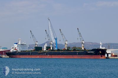
ALMYROS
Bulk Carrier
Current Trip
| Time Travelled | 3 days |
|---|---|
| Remaining Time | --- |
| Distance Travelled | 1034.33 nm |
| Remaining Distance | --- |
| AVG Speed | 9.9 Knots |
| MAX Speed | 13.4 Knots |
| AVG Wind | 15.2 knots |
| MAX Wind | 25.8 knots |
| MIN Temp | 19.1°C / 66.38°F |
| MAX Temp | 22.6°C / 72.68°F |
| Dybgang | 6.6 m |
| Position Modtaget | 1 d siden |
Current Position
| Longitude | -17.28443° |
|---|---|
| Latitude | 27.28573° |
| Status | Under way using engine |
| Fart | 10.8 Knots |
| Kurs | 231.8° |
| Område | North Atlantic Ocean |
| Station | T-AIS |
| Position Modtaget | 1 d siden |
Info
Information
The current position of ALMYROS is in North Atlantic Ocean with coordinates 27.28573° / -17.28443° as reported on 2024-06-20 02:46 by AIS to our vessel tracker app. The vessel's current speed is 10.8 Knots and is heading at the port of MACAPA. The estimated time of arrival as calculated by MyShipTracking vessel tracking app is 2024-06-28 17:00 LT
The vessel ALMYROS (IMO: 9584138, MMSI: 248779000) is a Bulk Carrier that was built in 2010 ( 14 år gamle ). It's sailing under the flag of [MT] Malta.
In this page you can find informations about the vessels current position, last detected port calls, and current voyage information. If the vessels is not in coverage by AIS you will find the latest position.
The current position of ALMYROS is detected by our AIS receivers and we are not responsible for the reliability of the data. The last position was recorded while the vessel was in Coverage by the Ais receivers of our vessel tracking app.
The current draught of ALMYROS as reported by AIS is 6.6 meters
Weather
| Temperature | 22.5°C / 72.5°F |
|---|---|
| Wind Speed | 19 knots |
| Direction | 39° NE |
| Pressure | 1019.1 hPa |
| Humidity | 77.1 % |
| Cloud Coverage | 64 % |
Featured Company
Last Port Calls
| Port | Arrival | Departure | Time In Port |
|---|---|---|---|
| 2024-05-31 09:44 | 2024-06-17 20:39 | 17 d | |
| 2024-05-28 14:02 | 2024-05-30 06:33 | 1 d | |
| 2024-04-10 04:21 | 2024-04-26 20:12 | 16 d |
Most Visited Ports (Last year)
| Port | Arrivals | |
|---|---|---|
| 2 | ||
| 1 | ||
| 1 | ||
| 1 | ||
| 1 | ||
| 1 |
Last Trips
| Origin | Departure | Destination | Arrival | Distance | |
|---|---|---|---|---|---|
| 2024-05-30 07:33 | 2024-05-31 10:44 | 8.87 nm | |||
| 2024-04-26 23:12 | 2024-05-28 15:02 | 4708.19 nm | |||
| 2024-03-26 04:36 | 2024-04-10 07:21 | 3715.15 nm |
Events
| Tid | Hændelsen | Detaljer | Position / Dest | Info |
|---|---|---|---|---|
| 2024-06-20 02:51 | Status er ændret | Default Under way using engine |
27.27699 / -17.29678
BRMCP
|
Fart: 10.8 kn Kurs: 231.8° |
| 2024-06-20 02:46 | Udenfor Dækning |
27.28573 / -17.28443
North Atlantic Ocean
BRMCP
|
Fart: 10.8 kn Kurs: 231.8° |
|
| 2024-06-20 02:26 | Status er ændret | Under way using engine Default |
27.32368 / -17.23168
BRMCP
|
Fart: 10.7 kn Kurs: 231° |
| 2024-06-20 02:23 | Status er ændret | Default Under way using engine |
27.32907 / -17.22424
BRMCP
|
Fart: 10.7 kn Kurs: 231.3° |
| 2024-06-19 18:10 | START Sejllads | 0.87 nm, South of SAN ANDRES |
28.49013 / -16.18345
BRMCP
|
Fart: 4.2 kn Kurs: 149° |
| 2024-06-19 17:54 | Status er ændret | Under way using engine At anchor |
28.49133 / -16.18400
BRMCP
|
Fart: 0.3 kn Kurs: 16° |
| 2024-06-19 17:41 | Status er ændret | At anchor Default |
28.49096 / -16.18457
BRMCP
|
Fart: 0.3 kn Kurs: 48° |
| 2024-06-19 17:38 | Status er ændret | Default At anchor |
28.49069 / -16.18479
BRMCP
|
Fart: 0.1 kn Kurs: 37° |
| 2024-06-19 16:30 | Destination er ændret | BRMCP ESSCT |
28.49045 / -16.18527
BRMCP
|
Fart: 0.2 kn Kurs: 55° |
| 2024-06-19 16:30 | ETA er ændret | 2024/06/28 17:00 2024/06/19 13:00 |
28.49045 / -16.18527
BRMCP
|
Fart: 0.2 kn Kurs: 55° |