

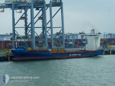
ALDEBARAN J
Container Ship

Current Trip
| Time Travelled | 1 day |
|---|---|
| Remaining Time | 9 h, 26 mins |
| Distance Travelled | 384.01 nm |
| Remaining Distance | 342.15 nm |
| AVG Speed | 16.1 Knots |
| MAX Speed | 17.7 Knots |
| AVG Wind | 12.6 knots |
| MAX Wind | 20 knots |
| MIN Temp | 17°C / 62.6°F |
| MAX Temp | 25.5°C / 77.9°F |
| Draught | 5.9 m |
| Position Received | 10 h, 51 m ago |
Current Position
| Longitude | --- |
|---|---|
| Latitude | --- |
| Status | Under way using engine |
| Speed | 16 Knots |
| Course | 7° |
| Area | North Atlantic Ocean |
| Station | T-AIS |
| Position Received | 10 h, 51 m ago |
Information
The current position of ALDEBARAN J is in North Atlantic Ocean with coordinates 25.59467° / -79.59409° as reported on 2025-02-20 19:39 by AIS to our vessel tracker app. The vessel's current speed is 16 Knots and is heading at the port of JACKSONVILLE. The estimated time of arrival as calculated by MyShipTracking vessel tracking app is 2025-02-21 10:56 LT
The vessel ALDEBARAN J (IMO: 9349186, MMSI: 304972000) is a Container Ship that was built in 2006 ( 19 years old ). It's sailing under the flag of [AG] Antigua Barbuda.
In this page you can find informations about the vessels current position, last detected port calls, and current voyage information. If the vessels is not in coverage by AIS you will find the latest position.
The current position of ALDEBARAN J is detected by our AIS receivers and we are not responsible for the reliability of the data. The last position was recorded while the vessel was in Coverage by the Ais receivers of our vessel tracking app.
The current draught of ALDEBARAN J as reported by AIS is 5.9 meters
Weather
| Temperature | 15.5°C / 59.9°F |
|---|---|
| Wind Speed | 20 knots |
| Direction | 353° N |
| Pressure | 1023.4 hPa |
| Humidity | 65 % |
| Cloud Coverage | 68 % |


Featured Company
Last Port Calls
| Port | Arrival | Departure | Time In Port |
|---|---|---|---|
| 2025-02-18 09:04 | 2025-02-19 23:50 | 1 d | |
| 2025-02-11 21:35 | 2025-02-14 23:23 | 3 d | |
| 2025-02-09 21:00 | 2025-02-10 07:24 | 10 h | |
| 2025-02-08 11:23 | 2025-02-08 16:41 | 5 h | |
| 2025-02-08 11:13 | 2025-02-08 11:21 | 8 m | |
| 2025-02-06 20:15 | 2025-02-07 08:47 | 12 h | |
| 2025-02-04 09:05 | 2025-02-05 03:45 | 18 h | |
| 2025-02-02 08:33 | 2025-02-02 16:51 | 8 h | |
| 2025-02-02 08:05 | 2025-02-02 08:16 | 10 m | |
| 2025-01-31 18:15 | 2025-01-31 22:47 | 4 h |
Most Visited Ports (Last year)
| Port | Arrivals | |
|---|---|---|
| 31 | ||
| 29 | ||
| 25 | ||
| 25 | ||
| 21 | ||
| 19 |
Last Trips
| Origin | Departure | Destination | Arrival | Distance | |
|---|---|---|---|---|---|
| 2025-02-14 23:23 | 2025-02-18 09:04 | 621.00 nm | |||
| 2025-02-10 07:24 | 2025-02-11 21:35 | 572.52 nm | |||
| 2025-02-08 16:41 | 2025-02-09 21:00 | 296.92 nm | |||
| 2025-02-08 11:21 | 2025-02-08 11:23 | 0.27 nm | |||
| 2025-02-07 08:47 | 2025-02-08 11:13 | 300.98 nm | |||
| 2025-02-05 03:45 | 2025-02-06 20:15 | 573.66 nm | |||
| 2025-02-02 16:51 | 2025-02-04 09:05 | 325.55 nm | |||
| 2025-02-02 08:16 | 2025-02-02 08:33 | 0.98 nm | |||
| 2025-01-31 22:47 | 2025-02-02 08:05 | 300.57 nm | |||
| 2025-01-30 05:57 | 2025-01-31 18:15 | 552.48 nm |
Events
| Time | Event | Details | Position / Dest | Info |
|---|---|---|---|---|
| 2025-02-20 19:46 | Status Changed | Default Under way using engine |
25.62608 / -79.58946
USJAX
|
Speed: 16 kn Course: 7° |
| 2025-02-20 19:39 | OUT of Coverage |
25.59467 / -79.59409
North Atlantic Ocean
|
Speed: 16 kn Course: 7° |
|
| 2025-02-20 19:14 | Status Changed | Under way using engine Default |
25.48342 / -79.60956
USJAX
|
Speed: 16 kn Course: 7° |
| 2025-02-20 19:08 | IN Coverage |
25.49579 / -79.60788
North Atlantic Ocean
|
Speed: 16 kn Course: 7° |
|
| 2025-02-20 04:50 | PORT DEPARTURE |
|
23.05369 / -82.75446
USJAX
|
Speed: 8.3 kn Course: 0° |
| 2025-02-20 04:29 | START Moving |
23.00561 / -82.75893
[CU] MARIEL
|
Speed: 3.2 kn Course: 52° |
|
| 2025-02-18 14:35 | STOP Moving |
23.00748 / -82.75995
[CU] MARIEL
|
Speed: Course: 236° |
|
| 2025-02-18 14:04 | PORT ARRIVAL |
|
23.00743 / -82.75721
[CU] MARIEL
|
Speed: 6.5 kn Course: 175° |
| 2025-02-18 09:34 | STOP Moving | 5.2 nm, North of MARIEL |
23.08991 / -82.75962
USJAX
|
Speed: 0.3 kn Course: 325° |
| 2025-02-18 04:41 | START Moving | 5.73 nm, North of MARIEL |
23.09729 / -82.73819
USJAX
|
Speed: 3.6 kn Course: 220° |