

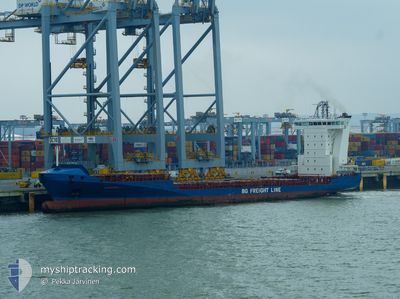
ALDEBARAN J
Container Ship

Current Trip
| Time Travelled | 3 days |
|---|---|
| Remaining Time | 3 h, 39 mins |
| Distance Travelled | 1086.77 nm |
| Remaining Distance | 298.51 nm |
| AVG Speed | 15 Knop |
| MAX Speed | 18.9 Knop |
| AVG Wind | 18.9 knots |
| MAX Wind | 26 knots |
| MIN Temp | 22.2°C / 71.96°F |
| MAX Temp | 28.3°C / 82.94°F |
| Djupgående | 7.3 m |
| Position mottagen | 14 h, 21 m sen |
Current Position
| Longitud | --- |
|---|---|
| Latitude | --- |
| Status | Under way using engine |
| Fart | 16.6 Knop |
| Kurs | 5.6° |
| Område | North Atlantic Ocean |
| Station | T-AIS |
| Position mottagen | 14 h, 21 m sen |
Information
The current position of ALDEBARAN J is in North Atlantic Ocean with coordinates 26.03657° / -79.76659° as reported on 2025-03-29 04:08 by AIS to our vessel tracker app. The vessel's current speed is 16.6 Knop and is heading at the port of JACKSONVILLE. The estimated time of arrival as calculated by MyShipTracking vessel tracking app is 2025-03-29 18:08 LT
The vessel ALDEBARAN J (IMO: 9349186, MMSI: 304972000) is a Container Ship that was built in 2006 ( 19 År gammal ). It's sailing under the flag of [AG] Antigua Barbuda.
In this page you can find informations about the vessels current position, last detected port calls, and current voyage information. If the vessels is not in coverage by AIS you will find the latest position.
The current position of ALDEBARAN J is detected by our AIS receivers and we are not responsible for the reliability of the data. The last position was recorded while the vessel was in Coverage by the Ais receivers of our vessel tracking app.
The current draught of ALDEBARAN J as reported by AIS is 7.3 meters
Weather
| Temperature | 22.3°C / 72.14°F |
|---|---|
| Wind Speed | 17 knots |
| Direction | 130° SE |
| Pressure | 1023.4 hPa |
| Humidity | 74.6 % |
| Cloud Coverage | 100 % |


Featured Company
Last Port Calls
| Port | Arrival | Departure | Time In Port |
|---|---|---|---|
| 2025-03-25 21:32 | 2025-03-26 09:58 | 12 h | |
| 2025-03-24 13:36 | 2025-03-25 07:01 | 17 h | |
| 2025-03-21 07:16 | 2025-03-21 22:16 | 14 h | |
| 2025-03-21 07:06 | 2025-03-21 07:13 | 7 m | |
| 2025-03-18 00:45 | 2025-03-18 17:53 | 17 h | |
| 2025-03-17 05:44 | 2025-03-17 19:56 | 14 h | |
| 2025-03-13 16:03 | 2025-03-14 08:15 | 16 h | |
| 2025-03-13 15:32 | 2025-03-13 15:43 | 11 m | |
| 2025-03-10 21:48 | 2025-03-11 05:11 | 7 h | |
| 2025-03-10 05:09 | 2025-03-10 17:10 | 12 h |
Most Visited Ports (Last year)
| Port | Arrivals | |
|---|---|---|
| 30 | ||
| 29 | ||
| 25 | ||
| 24 | ||
| 22 | ||
| 19 |
Last Trips
| Origin | Departure | Destination | Arrival | Distance | |
|---|---|---|---|---|---|
| 2025-03-25 07:01 | 2025-03-25 21:32 | 62.05 nm | |||
| 2025-03-21 22:16 | 2025-03-24 13:36 | 895.29 nm | |||
| 2025-03-21 07:13 | 2025-03-21 07:16 | 0.32 nm | |||
| 2025-03-18 17:53 | 2025-03-21 07:06 | 808.67 nm | |||
| 2025-03-17 19:56 | 2025-03-18 00:45 | 62.19 nm | |||
| 2025-03-14 08:15 | 2025-03-17 05:44 | 886.79 nm | |||
| 2025-03-13 15:43 | 2025-03-13 16:03 | 1.05 nm | |||
| 2025-03-11 05:11 | 2025-03-13 15:32 | 856.72 nm | |||
| 2025-03-10 17:10 | 2025-03-10 21:48 | 57.37 nm | |||
| 2025-03-09 23:51 | 2025-03-10 05:09 | 63.15 nm |
Events
| Tid | Event | Detaljer | Position / Dest | Information |
|---|---|---|---|---|
| 2025-03-29 04:11 | Status ändrad | Default Under way using engine |
26.05003 / -79.76508
USJAX
|
Fart: 16.6 kn Kurs: 5.6° |
| 2025-03-29 04:08 | UTANFÖR täckningsområde |
26.03657 / -79.76659
North Atlantic Ocean
USJAX
|
Fart: 16.6 kn Kurs: 5.6° |
|
| 2025-03-29 03:18 | Status ändrad | Under way using engine Default |
25.80561 / -79.79313
USJAX
|
Fart: 16.5 kn Kurs: 3° |
| 2025-03-29 03:09 | Status ändrad | Default Under way using engine |
25.76349 / -79.79642
USJAX
|
Fart: 16.7 kn Kurs: 3.6° |
| 2025-03-29 01:20 | Status ändrad | Under way using engine Default |
25.27831 / -79.88558
USJAX
|
Fart: 15.6 kn Kurs: 16° |
| 2025-03-29 01:20 | I täckningsområde |
25.28835 / -79.88215
North Atlantic Ocean
USJAX
|
Fart: 15.6 kn Kurs: 17.1° |
|
| 2025-03-28 23:15 | Status ändrad | Default Under way using engine |
24.77335 / -80.08701
USJAX
|
Fart: 15 kn Kurs: 22.7° |
| 2025-03-28 23:13 | UTANFÖR täckningsområde |
24.76903 / -80.08902
North Atlantic Ocean
USJAX
|
Fart: 15 kn Kurs: 22.7° |
|
| 2025-03-28 23:03 | Djupgående ändrat | 7.3 6.7 |
24.72715 / -80.10880
USJAX
|
Fart: 15 kn Kurs: 24.2° |
| 2025-03-28 23:03 | Destination ändrad | USJAX GTSTC |
24.72715 / -80.10880
USJAX
|
Fart: 15 kn Kurs: 24.2° |