
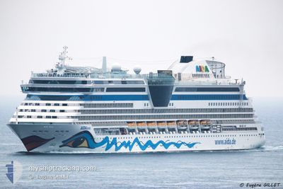
AIDALUNA
Passengers Ship
Current Trip
| Time Travelled | 1 day |
|---|---|
| Remaining Time | --- |
| Distance Travelled | 350.39 nm |
| Remaining Distance | --- |
| AVG Speed | 15.2 Knots |
| MAX Speed | 18.9 Knots |
| AVG Wind | 4.9 knots |
| MAX Wind | 10 knots |
| MIN Temp | 22.7°C / 72.86°F |
| MAX Temp | 27.4°C / 81.32°F |
| Draught | 7.3 m |
| Position Received | 15 m ago |
Current Position
| Longitude | --- |
|---|---|
| Latitude | --- |
| Status | Under way using engine |
| Speed | 18.8 Knots |
| Course | 312° |
| Area | North Atlantic Ocean |
| Station | T-AIS |
| Position Received | 15 m ago |
Information
The current position of AIDALUNA is in North Atlantic Ocean with coordinates 19.71484° / -69.53074° as reported on 2025-03-22 01:44 by AIS to our vessel tracker app. The vessel's current speed is 18.8 Knots and is heading at the port of MONTEGO BAY.
The vessel AIDALUNA (IMO: 9334868, MMSI: 247255400) is a Passengers Ship that was built in 2009 ( 16 years old ). It's sailing under the flag of [IT] Italy.
In this page you can find informations about the vessels current position, last detected port calls, and current voyage information. If the vessels is not in coverage by AIS you will find the latest position.
The current position of AIDALUNA is detected by our AIS receivers and we are not responsible for the reliability of the data. The last position was recorded while the vessel was in Coverage by the Ais receivers of our vessel tracking app.
The current draught of AIDALUNA as reported by AIS is 7.3 meters
Weather
| Temperature | 24.8°C / 76.64°F |
|---|---|
| Wind Speed | 9 knots |
| Direction | 48° NE |
| Pressure | 1019.7 hPa |
| Humidity | 67.8 % |
| Cloud Coverage | 2 % |
Featured Company
Last Port Calls
| Port | Arrival | Departure | Time In Port |
|---|---|---|---|
| 2025-03-20 10:27 | 2025-03-20 20:32 | 10 h | |
| 2025-03-19 09:05 | 2025-03-19 22:27 | 13 h | |
| 2025-03-18 10:29 | 2025-03-19 00:01 | 13 h | |
| 2025-03-17 10:51 | 2025-03-18 00:17 | 13 h | |
| 2025-03-15 10:46 | 2025-03-16 01:08 | 14 h | |
| 2025-03-13 13:41 | 2025-03-13 22:27 | 8 h | |
| 2025-03-12 09:43 | 2025-03-12 21:10 | 11 h | |
| 2025-03-11 13:28 | 2025-03-11 22:49 | 9 h | |
| 2025-03-09 11:46 | 2025-03-10 02:10 | 14 h | |
| 2025-03-08 17:12 | 2025-03-09 02:06 | 8 h |
Most Visited Ports (Last year)
| Port | Arrivals | |
|---|---|---|
| 26 | ||
| 10 | ||
| 10 | ||
| 9 | ||
| 9 | ||
| 8 |
Last Trips
| Origin | Departure | Destination | Arrival | Distance | |
|---|---|---|---|---|---|
| 2025-03-19 18:27 | 2025-03-20 06:27 | 94.52 nm | |||
| 2025-03-18 20:01 | 2025-03-19 05:05 | 79.15 nm | |||
| 2025-03-17 20:17 | 2025-03-18 06:29 | 82.04 nm | |||
| 2025-03-15 21:08 | 2025-03-17 06:51 | 427.33 nm | |||
| 2025-03-13 17:27 | 2025-03-15 06:46 | 648.02 nm | |||
| 2025-03-12 16:10 | 2025-03-13 08:41 | 278.58 nm | |||
| 2025-03-11 16:49 | 2025-03-12 04:43 | 193.60 nm | |||
| 2025-03-09 21:10 | 2025-03-11 07:28 | 611.28 nm | |||
| 2025-03-08 21:06 | 2025-03-09 06:46 | 72.02 nm | |||
| 2025-03-06 16:09 | 2025-03-08 12:12 | 767.87 nm |
Events
| Time | Event | Details | Position / Dest | Info |
|---|---|---|---|---|
| 2025-03-22 01:54 | Status Changed | Default Under way using engine |
19.75189 / -69.57310
DOSAM-JMMBJ
|
Speed: 18.8 kn Course: 312° |
| 2025-03-22 01:05 | Status Changed | Under way using engine Default |
19.58196 / -69.36623
DOSAM-JMMBJ
|
Speed: 18.5 kn Course: 300° |
| 2025-03-22 00:27 | Status Changed | Default Under way using engine |
19.48393 / -69.18742
DOSAM-JMMBJ
|
Speed: 17.7 kn Course: 345.5° |
| 2025-03-21 23:52 | Status Changed | Under way using engine Default |
19.33420 / -69.11302
DOSAM-JMMBJ
|
Speed: 18.1 kn Course: 350° |
| 2025-03-21 23:50 | Status Changed | Default Under way using engine |
19.32427 / -69.11129
DOSAM-JMMBJ
|
Speed: 17.9 kn Course: 350.5° |
| 2025-03-21 23:37 | Status Changed | Under way using engine Default |
19.25616 / -69.09936
DOSAM-JMMBJ
|
Speed: 17.7 kn Course: 347° |
| 2025-03-21 23:26 | Status Changed | Default Under way using engine |
19.20452 / -69.08740
DOSAM-JMMBJ
|
Speed: 17.4 kn Course: 20.3° |
| 2025-03-21 22:50 | Destination Changed | DOSAM-JMMBJ VGTOV-DOSAM |
19.16512 / -69.22736
DOSAM-JMMBJ
|
Speed: 14.2 kn Course: 104.5° |
| 2025-03-21 22:15 | START Moving | 1.44 nm, South East of SAMANA |
19.18626 / -69.31127
VGTOV-DOSAM
|
Speed: 6.2 kn Course: 154.1° |
| 2025-03-21 22:01 | Status Changed | Under way using engine At anchor |
19.18868 / -69.31190
VGTOV-DOSAM
|
Speed: 0.4 kn Course: 122° |