

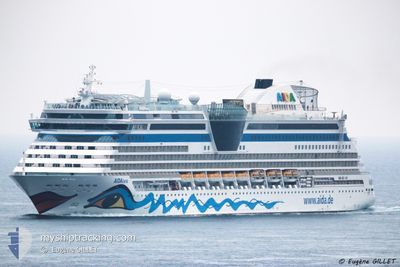
AIDALUNA
Passengers Ship

Current Trip
COCTG-COSMR
| Time Travelled | 46 mins |
|---|---|
| Remaining Time | --- |
| Distance Travelled | 1.81 nm |
| Remaining Distance | --- |
| AVG Speed | 12.9 Noeuds |
| MAX Speed | 12.9 Noeuds |
| AVG Wind | 18.9 knots |
| MAX Wind | 19 knots |
| MIN Temp | 26.8°C / 80.24°F |
| MAX Temp | 27°C / 80.6°F |
| Tirant d eau | 7.3 m |
| Position reçue | 56 m depuis |
Current Position
| Longitude | --- |
|---|---|
| Latitude | --- |
| Etat | Under way using engine |
| Vitesse | 1.3 Noeuds |
| Parcours | 220° |
| Zone | Caribbean Sea |
| Station | T-AIS |
| Position reçue | 56 m depuis |
Information
The current position of AIDALUNA is in Caribbean Sea with coordinates 11.25036° / -74.21647° as reported on 2025-03-27 21:53 by AIS to our vessel tracker app. The vessel's current speed is 1.3 Noeuds
The vessel AIDALUNA (IMO: 9334868, MMSI: 247255400) is a Passengers Ship that was built in 2009 ( 16 Age ). It's sailing under the flag of [IT] Italy.
In this page you can find informations about the vessels current position, last detected port calls, and current voyage information. If the vessels is not in coverage by AIS you will find the latest position.
The current position of AIDALUNA is detected by our AIS receivers and we are not responsible for the reliability of the data. The last position was recorded while the vessel was in Coverage by the Ais receivers of our vessel tracking app.
The current draught of AIDALUNA as reported by AIS is 7.3 meters
Weather
| Temperature | 27°C / 80.6°F |
|---|---|
| Wind Speed | 19 knots |
| Direction | 48° NE |
| Pressure | 1006.9 hPa |
| Humidity | 78 % |
| Cloud Coverage | 76 % |


Featured Company
Last Port Calls
| Port | Arrival | Departure | Time In Port |
|---|---|---|---|
| 2025-03-27 07:23 | 2025-03-27 17:03 | 9 h | |
| 2025-03-26 12:47 | 2025-03-26 20:27 | 7 h | |
| 2025-03-25 05:18 | 2025-03-25 20:04 | 14 h | |
| 2025-03-23 06:50 | 2025-03-23 21:02 | 14 h | |
| 2025-03-20 06:27 | 2025-03-20 16:32 | 10 h | |
| 2025-03-19 05:05 | 2025-03-19 18:27 | 13 h | |
| 2025-03-18 06:29 | 2025-03-18 20:01 | 13 h | |
| 2025-03-17 06:51 | 2025-03-17 20:17 | 13 h | |
| 2025-03-15 06:46 | 2025-03-15 21:08 | 14 h | |
| 2025-03-13 08:41 | 2025-03-13 17:27 | 8 h |
Most Visited Ports (Last year)
| Port | Arrivals | |
|---|---|---|
| 26 | ||
| 10 | ||
| 10 | ||
| 9 | ||
| 9 | ||
| 7 |
Last Trips
| Origin | Departure | Destination | Arrival | Distance | |
|---|---|---|---|---|---|
| 2025-03-26 20:27 | 2025-03-27 07:23 | 129.98 nm | |||
| 2025-03-25 20:04 | 2025-03-26 12:47 | 278.54 nm | |||
| 2025-03-23 21:02 | 2025-03-25 05:18 | 587.20 nm | |||
| 2025-03-20 16:32 | 2025-03-23 06:50 | 860.97 nm | |||
| 2025-03-19 18:27 | 2025-03-20 06:27 | 94.52 nm | |||
| 2025-03-18 20:01 | 2025-03-19 05:05 | 79.15 nm | |||
| 2025-03-17 20:17 | 2025-03-18 06:29 | 82.04 nm | |||
| 2025-03-15 21:08 | 2025-03-17 06:51 | 427.33 nm | |||
| 2025-03-13 17:27 | 2025-03-15 06:46 | 648.02 nm | |||
| 2025-03-12 16:10 | 2025-03-13 08:41 | 278.58 nm |
Events
| Heure | Evenement | Détails | Position/ Destination | Info |
|---|---|---|---|---|
| 2025-03-27 22:03 | Démarrage | 0.2 nm, West of SANTA MARTA |
11.24577 / -74.22327
COCTG-COSMR
|
Vitesse: 6.9 kn Parcours: 250° |
| 2025-03-27 22:03 | PORT DE DEPART |
|
11.24577 / -74.22327
COCTG-COSMR
|
Vitesse: 2.6 kn Parcours: 235° |
| 2025-03-27 21:59 | Etat Changé | Default Under way using engine |
11.24787 / -74.21976
[CO] SANTA MARTA
|
Vitesse: 1.3 kn Parcours: 220° |
| 2025-03-27 21:53 | Etat Changé | Under way using engine Default |
11.25036 / -74.21647
[CO] SANTA MARTA
|
Vitesse: Parcours: 205° |
| 2025-03-27 21:53 | Dans la zone couverte |
11.25036 / -74.21647
Caribbean Sea
[CO] SANTA MARTA
|
Vitesse: 1.3 kn Parcours: 264.9° |
|
| 2025-03-27 12:35 | Arret |
11.24954 / -74.21626
[CO] SANTA MARTA
|
Vitesse: 0.2 kn Parcours: 206° |
|
| 2025-03-27 12:23 | Port d'arrivée |
|
11.24790 / -74.21970
[CO] SANTA MARTA
|
Vitesse: 1.4 kn Parcours: 239° |
| 2025-03-27 10:11 | Etat Changé | Default Under way using engine |
11.22546 / -74.63313
COCTG-COSMR
|
Vitesse: 13.1 kn Parcours: 87° |
| 2025-03-27 10:08 | Hors de la zone couverte |
11.22517 / -74.64439
Caribbean Sea
COCTG-COSMR
|
Vitesse: 13.1 kn Parcours: 87° |
|
| 2025-03-27 05:20 | Changement de destination | COCTG-COSMR DOSAM-JMMBJ |
10.86766 / -75.52498
COCTG-COSMR
|
Vitesse: 12.4 kn Parcours: 55.5° |