

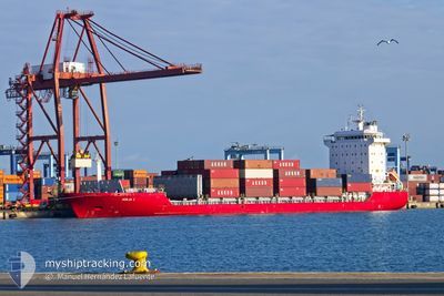
ADILIA I
Container Ship

Current Trip
| Time Travelled | 3 days |
|---|---|
| Remaining Time | --- |
| Distance Travelled | 1019.44 nm |
| Remaining Distance | --- |
| AVG Speed | 15.5 Knots |
| MAX Speed | 18.4 Knots |
| AVG Wind | 9.6 knots |
| MAX Wind | 20.3 knots |
| MIN Temp | 13.9°C / 57.02°F |
| MAX Temp | 16.5°C / 61.7°F |
| Draught | 6.8 m |
| Position Received | 16 h, 37 m ago |
Current Position
| Longitude | --- |
|---|---|
| Latitude | --- |
| Status | Under way using engine |
| Speed | 14.5 Knots |
| Course | 106.4° |
| Area | Mediterranean Sea - Eastern Basin |
| Station | T-AIS |
| Position Received | 16 h, 37 m ago |
Information
The current position of ADILIA I is in Mediterranean Sea - Eastern Basin with coordinates 36.38848° / 14.61703° as reported on 2025-02-19 02:12 by AIS to our vessel tracker app. The vessel's current speed is 14.5 Knots and is heading at the port of TUZLA. The estimated time of arrival as calculated by MyShipTracking vessel tracking app is 2025-02-21 22:00 LT
The vessel ADILIA I (IMO: 9318761, MMSI: 255806330) is a Container Ship that was built in 2004 ( 21 years old ). It's sailing under the flag of [PT] Portugal.
In this page you can find informations about the vessels current position, last detected port calls, and current voyage information. If the vessels is not in coverage by AIS you will find the latest position.
The current position of ADILIA I is detected by our AIS receivers and we are not responsible for the reliability of the data. The last position was recorded while the vessel was in Coverage by the Ais receivers of our vessel tracking app.
The current draught of ADILIA I as reported by AIS is 6.8 meters
Weather
| Temperature | 14.4°C / 57.92°F |
|---|---|
| Wind Speed | 14 knots |
| Direction | 4° N |
| Pressure | 1024.2 hPa |
| Humidity | 61.4 % |
| Cloud Coverage | 40 % |


Featured Company
Last Port Calls
| Port | Arrival | Departure | Time In Port |
|---|---|---|---|
| 2025-02-15 19:12 | 2025-02-16 09:06 | 13 h | |
| 2025-02-15 11:06 | 2025-02-15 19:05 | 7 h | |
| 2025-02-11 16:15 | 2025-02-12 04:37 | 12 h | |
| 2025-02-08 22:51 | 2025-02-10 12:39 | 1 d | |
| 2025-02-05 22:20 | 2025-02-06 05:17 | 6 h | |
| 2025-02-05 07:21 | 2025-02-05 14:25 | 7 h | |
| 2025-02-03 05:16 | 2025-02-04 05:50 | 1 d | |
| 2025-01-31 09:10 | 2025-02-01 14:25 | 1 d | |
| 2025-01-29 07:50 | 2025-01-29 14:17 | 6 h | |
| 2025-01-28 07:29 | 2025-01-28 13:00 | 5 h |
Last Trips
| Origin | Departure | Destination | Arrival | Distance | |
|---|---|---|---|---|---|
| 2025-02-15 20:05 | 2025-02-15 20:12 | 0.70 nm | |||
| 2025-02-12 05:37 | 2025-02-15 12:06 | 900.61 nm | |||
| 2025-02-10 13:39 | 2025-02-11 17:15 | 119.74 nm | |||
| 2025-02-06 06:17 | 2025-02-08 23:51 | 901.51 nm | |||
| 2025-02-05 15:25 | 2025-02-05 23:20 | 47.07 nm | |||
| 2025-02-04 06:50 | 2025-02-05 08:21 | 19.73 nm | |||
| 2025-02-01 15:25 | 2025-02-03 06:16 | 454.59 nm | |||
| 2025-01-29 14:17 | 2025-01-31 10:10 | 403.09 nm | |||
| 2025-01-28 13:00 | 2025-01-29 07:50 | 100.51 nm | |||
| 2025-01-25 08:52 | 2025-01-28 07:29 | 735.45 nm |
Events
| Time | Event | Details | Position / Dest | Info |
|---|---|---|---|---|
| 2025-02-19 02:15 | Status Changed | Default Under way using engine |
36.38470 / 14.63235
TRTUZ
|
Speed: 14.5 kn Course: 106.4° |
| 2025-02-19 02:12 | Status Changed | Under way using engine Default |
36.38848 / 14.61703
TRTUZ
|
Speed: 14.5 kn Course: 106° |
| 2025-02-19 02:12 | OUT of Coverage |
36.38848 / 14.61703
Mediterranean Sea - Eastern Basin
TRTUZ
|
Speed: 14.5 kn Course: 106.4° |
|
| 2025-02-19 02:05 | Status Changed | Default Under way using engine |
36.39691 / 14.58144
TRTUZ
|
Speed: 14.5 kn Course: 106.5° |
| 2025-02-19 01:52 | Change Sea Area | Italian part of the Mediterranean Sea - Eastern Basin Algerian part of the Mediterranean Sea - Western Basin |
36.41244 / 14.51710
Mediterranean Sea - Eastern Basin
TRTUZ
|
Speed: 14.5 kn Course: 106.6° |
| 2025-02-19 01:52 | Status Changed | Under way using engine Default |
36.41244 / 14.51710
TRTUZ
|
Speed: 14.5 kn Course: 115° |
| 2025-02-19 01:45 | IN Coverage |
36.41244 / 14.51710
Mediterranean Sea - Eastern Basin
TRTUZ
|
Speed: 14.5 kn Course: 106.6° |
|
| 2025-02-17 00:03 | Status Changed | Default Under way using engine |
36.54389 / -.66322
TRTUZ
|
Speed: 15 kn Course: 82.1° |
| 2025-02-16 23:52 | OUT of Coverage |
36.53800 / -.71691
Mediterranean Sea - Western Basin
TRTUZ
|
Speed: 15 kn Course: 82.1° |
|
| 2025-02-16 23:52 | Status Changed | Under way using engine Default |
36.53771 / -.71956
TRTUZ
|
Speed: 15 kn Course: 84° |