
AC SESODA
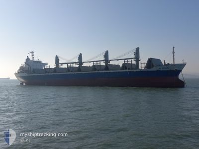
Bulk Carrier
Current Trip
| Trip Time | 2 days |
|---|---|
| Trip Distance | 383.68 nm |
| AVG Speed | 12.4 Knots |
| MAX Speed | 15.6 Knots |
| Draught | 8.8 m |
| AVG Wind | 13.9 knots |
| MAX Wind | 29 knots |
| MIN Temp | 1.6°C / 34.88°F |
| MAX Temp | 8.7°C / 47.66°F |
| Position Received | 1 d ago |
Current Position
| Longitude | --- |
|---|---|
| Latitude | --- |
| Status | Under way using engine |
| Speed | 10.3 Knots |
| Course | 17.1° |
| Area | Philippine Sea |
| Station | T-AIS |
| Position Received | 1 d ago |
Info
Information
The current position of AC SESODA is in Philippine Sea with coordinates 34.90991° / 136.76954° as reported on 2025-02-24 20:29 by AIS to our vessel tracker app. The vessel's current speed is 10.3 Knots and is currently inside the port of NAGOYA.
The vessel AC SESODA (IMO: 9470791, MMSI: 354950000) is a Bulk Carrier that was built in 2008 ( 17 years old ). It's sailing under the flag of [PA] Panama.
In this page you can find informations about the vessels current position, last detected port calls, and current voyage information. If the vessels is not in coverage by AIS you will find the latest position.
The current position of AC SESODA is detected by our AIS receivers and we are not responsible for the reliability of the data. The last position was recorded while the vessel was in Coverage by the Ais receivers of our vessel tracking app.
The current draught of AC SESODA as reported by AIS is 8.8 meters
Weather
| Temperature | 6.7°C / 44.06°F |
|---|---|
| Wind Speed | 8 knots |
| Direction | 347° NNW |
| Pressure | 1022.3 hPa |
| Humidity | 64.6 % |
| Cloud Coverage | 19 % |
Featured Company
Events
| Time | Event | Details | Position / Dest | Info |
|---|---|---|---|---|
| 2025-02-24 21:53 | STOP Moving |
35.07216 / 136.86375
[JP] NAGOYA
|
Speed: 0.2 kn Course: 324° |
|
| 2025-02-24 21:01 | PORT ARRIVAL |
|
34.99985 / 136.82782
[JP] NAGOYA
|
Speed: 11.2 kn Course: 34° |
| 2025-02-24 20:29 | Status Changed | Default Under way using engine |
34.91084 / 136.76990
TSUKUMI
|
Speed: 10.3 kn Course: 17.1° |
| 2025-02-24 20:29 | Status Changed | Under way using engine Default |
34.90991 / 136.76954
TSUKUMI
|
Speed: 9.2 kn Course: 19° |
| 2025-02-24 20:29 | IN Coverage |
34.90991 / 136.76954
Philippine Sea
|
Speed: 10.3 kn Course: 17.1° |
|
| 2025-02-24 20:29 | OUT of Coverage |
34.90991 / 136.76954
Philippine Sea
[JP] NAGOYA
|
Speed: 10.3 kn Course: 17.1° |
|
| 2025-02-24 20:17 | START Moving | 4.18 nm, West of TOKONAME |
34.89091 / 136.75229
TSUKUMI
|
Speed: 3.9 kn Course: 59° |
| 2025-02-23 09:44 | STOP Moving | 4.24 nm, West of TOKONAME |
34.88710 / 136.74995
TSUKUMI
|
Speed: 0.2 kn Course: 20° |
| 2025-02-23 08:24 | Status Changed | Default Under way using engine |
34.69732 / 136.84964
TSUKUMI
|
Speed: 12.6 kn Course: 326° |
| 2025-02-23 08:21 | OUT of Coverage |
34.68767 / 136.85757
Philippine Sea
|
Speed: 12.6 kn Course: 326° |