

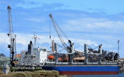
AC AMITY
Cargo

Current Trip
| Trip Time | 8 days |
|---|---|
| Trip Distance | 1285.23 nm |
| AVG Speed | 11.1 Knots |
| MAX Speed | 13.6 Knots |
| Draught | 6.6 m |
| AVG Wind | 8 knots |
| MAX Wind | 27.7 knots |
| MIN Temp | 7.6°C / 45.68°F |
| MAX Temp | 17.7°C / 63.86°F |
| Position Received | 4 d ago |
Current Position
| Longitude | --- |
|---|---|
| Latitude | --- |
| Status | Under way using engine |
| Speed | 1.2 Knots |
| Course | 333° |
| Area | Mediterranean Sea - Western Basin |
| Station | T-AIS |
| Position Received | 4 d ago |
Information
The current position of AC AMITY is in Mediterranean Sea - Western Basin with coordinates 37.20187° / 5.84568° as reported on 2025-02-16 18:21 by AIS to our vessel tracker app. The vessel's current speed is 1.2 Knots and is currently inside the port of DJEN DJEN.
The vessel AC AMITY (IMO: 9623116, MMSI: 351187000) is a Cargo It's sailing under the flag of [PA] Panama.
In this page you can find informations about the vessels current position, last detected port calls, and current voyage information. If the vessels is not in coverage by AIS you will find the latest position.
The current position of AC AMITY is detected by our AIS receivers and we are not responsible for the reliability of the data. The last position was recorded while the vessel was in Coverage by the Ais receivers of our vessel tracking app.
The current draught of AC AMITY as reported by AIS is 6.6 meters
Weather
| Temperature | 9.3°C / 48.74°F |
|---|---|
| Wind Speed | 3 knots |
| Direction | 207° SSW |
| Pressure | 1027.5 hPa |
| Humidity | 81.4 % |
| Cloud Coverage | 3 % |


Featured Company
Last Port Calls
| Port | Arrival | Departure | Time In Port |
|---|---|---|---|
| 2025-02-20 14:17 | |||
| 2025-02-08 11:22 | 2025-02-12 12:58 | 4 d | |
| 2025-01-23 14:54 | 2025-02-01 08:21 | 8 d | |
| 2025-01-08 07:17 | 2025-01-11 15:06 | 3 d | |
| 2024-12-03 01:10 |
Most Visited Ports (Last year)
| Port | Arrivals | |
|---|---|---|
| 2 | ||
| 2 | ||
| 2 | ||
| 1 | ||
| 1 | ||
| 1 |
Last Trips
| Origin | Departure | Destination | Arrival | Distance | |
|---|---|---|---|---|---|
| 2025-02-12 13:58 | 2025-02-20 15:17 | 1285.23 nm | |||
| 2025-02-01 09:21 | 2025-02-08 12:22 | 1524.44 nm | |||
| 2025-01-11 16:06 | 2025-01-23 15:54 | 974.32 nm | |||
| 2024-12-02 19:10 | 2025-01-08 08:17 | 4923.47 nm |
Events
| Time | Event | Details | Position / Dest | Info |
|---|---|---|---|---|
| 2025-02-20 14:53 | STOP Moving |
36.82198 / 5.88367
[DZ] DJEN DJEN
|
Speed: 0.1 kn Course: 27° |
|
| 2025-02-20 14:17 | PORT ARRIVAL |
|
36.83128 / 5.89700
[DZ] DJEN DJEN
|
Speed: 4.1 kn Course: 251° |
| 2025-02-20 12:07 | START Moving | 4.27 nm, North East of JIJEL |
36.88428 / 5.82841
DZ DJE
|
Speed: 3.3 kn Course: 46° |
| 2025-02-17 22:36 | STOP Moving | 4.27 nm, North West of DJEN DJEN |
36.88242 / 5.83400
DZ DJE
|
Speed: 0.3 kn Course: 248° |
| 2025-02-17 19:58 | START Moving |
37.19957 / 5.89564
DZ DJE
|
Speed: 6 kn Course: 175° |
|
| 2025-02-17 16:23 | STOP Moving | 21.44 nm, North of DJEN DJEN |
37.18604 / 5.87854
DZ DJE
|
Speed: 0.1 kn Course: 220° |
| 2025-02-17 14:59 | START Moving | 18.85 nm, North of DJEN DJEN |
37.12136 / 6.03500
DZ DJE
|
Speed: 3.8 kn Course: 300° |
| 2025-02-17 04:55 | STOP Moving | 19.72 nm, North of DJEN DJEN |
37.15453 / 5.94740
DZ DJE
|
Speed: 0.3 kn Course: 312° |
| 2025-02-16 18:29 | Status Changed | Default Under way using engine |
37.20361 / 5.84323
DZ DJE
|
Speed: 1.2 kn Course: 333° |
| 2025-02-16 18:21 | OUT of Coverage |
37.20187 / 5.84568
Mediterranean Sea - Western Basin
DZ DJE
|
Speed: 1.2 kn Course: 305.8° |