

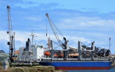
AC AMITY
Cargo

Current Trip
| Time Travelled | 13 days |
|---|---|
| Remaining Time | --- |
| Distance Travelled | 3159.53 nm |
| Remaining Distance | --- |
| AVG Speed | 9.6 Knop |
| MAX Speed | 13.6 Knop |
| AVG Wind | 14.6 knots |
| MAX Wind | 40.2 knots |
| MIN Temp | 12.6°C / 54.68°F |
| MAX Temp | 21.6°C / 70.88°F |
| Djupgående | 8.4 m |
| Position mottagen | 4 d sen |
Current Position
| Longitud | --- |
|---|---|
| Latitude | --- |
| Status | Under way using engine |
| Fart | 12.5 Knop |
| Kurs | 270° |
| Område | North Atlantic Ocean |
| Station | T-AIS |
| Position mottagen | 4 d sen |
Information
The current position of AC AMITY is in North Atlantic Ocean with coordinates 30.02657° / -27.69187° as reported on 2025-03-23 04:10 by AIS to our vessel tracker app. The vessel's current speed is 12.5 Knop and is heading at the port of JACKSONVILLE. The estimated time of arrival as calculated by MyShipTracking vessel tracking app is 2025-03-31 18:00 LT
The vessel AC AMITY (IMO: 9623116, MMSI: 351187000) is a Cargo It's sailing under the flag of [PA] Panama.
In this page you can find informations about the vessels current position, last detected port calls, and current voyage information. If the vessels is not in coverage by AIS you will find the latest position.
The current position of AC AMITY is detected by our AIS receivers and we are not responsible for the reliability of the data. The last position was recorded while the vessel was in Coverage by the Ais receivers of our vessel tracking app.
The current draught of AC AMITY as reported by AIS is 8.4 meters
Weather
| Temperature | 21.5°C / 70.7°F |
|---|---|
| Wind Speed | 18 knots |
| Direction | 157° SSE |
| Pressure | 1025.7 hPa |
| Humidity | 82.4 % |
| Cloud Coverage | 95 % |


Featured Company
Last Port Calls
| Port | Arrival | Departure | Time In Port |
|---|---|---|---|
| 2025-02-20 15:17 | 2025-03-14 14:55 | 21 d | |
| 2025-02-08 12:22 | 2025-02-12 13:58 | 4 d | |
| 2025-01-23 15:54 | 2025-02-01 09:21 | 8 d | |
| 2025-01-08 08:17 | 2025-01-11 16:06 | 3 d |
Most Visited Ports (Last year)
| Port | Arrivals | |
|---|---|---|
| 2 | ||
| 2 | ||
| 2 | ||
| 1 | ||
| 1 | ||
| 1 |
Last Trips
| Origin | Departure | Destination | Arrival | Distance | |
|---|---|---|---|---|---|
| 2025-02-12 13:58 | 2025-02-20 15:17 | 1285.23 nm | |||
| 2025-02-01 09:21 | 2025-02-08 12:22 | 1524.44 nm | |||
| 2025-01-11 16:06 | 2025-01-23 15:54 | 974.32 nm | |||
| 2024-12-02 19:10 | 2025-01-08 08:17 | 4923.47 nm |
Events
| Tid | Event | Detaljer | Position / Dest | Information |
|---|---|---|---|---|
| 2025-03-23 04:14 | Status ändrad | Default Under way using engine |
30.02677 / -27.71073
US JAX
|
Fart: 12.5 kn Kurs: 270° |
| 2025-03-23 04:10 | Status ändrad | Under way using engine Default |
30.02657 / -27.69187
US JAX
|
Fart: 12.5 kn Kurs: 270° |
| 2025-03-23 04:10 | UTANFÖR täckningsområde |
30.02657 / -27.69187
North Atlantic Ocean
US JAX
|
Fart: 12.5 kn Kurs: 270° |
|
| 2025-03-23 04:06 | Status ändrad | Default Under way using engine |
30.02643 / -27.67592
US JAX
|
Fart: 12.4 kn Kurs: 269.4° |
| 2025-03-23 03:53 | Status ändrad | Under way using engine Default |
30.02622 / -27.62572
US JAX
|
Fart: 12.5 kn Kurs: 269° |
| 2025-03-23 03:39 | Status ändrad | Default Under way using engine |
30.02606 / -27.56895
US JAX
|
Fart: 12.5 kn Kurs: 269° |
| 2025-03-23 03:16 | Status ändrad | Under way using engine Default |
30.02632 / -27.47574
US JAX
|
Fart: 12.6 kn Kurs: 271° |
| 2025-03-23 02:51 | Status ändrad | Default Under way using engine |
30.02435 / -27.37448
US JAX
|
Fart: 12.7 kn Kurs: 272.1° |
| 2025-03-23 02:46 | Byter havsområde | High seas of the North Atlantic Ocean Moroccan part of the North Atlantic Ocean |
30.02409 / -27.35524
North Atlantic Ocean
US JAX
|
Fart: 12.7 kn Kurs: 272.1° |
| 2025-03-23 02:46 | Status ändrad | Under way using engine Default |
30.02409 / -27.35524
US JAX
|
Fart: 12.9 kn Kurs: 272° |