
AASTIND
General Cargo
Current Trip
| Time Travelled | 2 days |
|---|---|
| Remaining Time | 11 h, 55 mins |
| Distance Travelled | 457.17 nm |
| Remaining Distance | 147.12 nm |
| AVG Speed | 10.6 Knots |
| MAX Speed | 13.8 Knots |
| AVG Wind | 17.5 knots |
| MAX Wind | 25 knots |
| MIN Temp | 6.5°C / 43.7°F |
| MAX Temp | 9.7°C / 49.46°F |
| Draught | 4.2 m |
| Position Received | 5 h, 15 m ago |
Current Position
| Longitude | --- |
|---|---|
| Latitude | --- |
| Status | Under way using engine |
| Speed | 11 Knots |
| Course | 39.3° |
| Area | Kattegat |
| Station | T-AIS |
| Position Received | 5 h, 15 m ago |
Info
Information
The current position of AASTIND is in Kattegat with coordinates 55.86541° / 10.88364° as reported on 2025-12-11 01:27 by AIS to our vessel tracker app. The vessel's current speed is 11 Knots and is heading at the port of ARENDAL. The estimated time of arrival as calculated by MyShipTracking vessel tracking app is 2025-12-11 18:37 LT
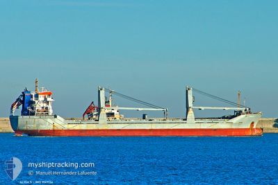
The vessel AASTIND (IMO: 9147136, MMSI: 236729000) is a General Cargo that was built in 1997 ( 28 years old ). It's sailing under the flag of [GI] Gibraltar.
In this page you can find informations about the vessels current position, last detected port calls, and current voyage information. If the vessels is not in coverage by AIS you will find the latest position.
The current position of AASTIND is detected by our AIS receivers and we are not responsible for the reliability of the data. The last position was recorded while the vessel was in Coverage by the Ais receivers of our vessel tracking app.
The current draught of AASTIND as reported by AIS is 4.2 meters
Weather
| Temperature | 8.2°C / 46.76°F |
|---|---|
| Wind Speed | 22 knots |
| Direction | 251° WSW |
| Pressure | 1009.7 hPa |
| Humidity | 87.9 % |
| Cloud Coverage | 100 % |
Featured Company
Last Port Calls
| Port | Arrival | Departure | Time In Port |
|---|---|---|---|
| 2025-12-06 19:45 | 2025-12-08 16:35 | 1 d | |
| 2025-12-02 14:47 | 2025-12-03 10:15 | 19 h | |
| 2025-11-29 16:41 | 2025-11-30 08:14 | 15 h | |
| 2025-11-26 05:04 | 2025-11-26 21:52 | 16 h | |
| 2025-11-23 03:08 | 2025-11-23 15:07 | 11 h | |
| 2025-11-19 16:41 | 2025-11-20 17:16 | 1 d | |
| 2025-11-16 16:02 | 2025-11-17 14:43 | 22 h | |
| 2025-11-15 03:44 | 2025-11-15 20:28 | 16 h | |
| 2025-11-09 06:52 | 2025-11-09 21:44 | 14 h | |
| 2025-11-06 05:07 | 2025-11-06 19:01 | 13 h |
Last Trips
| Origin | Departure | Destination | Arrival | Distance | |
|---|---|---|---|---|---|
| 2025-12-03 11:15 | 2025-12-06 20:45 | 591.15 nm | |||
| 2025-11-30 09:14 | 2025-12-02 15:47 | 424.49 nm | |||
| 2025-11-26 22:52 | 2025-11-29 17:41 | 419.77 nm | |||
| 2025-11-23 16:07 | 2025-11-26 06:04 | 419.66 nm | |||
| 2025-11-20 18:16 | 2025-11-23 04:08 | 419.84 nm | |||
| 2025-11-17 15:43 | 2025-11-19 17:41 | 420.41 nm | |||
| 2025-11-15 21:28 | 2025-11-16 17:02 | 230.75 nm | |||
| 2025-11-09 22:44 | 2025-11-15 04:44 | 761.07 nm | |||
| 2025-11-06 20:01 | 2025-11-09 07:52 | 414.60 nm | |||
| 2025-11-03 23:10 | 2025-11-06 06:07 | 420.81 nm |
Events
| Time | Event | Details | Position / Dest | Info |
|---|---|---|---|---|
| 2025-12-11 01:33 | Status Changed | Default Under way using engine |
55.87961 / 10.90456
NOARE
|
Speed: 11 kn Course: 39.3° |
| 2025-12-11 01:27 | OUT of Coverage |
55.86541 / 10.88364
Kattegat
NOARE
|
Speed: 11 kn Course: 39.3° |
|
| 2025-12-11 00:11 | Status Changed | Under way using engine Default |
55.64988 / 10.79525
NOARE
|
Speed: 10.2 kn Course: 339° |
| 2025-12-10 23:29 | Status Changed | Default Under way using engine |
55.53821 / 10.87636
NOARE
|
Speed: 10.1 kn Course: 333.6° |
| 2025-12-10 23:22 | Status Changed | Under way using engine Default |
55.51961 / 10.89148
NOARE
|
Speed: 10.3 kn Course: 334° |
| 2025-12-10 23:21 | Status Changed | Default Under way using engine |
55.51747 / 10.89330
NOARE
|
Speed: 10.4 kn Course: 332.4° |
| 2025-12-10 18:49 | Change Sea Area | Danish part of the Kattegat Danish part of the Baltic Sea |
54.75112 / 10.88777
Kattegat
NOARE
|
Speed: 11.3 kn Course: 355.6° |
| 2025-12-10 16:43 | START Moving | 1.43 nm, South East of RODBYHAVN |
54.63714 / 11.37970
NOARE
|
Speed: 3.7 kn Course: 200° |
| 2025-12-10 16:38 | Status Changed | Under way using engine Moored |
54.63775 / 11.37749
NOARE
|
Speed: 1.6 kn Course: 287° |
| 2025-12-10 16:30 | Status Changed | Moored Default |
54.63838 / 11.37532
NOARE
|
Speed: Course: 296° |