

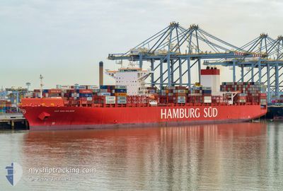
CAP SAN MALEAS
Container Ship

Current Trip
| Time Travelled | 14 days |
|---|---|
| Remaining Time | 8 days |
| Distance Travelled | 5392.29 nm |
| Remaining Distance | 3634.15 nm |
| AVG Speed | 16.4 Knots |
| MAX Speed | 19.9 Knots |
| AVG Wind | 11.9 knots |
| MAX Wind | 27 knots |
| MIN Temp | 14.7°C / 58.46°F |
| MAX Temp | 26.6°C / 79.88°F |
| Draught | 13.7 m |
| Position Received | 3 d ago |
Current Position
| Longitude | --- |
|---|---|
| Latitude | --- |
| Status | Under way using engine |
| Speed | 18.7 Knots |
| Course | 67.1° |
| Area | Indian Ocean |
| Station | T-AIS |
| Position Received | 3 d ago |
Information
The current position of CAP SAN MALEAS is in Indian Ocean with coordinates -32.80875° / 31.87208° as reported on 2025-03-30 00:06 by AIS to our vessel tracker app. The vessel's current speed is 18.7 Knots and is heading at the port of SINGAPORE. The estimated time of arrival as calculated by MyShipTracking vessel tracking app is 2025-04-10 19:29 LT
The vessel CAP SAN MALEAS (IMO: 9633941, MMSI: 353365000) is a Container Ship that was built in 2014 ( 11 years old ). It's sailing under the flag of [PA] Panama.
In this page you can find informations about the vessels current position, last detected port calls, and current voyage information. If the vessels is not in coverage by AIS you will find the latest position.
The current position of CAP SAN MALEAS is detected by our AIS receivers and we are not responsible for the reliability of the data. The last position was recorded while the vessel was in Coverage by the Ais receivers of our vessel tracking app.
The current draught of CAP SAN MALEAS as reported by AIS is 13.7 meters
Weather
| Temperature | 26°C / 78.8°F |
|---|---|
| Wind Speed | 11 knots |
| Direction | 113° ESE |
| Pressure | 1014.6 hPa |
| Humidity | 65.2 % |
| Cloud Coverage | --- |


Featured Company
Last Port Calls
| Port | Arrival | Departure | Time In Port |
|---|---|---|---|
| 2025-03-18 16:36 | 2025-03-18 17:01 | 25 m | |
| 2025-03-16 20:05 | 2025-03-17 13:20 | 17 h | |
| 2025-03-15 18:14 | 2025-03-16 11:25 | 17 h | |
| 2025-03-12 00:22 | 2025-03-13 05:26 | 1 d | |
| 2025-03-07 02:46 | 2025-03-08 08:46 | 1 d | |
| 2025-03-03 08:32 | 2025-03-03 22:19 | 13 h | |
| 2025-03-01 05:34 | 2025-03-02 13:34 | 1 d | |
| 2025-02-16 13:12 | 2025-02-17 03:38 | 14 h | |
| 2025-02-11 11:10 | 2025-02-13 00:17 | 1 d | |
| 2025-02-08 10:39 | 2025-02-09 17:42 | 1 d |
Most Visited Ports (Last year)
| Port | Arrivals | |
|---|---|---|
| 12 | ||
| 11 | ||
| 6 | ||
| 6 | ||
| 6 | ||
| 6 |
Last Trips
| Origin | Departure | Destination | Arrival | Distance | |
|---|---|---|---|---|---|
| 2025-03-17 10:20 | 2025-03-18 13:36 | 176.21 nm | |||
| 2025-03-16 08:25 | 2025-03-16 17:05 | 76.92 nm | |||
| 2025-03-13 02:26 | 2025-03-15 15:14 | 783.50 nm | |||
| 2025-03-08 05:46 | 2025-03-11 21:22 | 415.89 nm | |||
| 2025-03-03 19:19 | 2025-03-06 23:46 | 910.92 nm | |||
| 2025-03-02 10:34 | 2025-03-03 05:32 | 178.94 nm | |||
| 2025-02-17 04:38 | 2025-03-01 02:34 | 4417.88 nm | |||
| 2025-02-13 01:17 | 2025-02-16 14:12 | 1427.82 nm | |||
| 2025-02-09 18:42 | 2025-02-11 12:10 | 392.88 nm | |||
| 2025-02-07 23:18 | 2025-02-08 11:39 | 144.50 nm |
Events
| Time | Event | Details | Position / Dest | Info |
|---|---|---|---|---|
| 2025-03-30 00:12 | Status Changed | Default Under way using engine |
-32.79546 / 31.90946
BRSSZ>>>SGSIN
|
Speed: 18.7 kn Course: 67.1° |
| 2025-03-30 00:06 | Status Changed | Under way using engine Default |
-32.80875 / 31.87208
BRSSZ>>>SGSIN
|
Speed: 18.6 kn Course: 66° |
| 2025-03-30 00:06 | OUT of Coverage |
-32.80875 / 31.87208
Indian Ocean
BRSSZ>>>SGSIN
|
Speed: 18.7 kn Course: 67.1° |
|
| 2025-03-29 23:59 | Status Changed | Default Under way using engine |
-32.82251 / 31.83446
BRSSZ>>>SGSIN
|
Speed: 18.6 kn Course: 65.7° |
| 2025-03-29 23:50 | Status Changed | Under way using engine Default |
-32.84093 / 31.78590
BRSSZ>>>SGSIN
|
Speed: 18.5 kn Course: 64° |
| 2025-03-29 23:47 | Status Changed | Default Under way using engine |
-32.84819 / 31.76702
BRSSZ>>>SGSIN
|
Speed: 18.4 kn Course: 64.9° |
| 2025-03-29 23:44 | Change Sea Area | South African part of the Indian Ocean Brazilian part of the South Atlantic Ocean |
-32.85571 / 31.74763
Indian Ocean
BRSSZ>>>SGSIN
|
Speed: 18.4 kn Course: 64.9° |
| 2025-03-29 23:43 | Status Changed | Under way using engine Default |
-32.85656 / 31.74552
BRSSZ>>>SGSIN
|
Speed: 18.5 kn Course: 65° |
| 2025-03-29 23:38 | IN Coverage |
-32.85571 / 31.74763
Indian Ocean
BRSSZ>>>SGSIN
|
Speed: 18.4 kn Course: 64.9° |