
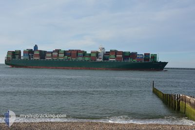
CHARLESTON EXPRESS
Container Ship
Current Trip
| Time Travelled | 4 days |
|---|---|
| Remaining Time | --- |
| Distance Travelled | 396.30 nm |
| Remaining Distance | --- |
| AVG Speed | 9.4 Knots |
| MAX Speed | 19.7 Knots |
| AVG Wind | 5.3 knots |
| MAX Wind | 12.9 knots |
| MIN Temp | 25.6°C / 78.08°F |
| MAX Temp | 29.9°C / 85.82°F |
| Draught | 14 m |
| Position Received | 4 d ago |
Current Position
| Longitude | 107.03151° |
|---|---|
| Latitude | 10.41347° |
| Status | Under way using engine |
| Speed | 12.4 Knots |
| Course | 150.3° |
| Area | South China Sea |
| Station | T-AIS |
| Position Received | 4 d ago |
Info
Information
The current position of CHARLESTON EXPRESS is in South China Sea with coordinates 10.41347° / 107.03151° as reported on 2024-06-26 01:41 by AIS to our vessel tracker app. The vessel's current speed is 12.4 Knots
The vessel CHARLESTON EXPRESS (IMO: 9665645, MMSI: 636093018) is a Container Ship that was built in 2014 ( 10 years old ). It's sailing under the flag of [LR] Liberia.
In this page you can find informations about the vessels current position, last detected port calls, and current voyage information. If the vessels is not in coverage by AIS you will find the latest position.
The current position of CHARLESTON EXPRESS is detected by our AIS receivers and we are not responsible for the reliability of the data. The last position was recorded while the vessel was in Coverage by the Ais receivers of our vessel tracking app.
The current draught of CHARLESTON EXPRESS as reported by AIS is 14 meters
Weather
| Temperature | 29.5°C / 85.1°F |
|---|---|
| Wind Speed | 12 knots |
| Direction | 189° S |
| Pressure | 1008.4 hPa |
| Humidity | 74.2 % |
| Cloud Coverage | 76 % |
Featured Company
Last Port Calls
| Port | Arrival | Departure | Time In Port |
|---|---|---|---|
| 2024-06-25 10:08 | 2024-06-26 07:31 | 21 h | |
| 2024-06-20 10:58 | 2024-06-20 22:42 | 11 h | |
| 2024-06-19 08:01 | 2024-06-19 17:41 | 9 h | |
| 2024-06-17 11:49 | 2024-06-18 00:28 | 12 h | |
| 2024-04-18 11:57 | |||
| 2024-04-12 07:34 | 2024-04-13 13:49 | 1 d | |
| 2024-04-02 01:37 | 2024-04-02 14:08 | 12 h |
Last Trips
| Origin | Departure | Destination | Arrival | Distance | |
|---|---|---|---|---|---|
| 2024-06-20 22:42 | 2024-06-25 10:08 | 937.30 nm | |||
| 2024-06-19 17:41 | 2024-06-20 10:58 | 79.41 nm | |||
| 2024-06-18 00:28 | 2024-06-19 08:01 | 459.97 nm | |||
| 2024-04-13 13:49 | 2024-04-18 11:57 | 575.12 nm | |||
| 2024-04-02 14:08 | 2024-04-12 07:34 | 2897.62 nm | |||
| 2024-03-02 03:29 | 2024-04-02 01:37 | 11838.58 nm |
Events
| Time | Event | Details | Position / Dest | Info |
|---|---|---|---|---|
| 2024-06-30 10:41 | STOP Moving |
5.81019 / 106.40673
SGSIN
|
Speed: 0.2 kn Course: 238° |
|
| 2024-06-30 09:14 | START Moving |
5.83023 / 106.48229
SGSIN
|
Speed: 3.8 kn Course: 265° |
|
| 2024-06-30 00:37 | STOP Moving |
5.81747 / 106.39196
SGSIN
|
Speed: 0.2 kn Course: 238° |
|
| 2024-06-29 23:13 | START Moving |
5.78039 / 106.47142
SGSIN
|
Speed: 4.1 kn Course: 301° |
|
| 2024-06-29 12:48 | STOP Moving |
5.82414 / 106.38898
SGSIN
|
Speed: 0.3 kn Course: 257° |
|
| 2024-06-29 11:17 | START Moving |
5.78010 / 106.48274
SGSIN
|
Speed: 4.1 kn Course: 293° |
|
| 2024-06-29 09:07 | STOP Moving |
5.78202 / 106.46980
SGSIN
|
Speed: 0.3 kn Course: 261° |
|
| 2024-06-28 22:56 | START Moving |
5.77660 / 106.48052
SGSIN
|
Speed: 4.5 kn Course: 295° |
|
| 2024-06-28 19:07 | STOP Moving |
5.79711 / 106.45081
SGSIN
|
Speed: Course: 295° |
|
| 2024-06-28 18:15 | START Moving |
5.74362 / 106.47664
SGSIN
|
Speed: 4.4 kn Course: 300° |