

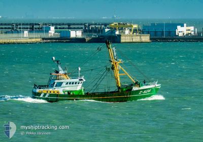
Z526 VAYA CON DIOS
Fishing

Current Trip
| Trip Time | 4 days |
|---|---|
| Trip Distance | 656.48 nm |
| AVG Speed | 5 Knop |
| MAX Speed | 5 Knop |
| Djupgående | 4.8 m |
| AVG Wind | 15.6 knots |
| MAX Wind | 29 knots |
| MIN Temp | 3.7°C / 38.66°F |
| MAX Temp | 10.9°C / 51.62°F |
| Position mottagen | 1 d sen |
Current Position
| Longitud | --- |
|---|---|
| Latitude | --- |
| Status | Under way using engine |
| Fart | |
| Kurs | 141° |
| Område | North Sea |
| Station | T-AIS |
| Position mottagen | 1 d sen |
Information
The current position of Z526 VAYA CON DIOS is in North Sea with coordinates 51.23202° / 2.93351° as reported on 2025-03-02 05:58 by AIS to our vessel tracker app. The vessel's current speed is 0 Knop and is currently inside the port of OOSTENDE.
The vessel Z526 VAYA CON DIOS (IMO: 9202871, MMSI: 205316000) is a Fishing It's sailing under the flag of [BE] Belgium.
In this page you can find informations about the vessels current position, last detected port calls, and current voyage information. If the vessels is not in coverage by AIS you will find the latest position.
The current position of Z526 VAYA CON DIOS is detected by our AIS receivers and we are not responsible for the reliability of the data. The last position was recorded while the vessel was in Coverage by the Ais receivers of our vessel tracking app.
The current draught of Z526 VAYA CON DIOS as reported by AIS is 4.8 meters
Weather
| Temperature | 2.7°C / 36.86°F |
|---|---|
| Wind Speed | 5 knots |
| Direction | 88° E |
| Pressure | 1035.1 hPa |
| Humidity | 85.5 % |
| Cloud Coverage | 100 % |


Featured Company
Last Port Calls
| Port | Arrival | Departure | Time In Port |
|---|---|---|---|
| 2025-03-01 05:29 | |||
| 2025-02-23 23:25 | 2025-02-24 11:20 | 11 h | |
| 2025-02-20 06:25 | 2025-02-20 17:13 | 10 h | |
| 2025-02-06 01:51 | 2025-02-10 17:52 | 4 d | |
| 2025-01-26 20:56 | 2025-01-29 09:14 | 2 d | |
| 2025-01-19 10:02 | 2025-01-22 16:48 | 3 d | |
| 2025-01-09 08:21 | 2025-01-10 16:37 | 1 d | |
| 2025-01-03 15:32 |
Last Trips
| Origin | Departure | Destination | Arrival | Distance | |
|---|---|---|---|---|---|
| 2025-02-24 11:20 | 2025-03-01 05:29 | 656.48 nm | |||
| 2025-02-20 17:13 | 2025-02-23 23:25 | 468.68 nm | |||
| 2025-02-10 17:52 | 2025-02-20 06:25 | 1104.78 nm | |||
| 2025-01-29 09:14 | 2025-02-06 01:51 | 840.25 nm | |||
| 2025-01-22 16:48 | 2025-01-26 20:56 | 496.10 nm | |||
| 2025-01-10 16:37 | 2025-01-19 10:02 | 848.07 nm | |||
| 2025-01-03 15:32 | 2025-01-09 08:21 | 564.97 nm |
Events
| Tid | Event | Detaljer | Position / Dest | Information |
|---|---|---|---|---|
| 2025-03-02 05:58 | UTANFÖR täckningsområde |
51.23202 / 2.93351
North Sea
[BE] OOSTENDE
|
Fart: Kurs: 141° |
|
| 2025-03-01 05:04 | STOPPAR förflyttning |
51.23277 / 2.93245
[BE] OOSTENDE
|
Fart: 0.3 kn Kurs: 137° |
|
| 2025-03-01 04:59 | STARTAR förflyttning |
51.23447 / 2.93076
[BE] OOSTENDE
|
Fart: 3.3 kn Kurs: 141° |
|
| 2025-03-01 04:40 | STOPPAR förflyttning |
51.23485 / 2.92791
[BE] OOSTENDE
|
Fart: 0.3 kn Kurs: 85° |
|
| 2025-03-01 04:29 | ANLÄNDER HAMN |
|
51.24072 / 2.91802
[BE] OOSTENDE
|
Fart: 9.6 kn Kurs: 147° |
| 2025-03-01 02:22 | Byter havsområde | Belgian part of the North Sea French part of the North Sea |
51.33681 / 2.35986
North Sea
OOSTENDE
|
Fart: 12.6 kn Kurs: 66.5° |
| 2025-03-01 00:58 | Byter havsområde | French part of the North Sea United Kingdom part of the North Sea |
51.34869 / 2.04503
North Sea
OOSTENDE
|
Fart: 4.9 kn Kurs: 100.5° |
| 2025-02-28 16:59 | STARTAR förflyttning | 20.78 nm, East of RAMSGATE |
51.35489 / 1.97163
OOSTENDE
|
Fart: 5.4 kn Kurs: 3.6° |
| 2025-02-28 16:56 | STOPPAR förflyttning | 20.78 nm, East of RAMSGATE |
51.35309 / 1.97171
OOSTENDE
|
Fart: 0.3 kn Kurs: 5° |
| 2025-02-28 15:07 | Byter havsområde | United Kingdom part of the North Sea French part of the North Sea |
51.08759 / 1.68295
North Sea
OOSTENDE
|
Fart: 11.6 kn Kurs: 29.7° |