
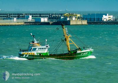
Z526 VAYA CON DIOS
Fishing
Current Trip
| Time Travelled | 3 days |
|---|---|
| Remaining Time | 1 day |
| Distance Travelled | 348.61 nm |
| Remaining Distance | 168.56 nm |
| AVG Speed | 4.7 Noeuds |
| MAX Speed | 10.7 Noeuds |
| AVG Wind | 6.7 knots |
| MAX Wind | 14 knots |
| MIN Temp | 5°C / 41°F |
| MAX Temp | 7.4°C / 45.32°F |
| Tirant d eau | 4.8 m |
| Position reçue | Maintenant |
Current Position
| Longitude | --- |
|---|---|
| Latitude | --- |
| Etat | Engaged in Fishing |
| Vitesse | 4.2 Noeuds |
| Parcours | 194° |
| Zone | English Channel |
| Station | T-AIS |
| Position reçue | Maintenant |
Info
Information
The current position of Z526 VAYA CON DIOS is in English Channel with coordinates 49.99253° / -0.37265° as reported on 2025-01-14 07:21 by AIS to our vessel tracker app. The vessel's current speed is 4.2 Noeuds and is heading at the port of ZEEBRUGGE. The estimated time of arrival as calculated by MyShipTracking vessel tracking app is 2025-01-15 21:31 LT
The vessel Z526 VAYA CON DIOS (IMO: 9202871, MMSI: 205316000) is a Fishing It's sailing under the flag of [BE] Belgium.
In this page you can find informations about the vessels current position, last detected port calls, and current voyage information. If the vessels is not in coverage by AIS you will find the latest position.
The current position of Z526 VAYA CON DIOS is detected by our AIS receivers and we are not responsible for the reliability of the data. The last position was recorded while the vessel was in Coverage by the Ais receivers of our vessel tracking app.
The current draught of Z526 VAYA CON DIOS as reported by AIS is 4.8 meters
Weather
| Temperature | 7.4°C / 45.32°F |
|---|---|
| Wind Speed | 4 knots |
| Direction | 264° W |
| Pressure | 1036.4 hPa |
| Humidity | 64.6 % |
| Cloud Coverage | 100 % |
Featured Company
Last Port Calls
| Port | Arrival | Departure | Time In Port |
|---|---|---|---|
| 2025-01-09 07:21 | 2025-01-10 15:37 | 1 d | |
| 2024-12-22 15:39 | 2025-01-03 14:32 | 11 d | |
| 2024-12-16 09:24 | 2024-12-16 21:03 | 11 h | |
| 2024-12-06 11:37 | 2024-12-10 14:36 | 4 d | |
| 2024-12-03 12:52 | 2024-12-03 22:55 | 10 h | |
| 2024-11-23 13:45 | 2024-11-26 19:15 | 3 d | |
| 2024-11-14 10:44 | 2024-11-15 15:06 | 1 d | |
| 2024-11-03 13:48 | 2024-11-05 14:19 | 2 d |
Last Trips
| Origin | Departure | Destination | Arrival | Distance | |
|---|---|---|---|---|---|
| 2025-01-03 15:32 | 2025-01-09 08:21 | 564.97 nm | |||
| 2024-12-16 22:03 | 2024-12-22 16:39 | 597.03 nm | |||
| 2024-12-10 15:36 | 2024-12-16 10:24 | 436.61 nm | |||
| 2024-12-03 23:55 | 2024-12-06 12:37 | 353.50 nm | |||
| 2024-11-26 20:15 | 2024-12-03 13:52 | 709.00 nm | |||
| 2024-11-15 16:06 | 2024-11-23 14:45 | 397.18 nm | |||
| 2024-11-05 15:19 | 2024-11-14 11:44 | 677.38 nm | |||
| 2024-10-26 17:06 | 2024-11-03 14:48 | 841.58 nm |
Events
| Heure | Evenement | Détails | Position/ Destination | Info |
|---|---|---|---|---|
| 2025-01-13 17:36 | Changement de destination | ZEEBRUGGE LEHAVRE |
50.15096 / -.19526
ZEEBRUGGE
|
Vitesse: 5 kn Parcours: 0° |
| 2025-01-13 17:36 | Changement d'ETA | 2025/01/19 10:00 2025/01/09 07:00 |
50.15096 / -.19526
ZEEBRUGGE
|
Vitesse: 5 kn Parcours: 0° |
| 2025-01-13 06:16 | Dans la zone couverte |
49.98897 / -.18691
English Channel
|
Vitesse: 3.8 kn Parcours: 122.4° |
|
| 2025-01-13 05:05 | Hors de la zone couverte |
50.08588 / -.19230
English Channel
|
Vitesse: 5.5 kn Parcours: 140.6° |
|
| 2025-01-13 04:37 | Dans la zone couverte |
50.07843 / -.24933
English Channel
|
Vitesse: 4.7 kn Parcours: 75.3° |
|
| 2025-01-13 01:20 | Hors de la zone couverte |
50.08966 / -.29752
English Channel
|
Vitesse: 3.9 kn Parcours: 78.6° |
|
| 2025-01-12 21:36 | Dans la zone couverte |
50.11041 / -.20859
English Channel
|
Vitesse: 4.5 kn Parcours: 54.9° |
|
| 2025-01-12 19:35 | Hors de la zone couverte |
50.10485 / -.21486
English Channel
|
Vitesse: 3.5 kn Parcours: 228.6° |
|
| 2025-01-12 17:03 | Dans la zone couverte |
50.08569 / -.32697
English Channel
|
Vitesse: 4.7 kn Parcours: 112.9° |
|
| 2025-01-12 15:20 | Hors de la zone couverte |
50.08118 / -.42116
English Channel
|
Vitesse: 1.5 kn Parcours: 256.2° |