
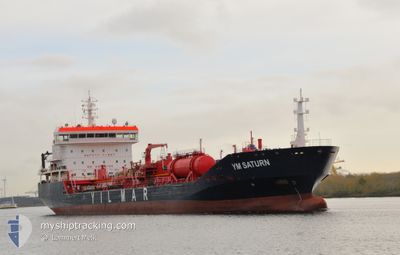
YM SATURN
Oil/Chemical Tanker
Current Trip
| Time Travelled | 8 days |
|---|---|
| Remaining Time | 6 days |
| Distance Travelled | 2305.29 nm |
| Remaining Distance | 1703.55 nm |
| AVG Speed | 11.3 Knop |
| MAX Speed | 16.5 Knop |
| AVG Wind | 11.2 knots |
| MAX Wind | 23.2 knots |
| MIN Temp | 11.9°C / 53.42°F |
| MAX Temp | 19.9°C / 67.82°F |
| Djupgående | 6.5 m |
| Position mottagen | 4 d sen |
Current Position
| Longitud | -14.07350° |
|---|---|
| Latitude | 38.15650° |
| Status | Under way using engine |
| Fart | 12.3 Knop |
| Kurs | 296° |
| Område | North Atlantic Ocean |
| Station | T-AIS |
| Position mottagen | 4 d sen |
Info
Information
The current position of YM SATURN is in North Atlantic Ocean with coordinates 38.15650° / -14.07350° as reported on 2024-05-09 08:10 by AIS to our vessel tracker app. The vessel's current speed is 12.3 Knop and is heading at the port of MONTREAL. The estimated time of arrival as calculated by MyShipTracking vessel tracking app is 2024-05-19 16:38 LT
The vessel YM SATURN (IMO: 9362138, MMSI: 256929000) is a Oil/Chemical Tanker that was built in 2007 ( 17 År gammal ). It's sailing under the flag of [MT] Malta.
In this page you can find informations about the vessels current position, last detected port calls, and current voyage information. If the vessels is not in coverage by AIS you will find the latest position.
The current position of YM SATURN is detected by our AIS receivers and we are not responsible for the reliability of the data. The last position was recorded while the vessel was in Coverage by the Ais receivers of our vessel tracking app.
The current draught of YM SATURN as reported by AIS is 6.5 meters
Weather
| Temperature | 14.5°C / 58.1°F |
|---|---|
| Wind Speed | 10 knots |
| Direction | 159° SSE |
| Pressure | 1032.4 hPa |
| Humidity | 75.1 % |
| Cloud Coverage | 76 % |
Featured Company
Last Port Calls
| Port | Arrival | Departure | Time In Port |
|---|---|---|---|
| 2024-05-03 07:42 | 2024-05-04 17:32 | 1 d | |
| 2024-04-29 10:13 | 2024-04-30 21:24 | 1 d | |
| 2024-04-26 15:56 | 2024-04-28 07:40 | 1 d | |
| 2024-04-19 20:22 | 2024-04-21 13:39 | 1 d | |
| 2024-04-14 21:26 | 2024-04-16 12:34 | 1 d | |
| 2024-04-10 11:10 | 2024-04-11 15:49 | 1 d | |
| 2024-04-04 18:36 | 2024-04-04 19:28 | 52 m | |
| 2024-04-03 06:43 | 2024-04-04 18:03 | 1 d | |
| 2024-04-03 05:24 | 2024-04-03 06:14 | 49 m | |
| 2024-04-02 13:59 | 2024-04-03 03:03 | 13 h |
Most Visited Ports (Last year)
| Port | Arrivals | |
|---|---|---|
| 2 | ||
| 2 | ||
| 2 | ||
| 2 | ||
| 2 | ||
| 1 |
Last Trips
| Origin | Departure | Destination | Arrival | Distance | |
|---|---|---|---|---|---|
| 2024-04-30 23:24 | 2024-05-03 09:42 | 351.25 nm | |||
| 2024-04-28 09:40 | 2024-04-29 12:13 | 54.93 nm | |||
| 2024-04-21 15:39 | 2024-04-26 17:56 | 200.69 nm | |||
| 2024-04-16 14:34 | 2024-04-19 22:22 | 968.08 nm | |||
| 2024-04-11 17:49 | 2024-04-14 23:26 | 599.92 nm | |||
| 2024-04-04 20:28 | 2024-04-10 13:10 | 1290.78 nm | |||
| 2024-04-04 19:03 | 2024-04-04 19:36 | 1.99 nm | |||
| 2024-04-03 07:14 | 2024-04-03 07:43 | 1.98 nm | |||
| 2024-03-26 04:42 | 2024-04-03 06:24 | 1488.65 nm | |||
| 2024-03-26 04:42 | 2024-04-02 14:59 | 1454.80 nm |
Events
| Tid | Event | Detaljer | Position / Dest | Information |
|---|---|---|---|---|
| 2024-05-09 08:16 | Status ändrad | Default Under way using engine |
38.16469 / -14.09442
GIGIB > CACSN
|
Fart: 12.3 kn Kurs: 296° |
| 2024-05-09 08:10 | UTANFÖR täckningsområde |
38.15650 / -14.07350
North Atlantic Ocean
GIGIB > CACSN
|
Fart: 12.3 kn Kurs: 296° |
|
| 2024-05-09 07:52 | Upptäckt i hav | High seas of the North Atlantic Ocean |
38.13034 / -14.00553
North Atlantic Ocean
GIGIB > CACSN
|
Fart: 12.1 kn Kurs: 297° |
| 2024-05-09 07:52 | Status ändrad | Under way using engine Default |
38.12907 / -14.00224
GIGIB > CACSN
|
Fart: 11.8 kn Kurs: 298° |
| 2024-05-09 07:52 | I täckningsområde |
38.13034 / -14.00553
North Atlantic Ocean
GIGIB > CACSN
|
Fart: 12.1 kn Kurs: 297° |
|
| 2024-05-09 05:08 | Status ändrad | Default Under way using engine |
37.86850 / -13.38283
GIGIB > CACSN
|
Fart: 12.7 kn Kurs: 299° |
| 2024-05-09 05:01 | Status ändrad | Under way using engine Default |
37.85640 / -13.35536
GIGIB > CACSN
|
Fart: 12.5 kn Kurs: 298° |
| 2024-05-09 05:01 | UTANFÖR täckningsområde |
37.85640 / -13.35536
North Atlantic Ocean
GIGIB > CACSN
|
Fart: 12.7 kn Kurs: 299° |
|
| 2024-05-09 04:17 | Status ändrad | Default Under way using engine |
37.78567 / -13.18850
GIGIB > CACSN
|
Fart: 12.5 kn Kurs: 298° |
| 2024-05-09 04:02 | Status ändrad | Under way using engine Default |
37.76100 / -13.12933
GIGIB > CACSN
|
Fart: 12.5 kn Kurs: 299° |