
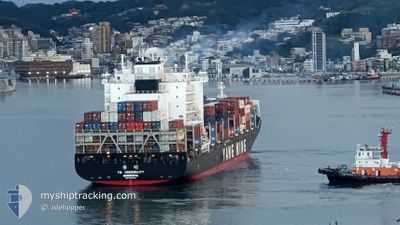
YM CREDIBILITY
Cargo D
Current Trip
BEANR>EGEDK
| Time Travelled | 2 h, 46 mins |
|---|---|
| Remaining Time | --- |
| Distance Travelled | 0.87 nm |
| Remaining Distance | --- |
| AVG Speed | --- |
| MAX Speed | --- |
| AVG Wind | 6 knots |
| MAX Wind | 6 knots |
| MIN Temp | 16.2°C / 61.16°F |
| MAX Temp | 16.2°C / 61.16°F |
| Djupgående | 10.6 m |
| Position mottagen | 4 d sen |
Current Position
| Longitud | --- |
|---|---|
| Latitude | --- |
| Status | Under way using engine |
| Fart | 11.3 Knop |
| Kurs | 112.2° |
| Område | Mediterranean Sea - Eastern Basin |
| Station | T-AIS |
| Position mottagen | 4 d sen |
Info
Information
The current position of YM CREDIBILITY is in Mediterranean Sea - Eastern Basin with coordinates 36.15031° / 14.71115° as reported on 2025-02-12 10:43 by AIS to our vessel tracker app. The vessel's current speed is 11.3 Knop
The vessel YM CREDIBILITY (IMO: 9864564, MMSI: 636019898) is a Cargo D It's sailing under the flag of [LR] Liberia.
In this page you can find informations about the vessels current position, last detected port calls, and current voyage information. If the vessels is not in coverage by AIS you will find the latest position.
The current position of YM CREDIBILITY is detected by our AIS receivers and we are not responsible for the reliability of the data. The last position was recorded while the vessel was in Coverage by the Ais receivers of our vessel tracking app.
The current draught of YM CREDIBILITY as reported by AIS is 10.6 meters
Weather
| Temperature | 16.1°C / 60.98°F |
|---|---|
| Wind Speed | 7 knots |
| Direction | 337° NNW |
| Pressure | 1015.8 hPa |
| Humidity | 63.3 % |
| Cloud Coverage | --- |
Featured Company
Last Port Calls
| Port | Arrival | Departure | Time In Port |
|---|---|---|---|
| 2025-02-15 18:49 | 2025-02-16 15:47 | 20 h | |
| 2025-02-05 14:35 | 2025-02-06 02:43 | 12 h | |
| 2025-01-31 12:56 | 2025-02-01 07:18 | 18 h | |
| 2025-01-29 08:18 | 2025-01-30 01:04 | 16 h | |
| 2025-01-28 10:00 | 2025-01-28 16:14 | 6 h | |
| 2025-01-25 14:16 | 2025-01-26 15:54 | 1 d | |
| 2025-01-20 04:13 | 2025-01-20 20:21 | 16 h | |
| 2024-12-16 16:37 | 2024-12-17 09:08 | 16 h | |
| 2024-12-14 21:28 | 2024-12-15 18:16 | 20 h | |
| 2024-12-12 02:27 | 2024-12-12 16:22 | 13 h |
Last Trips
| Origin | Departure | Destination | Arrival | Distance | |
|---|---|---|---|---|---|
| 2025-02-06 02:43 | 2025-02-15 18:49 | 3250.63 nm | |||
| 2025-02-01 07:18 | 2025-02-05 14:35 | 413.80 nm | |||
| 2025-01-30 01:04 | 2025-01-31 12:56 | 301.65 nm | |||
| 2025-01-28 16:14 | 2025-01-29 08:18 | 157.73 nm | |||
| 2025-01-26 15:54 | 2025-01-28 10:00 | 189.54 nm | |||
| 2025-01-20 20:21 | 2025-01-25 14:16 | 287.62 nm | |||
| 2024-12-17 09:08 | 2025-01-20 04:13 | 13134.65 nm | |||
| 2024-12-15 18:16 | 2024-12-16 16:37 | 349.47 nm | |||
| 2024-12-12 16:22 | 2024-12-14 21:28 | 486.67 nm | |||
| 2024-12-07 07:14 | 2024-12-12 02:27 | 1704.80 nm |
Events
| Tid | Event | Detaljer | Position / Dest | Information |
|---|---|---|---|---|
| 2025-02-16 13:47 | AVGÅTT HAMN |
|
31.17165 / 29.80496
BEANR>EGEDK
|
Fart: 9.3 kn Kurs: 353° |
| 2025-02-16 13:42 | STARTAR förflyttning |
31.15825 / 29.80745
[EG] EL DEKHEILA
|
Fart: 9.3 kn Kurs: 353° |
|
| 2025-02-15 17:11 | STOPPAR förflyttning |
31.14309 / 29.79741
[EG] EL DEKHEILA
|
Fart: 0.1 kn Kurs: 210° |
|
| 2025-02-15 16:49 | ANLÄNDER HAMN |
|
31.15230 / 29.80841
[EG] EL DEKHEILA
|
Fart: 6.5 kn Kurs: 175° |
| 2025-02-15 16:09 | STARTAR förflyttning | 4.32 nm, North West of ALEXANDRIA |
31.21962 / 29.79121
BEANR>EGEDK
|
Fart: 4.7 kn Kurs: 156° |
| 2025-02-15 15:00 | STOPPAR förflyttning | 4.6 nm, North West of ALEXANDRIA |
31.22259 / 29.78708
BEANR>EGEDK
|
Fart: 0.3 kn Kurs: 73° |
| 2025-02-12 16:34 | STARTAR förflyttning |
35.86517 / 15.51468
BEANR>EGEDK
|
Fart: 3.5 kn Kurs: 198° |
|
| 2025-02-12 15:15 | STOPPAR förflyttning |
35.87248 / 15.51992
BEANR>EGEDK
|
Fart: 0.3 kn Kurs: 291° |
|
| 2025-02-12 10:49 | Status ändrad | Default Under way using engine |
36.14347 / 14.73267
BEANR>EGEDK
|
Fart: 11.3 kn Kurs: 112.2° |
| 2025-02-12 10:43 | UTANFÖR täckningsområde |
36.15031 / 14.71115
Mediterranean Sea - Eastern Basin
BEANR>EGEDK
|
Fart: 11.3 kn Kurs: 112.2° |