
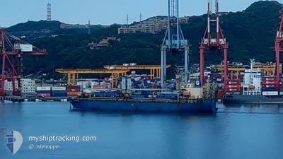
XINGHE CENTURY
Ro-Ro Cargo
Current Trip
| Time Travelled | 7 days |
|---|---|
| Remaining Time | --- |
| Distance Travelled | 2140.80 nm |
| Remaining Distance | --- |
| AVG Speed | 11.5 Knop |
| MAX Speed | 15 Knop |
| AVG Wind | 9.6 knots |
| MAX Wind | 19 knots |
| MIN Temp | 25°C / 77°F |
| MAX Temp | 28.4°C / 83.12°F |
| Djupgående | 5.4 m |
| Position mottagen | 2 d sen |
Current Position
| Longitud | --- |
|---|---|
| Latitude | --- |
| Status | Under way using engine |
| Fart | 10.8 Knop |
| Kurs | 78° |
| Område | Singapore Strait |
| Station | T-AIS |
| Position mottagen | 2 d sen |
Info
Information
The current position of XINGHE CENTURY is in Singapore Strait with coordinates 1.25322° / 104.14287° as reported on 2026-01-01 22:13 by AIS to our vessel tracker app. The vessel's current speed is 10.8 Knop
The vessel XINGHE CENTURY (IMO: 9282376, MMSI: 353345000) is a Ro-Ro Cargo that was built in 2003 ( 23 År gammal ). It's sailing under the flag of [PA] Panama.
In this page you can find informations about the vessels current position, last detected port calls, and current voyage information. If the vessels is not in coverage by AIS you will find the latest position.
The current position of XINGHE CENTURY is detected by our AIS receivers and we are not responsible for the reliability of the data. The last position was recorded while the vessel was in Coverage by the Ais receivers of our vessel tracking app.
The current draught of XINGHE CENTURY as reported by AIS is 5.4 meters
Weather
| Temperature | 26.4°C / 79.52°F |
|---|---|
| Wind Speed | 7 knots |
| Direction | 265° W |
| Pressure | 1011.9 hPa |
| Humidity | 78.4 % |
| Cloud Coverage | 100 % |
Featured Company
Last Port Calls
| Port | Arrival | Departure | Time In Port |
|---|---|---|---|
| 2025-12-26 08:42 | 2025-12-27 09:10 | 1 d | |
| 2025-12-10 09:52 | 2025-12-11 18:25 | 1 d | |
| 2025-12-02 07:55 | 2025-12-10 01:35 | 7 d | |
| 2025-11-08 17:28 | 2025-11-12 20:30 | 4 d |
Most Visited Ports (Last year)
| Port | Arrivals | |
|---|---|---|
| 2 | ||
| 2 | ||
| 1 | ||
| 1 | ||
| 1 | ||
| 1 |
Last Trips
| Origin | Departure | Destination | Arrival | Distance | |
|---|---|---|---|---|---|
| 2025-12-11 18:25 | 2025-12-26 08:42 | 4107.50 nm | |||
| 2025-12-10 01:35 | 2025-12-10 09:52 | 78.94 nm | |||
| 2025-11-12 20:30 | 2025-12-02 07:55 | 3053.52 nm | |||
| 2025-10-24 15:32 | 2025-11-08 17:28 | 2998.72 nm |
Events
| Tid | Event | Detaljer | Position / Dest | Information |
|---|---|---|---|---|
| 2026-01-03 17:04 | STOPPAR förflyttning | 6.6 nm, North East of JAKARTA |
-6.00207 / 106.89651
ID JAKARTA
|
Fart: 0.3 kn Kurs: 166° |
| 2026-01-01 22:21 | Status ändrad | Default Under way using engine |
1.25745 / 104.16563
ID JAKARTA
|
Fart: 10.8 kn Kurs: 78° |
| 2026-01-01 22:13 | UTANFÖR täckningsområde |
1.25322 / 104.14287
Singapore Strait
ID JAKARTA
|
Fart: 10.8 kn Kurs: 78° |
|
| 2026-01-01 17:57 | Status ändrad | Under way using engine Default |
1.13982 / 103.47665
ID JAKARTA
|
Fart: 11.5 kn Kurs: 119° |
| 2026-01-01 17:50 | Status ändrad | Default Under way using engine |
1.15188 / 103.45647
ID JAKARTA
|
Fart: 11.4 kn Kurs: 112° |
| 2026-01-01 17:46 | Byter havsområde | Indonesian part of the Singapore Strait Malaysian part of the Malacca Strait |
1.15707 / 103.44532
Singapore Strait
ID JAKARTA
|
Fart: 11.4 kn Kurs: 112° |
| 2026-01-01 17:45 | Status ändrad | Under way using engine Default |
1.15848 / 103.44193
ID JAKARTA
|
Fart: 11.4 kn Kurs: 116° |
| 2026-01-01 17:37 | I täckningsområde |
1.15707 / 103.44532
Singapore Strait
ID JAKARTA
|
Fart: 11.4 kn Kurs: 112° |
|
| 2026-01-01 11:28 | UTANFÖR täckningsområde |
1.84920 / 102.33437
Malacca Strait
ID JAKARTA
|
Fart: 13.5 kn Kurs: 117° |
|
| 2026-01-01 11:28 | Byter havsområde | Malaysian part of the Malacca Strait Indonesian part of the Malacca Strait |
1.84920 / 102.33437
Malacca Strait
ID JAKARTA
|
Fart: 13.5 kn Kurs: 117° |