
XINGHE CENTURY
Ro-Ro Cargo
Current Trip
ID TPP
| Time Travelled | 7 days |
|---|---|
| Remaining Time | --- |
| Distance Travelled | 1222.70 nm |
| Remaining Distance | --- |
| AVG Speed | 11.5 Noeuds |
| MAX Speed | 12.9 Noeuds |
| AVG Wind | 6.7 knots |
| MAX Wind | 19.2 knots |
| MIN Temp | 24.9°C / 76.82°F |
| MAX Temp | 29.4°C / 84.92°F |
| Tirant d eau | 8.2 m |
| Position reçue | 11 d depuis |
Current Position
| Longitude | --- |
|---|---|
| Latitude | --- |
| Etat | Under way using engine |
| Vitesse | 9.7 Noeuds |
| Parcours | 114° |
| Zone | South China Sea |
| Station | T-AIS |
| Position reçue | 11 d depuis |
Info
Information
The current position of XINGHE CENTURY is in South China Sea with coordinates 3.88273° / 103.58355° as reported on 2025-03-06 10:55 by AIS to our vessel tracker app. The vessel's current speed is 9.7 Noeuds
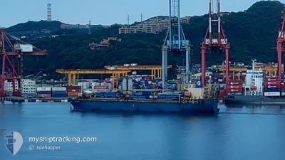
The vessel XINGHE CENTURY (IMO: 9282376, MMSI: 353345000) is a Ro-Ro Cargo that was built in 2003 ( 22 Age ). It's sailing under the flag of [PA] Panama.
In this page you can find informations about the vessels current position, last detected port calls, and current voyage information. If the vessels is not in coverage by AIS you will find the latest position.
The current position of XINGHE CENTURY is detected by our AIS receivers and we are not responsible for the reliability of the data. The last position was recorded while the vessel was in Coverage by the Ais receivers of our vessel tracking app.
The current draught of XINGHE CENTURY as reported by AIS is 8.2 meters
Weather
| Temperature | 26.2°C / 79.16°F |
|---|---|
| Wind Speed | 3 knots |
| Direction | 218° SW |
| Pressure | 1010.1 hPa |
| Humidity | 82.9 % |
| Cloud Coverage | 98 % |
Featured Company
Last Trips
| Origin | Departure | Destination | Arrival | Distance | |
|---|---|---|---|---|---|
| 2025-03-06 17:51 | 2025-03-09 12:53 | 674.47 nm | |||
| 2025-02-27 17:33 | 2025-03-03 07:00 | 925.00 nm | |||
| 2025-02-17 09:25 | 2025-02-26 11:45 | 1516.59 nm | |||
| 2025-01-31 15:09 | 2025-02-14 15:45 | 2661.29 nm | |||
| 2024-12-04 13:48 | 2025-01-29 20:33 | 4276.29 nm |
Events
| Heure | Evenement | Détails | Position/ Destination | Info |
|---|---|---|---|---|
| 2025-03-17 07:42 | Arret |
-2.79462 / 122.17893
ID TPP
|
Vitesse: 0.1 kn Parcours: 127° |
|
| 2025-03-17 07:19 | Démarrage |
-2.78362 / 122.17232
ID TPP
|
Vitesse: 5.4 kn Parcours: 198° |
|
| 2025-03-17 06:56 | Arret |
-2.77907 / 122.17667
ID TPP
|
Vitesse: 0.3 kn Parcours: 335° |
|
| 2025-03-17 06:26 | Démarrage |
-2.77757 / 122.18510
ID TPP
|
Vitesse: 3.1 kn Parcours: 267° |
|
| 2025-03-17 03:25 | Arret |
-2.76928 / 122.16148
ID TPP
|
Vitesse: 0.3 kn Parcours: 266° |
|
| 2025-03-17 02:10 | Démarrage |
-2.75923 / 122.19987
ID TPP
|
Vitesse: 5.6 kn Parcours: 269° |
|
| 2025-03-17 00:54 | Arret |
-2.75700 / 122.20464
ID TPP
|
Vitesse: 0.3 kn Parcours: 161° |
|
| 2025-03-16 10:50 | Démarrage |
-2.74725 / 122.15925
ID TPP
|
Vitesse: 4 kn Parcours: 146° |
|
| 2025-03-16 09:05 | Arret |
-2.75405 / 122.16685
ID TPP
|
Vitesse: 0.3 kn Parcours: 12° |
|
| 2025-03-12 01:57 | Démarrage | 4.4 nm, North East of JAKARTA |
-6.04042 / 106.88747
ID TPP
|
Vitesse: 6.2 kn Parcours: 332° |