
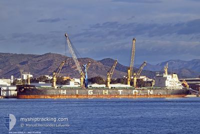
XIN HAITONG 9
Cargo
Current Trip
RU MUR
| Time Travelled | 3 days |
|---|---|
| Remaining Time | --- |
| Distance Travelled | 718.47 nm |
| Remaining Distance | --- |
| AVG Speed | 10.3 Knop |
| MAX Speed | 13.4 Knop |
| AVG Wind | 9.8 knots |
| MAX Wind | 30 knots |
| MIN Temp | 4.3°C / 39.74°F |
| MAX Temp | 8.6°C / 47.48°F |
| Djupgående | 6.9 m |
| Position mottagen | 2 d sen |
Current Position
| Longitud | -6.16340° |
|---|---|
| Latitude | 57.79461° |
| Status | Under way using engine |
| Fart | 10.8 Knop |
| Kurs | 43.8° |
| Område | Inner Seas off the West Coast of Scotland |
| Station | T-AIS |
| Position mottagen | 2 d sen |
Info
Information
The current position of XIN HAITONG 9 is in Inner Seas off the West Coast of Scotland with coordinates 57.79461° / -6.16340° as reported on 2024-04-27 06:53 by AIS to our vessel tracker app. The vessel's current speed is 10.8 Knop
The vessel XIN HAITONG 9 (IMO: 9741578, MMSI: 477585200) is a Cargo It's sailing under the flag of [HK] Hong Kong.
In this page you can find informations about the vessels current position, last detected port calls, and current voyage information. If the vessels is not in coverage by AIS you will find the latest position.
The current position of XIN HAITONG 9 is detected by our AIS receivers and we are not responsible for the reliability of the data. The last position was recorded while the vessel was in Coverage by the Ais receivers of our vessel tracking app.
The current draught of XIN HAITONG 9 as reported by AIS is 6.9 meters
Weather
| Temperature | 8°C / 46.4°F |
|---|---|
| Wind Speed | 26 knots |
| Direction | 189° S |
| Pressure | 1005.2 hPa |
| Humidity | 85.7 % |
| Cloud Coverage | 100 % |
Featured Company
Most Visited Ports (Last year)
| Port | Arrivals | |
|---|---|---|
| 3 | ||
| 2 | ||
| 1 | ||
| 1 | ||
| 1 | ||
| 1 |
Events
| Tid | Event | Detaljer | Position / Dest | Information |
|---|---|---|---|---|
| 2024-04-28 02:18 | STARTAR förflyttning | 17.27 nm, South East of STORNOWAY |
58.01847 / -5.94896
RU MUR
|
Fart: 4.2 kn Kurs: 50° |
| 2024-04-27 09:46 | STOPPAR förflyttning | 17.24 nm, South East of STORNOWAY |
58.01716 / -5.95203
RU MUR
|
Fart: 0.1 kn Kurs: 263° |
| 2024-04-27 06:58 | Status ändrad | Default Under way using engine |
57.80599 / -6.14381
RU MUR
|
Fart: 10.8 kn Kurs: 43.8° |
| 2024-04-27 06:53 | UTANFÖR täckningsområde |
57.79461 / -6.16340
Inner Seas off the West Coast of Scotland
RU MUR
|
Fart: 10.8 kn Kurs: 43.8° |
|
| 2024-04-27 06:47 | Status ändrad | Under way using engine Default |
57.78255 / -6.18685
RU MUR
|
Fart: 10.6 kn Kurs: 46° |
| 2024-04-27 06:38 | Status ändrad | Default Under way using engine |
57.76411 / -6.22181
RU MUR
|
Fart: 11.2 kn Kurs: 63.1° |
| 2024-04-27 06:30 | Status ändrad | Under way using engine Default |
57.75092 / -6.25767
RU MUR
|
Fart: 11.5 kn Kurs: 66° |
| 2024-04-27 06:27 | I täckningsområde |
57.75092 / -6.25767
Inner Seas off the West Coast of Scotland
RU MUR
|
Fart: 11.2 kn Kurs: 63.1° |
|
| 2024-04-27 05:22 | Status ändrad | Default Under way using engine |
57.65557 / -6.61271
RU MUR
|
Fart: 10.7 kn Kurs: 58.2° |
| 2024-04-27 05:16 | UTANFÖR täckningsområde |
57.64597 / -6.64193
Inner Seas off the West Coast of Scotland
RU MUR
|
Fart: 10.7 kn Kurs: 58.2° |