

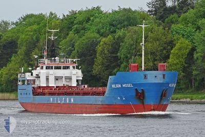
WILSON MOSEL
General Cargo

Current Trip
| Time Travelled | 1 h, 44 mins |
|---|---|
| Remaining Time | 10 h, 11 mins |
| Distance Travelled | 14.85 nm |
| Remaining Distance | 86.06 nm |
| AVG Speed | 9 Knop |
| MAX Speed | 9.8 Knop |
| AVG Wind | 2.4 knots |
| MAX Wind | 4 knots |
| MIN Temp | -4.9°C / 23.18°F |
| MAX Temp | -0.3°C / 31.46°F |
| Djupgående | 3.4 m |
| Position mottagen | 1 m sen |
Current Position
| Longitud | --- |
|---|---|
| Latitude | --- |
| Status | Under way using engine |
| Fart | 7.6 Knop |
| Kurs | 251° |
| Område | Skaggerak |
| Station | T-AIS |
| Position mottagen | 1 m sen |
Information
The current position of WILSON MOSEL is in Skaggerak with coordinates 59.03417° / 10.80334° as reported on 2025-02-18 19:24 by AIS to our vessel tracker app. The vessel's current speed is 7.6 Knop and is heading at the port of SKAGEN. The estimated time of arrival as calculated by MyShipTracking vessel tracking app is 2025-02-19 05:36 LT
The vessel WILSON MOSEL (IMO: 9060687, MMSI: 314424000) is a General Cargo that was built in 1993 ( 32 År gammal ). It's sailing under the flag of [BB] Barbados.
In this page you can find informations about the vessels current position, last detected port calls, and current voyage information. If the vessels is not in coverage by AIS you will find the latest position.
The current position of WILSON MOSEL is detected by our AIS receivers and we are not responsible for the reliability of the data. The last position was recorded while the vessel was in Coverage by the Ais receivers of our vessel tracking app.
The current draught of WILSON MOSEL as reported by AIS is 3.4 meters
Weather
| Temperature | -0.3°C / 31.46°F |
|---|---|
| Wind Speed | 4 knots |
| Direction | 355° N |
| Pressure | 1028.5 hPa |
| Humidity | 56.5 % |
| Cloud Coverage | --- |


Featured Company
Last Port Calls
| Port | Arrival | Departure | Time In Port |
|---|---|---|---|
| 2025-02-18 12:44 | 2025-02-18 17:41 | 4 h | |
| 2025-02-17 16:06 | 2025-02-18 08:33 | 16 h | |
| 2025-02-15 14:44 | 2025-02-16 10:07 | 19 h | |
| 2025-02-13 05:36 | 2025-02-13 12:06 | 6 h | |
| 2025-02-10 07:39 | 2025-02-12 17:40 | 2 d | |
| 2025-02-09 10:32 | 2025-02-09 11:18 | 46 m | |
| 2025-02-05 23:05 | 2025-02-06 20:06 | 21 h | |
| 2025-01-31 08:52 | 2025-01-31 18:50 | 9 h | |
| 2025-01-26 11:14 | 2025-01-28 14:28 | 2 d | |
| 2025-01-24 06:49 | 2025-01-25 04:10 | 21 h |
Last Trips
| Origin | Departure | Destination | Arrival | Distance | |
|---|---|---|---|---|---|
| 2025-02-18 09:33 | 2025-02-18 13:44 | 40.11 nm | |||
| 2025-02-16 11:07 | 2025-02-17 17:06 | 271.78 nm | |||
| 2025-02-13 13:06 | 2025-02-15 15:44 | 472.75 nm | |||
| 2025-02-12 18:40 | 2025-02-13 06:36 | 111.73 nm | |||
| 2025-02-09 12:18 | 2025-02-10 08:39 | 111.20 nm | |||
| 2025-02-06 21:06 | 2025-02-09 11:32 | 520.07 nm | |||
| 2025-01-31 19:50 | 2025-02-06 00:05 | 788.83 nm | |||
| 2025-01-28 15:28 | 2025-01-31 09:52 | 576.90 nm | |||
| 2025-01-25 05:10 | 2025-01-26 12:14 | 294.41 nm | |||
| 2025-01-20 19:46 | 2025-01-24 07:49 | 683.32 nm |
Events
| Tid | Event | Detaljer | Position / Dest | Information |
|---|---|---|---|---|
| 2025-02-18 18:32 | Djupgående ändrat | 3.4 3.5 |
59.05344 / 10.96859
DKSKA
|
Fart: 9.1 kn Kurs: 172.5° |
| 2025-02-18 17:41 | AVGÅTT HAMN |
|
59.17560 / 10.95381
DKSKA
|
Fart: 6.8 kn Kurs: 177° |
| 2025-02-18 17:40 | Status ändrad | Under way using engine Moored |
59.17814 / 10.95349
[NO] FREDRIKSTAD
|
Fart: 6.3 kn Kurs: 180° |
| 2025-02-18 17:39 | STARTAR förflyttning |
59.17903 / 10.95350
[NO] FREDRIKSTAD
|
Fart: 5.9 kn Kurs: 184° |
|
| 2025-02-18 15:05 | Status ändrad | Moored Under way using engine |
59.18161 / 10.95478
[NO] FREDRIKSTAD
|
Fart: Kurs: 343° |
| 2025-02-18 13:26 | Djupgående ändrat | 3.5 3.6 |
59.18157 / 10.95464
[NO] FREDRIKSTAD
|
Fart: Kurs: 343° |
| 2025-02-18 13:26 | Destination ändrad | DKSKA NOFRK |
59.18157 / 10.95464
[NO] FREDRIKSTAD
|
Fart: Kurs: 343° |
| 2025-02-18 13:26 | ETA ändrat | 2025/02/19 07:00 2025/02/18 13:00 |
59.18157 / 10.95464
[NO] FREDRIKSTAD
|
Fart: Kurs: 343° |
| 2025-02-18 12:54 | STOPPAR förflyttning |
59.18088 / 10.95445
[NO] FREDRIKSTAD
|
Fart: 0.3 kn Kurs: 349° |
|
| 2025-02-18 12:44 | ANLÄNDER HAMN |
|
59.17754 / 10.95354
[NO] FREDRIKSTAD
|
Fart: 4.5 kn Kurs: 357° |