
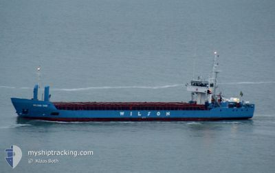
WILSON EMS
General Cargo
Current Trip
| Time Travelled | 2 days |
|---|---|
| Remaining Time | 15 h, 23 mins |
| Distance Travelled | 422.17 nm |
| Remaining Distance | 137.93 nm |
| AVG Speed | 9.4 Knop |
| MAX Speed | 11.5 Knop |
| AVG Wind | 14.6 knots |
| MAX Wind | 19.9 knots |
| MIN Temp | 1.8°C / 35.24°F |
| MAX Temp | 8.3°C / 46.94°F |
| Djupgående | 4 m |
| Position mottagen | Nu |
Current Position
| Longitud | --- |
|---|---|
| Latitude | --- |
| Status | Under way using engine |
| Fart | 8.5 Knop |
| Kurs | 139.5° |
| Område | Kattegat |
| Station | T-AIS |
| Position mottagen | Nu |
Info
Information
The current position of WILSON EMS is in Kattegat with coordinates 55.30591° / 12.64059° as reported on 2024-11-30 03:56 by AIS to our vessel tracker app. The vessel's current speed is 8.5 Knop and is heading at the port of SZCZECIN. The estimated time of arrival as calculated by MyShipTracking vessel tracking app is 2024-11-30 20:20 LT
The vessel WILSON EMS (IMO: 9117117, MMSI: 314258000) is a General Cargo that was built in 1995 ( 29 År gammal ). It's sailing under the flag of [BB] Barbados.
In this page you can find informations about the vessels current position, last detected port calls, and current voyage information. If the vessels is not in coverage by AIS you will find the latest position.
The current position of WILSON EMS is detected by our AIS receivers and we are not responsible for the reliability of the data. The last position was recorded while the vessel was in Coverage by the Ais receivers of our vessel tracking app.
The current draught of WILSON EMS as reported by AIS is 4 meters
Weather
| Temperature | 6.1°C / 42.98°F |
|---|---|
| Wind Speed | 18 knots |
| Direction | 214° SW |
| Pressure | 1031.1 hPa |
| Humidity | 78.6 % |
| Cloud Coverage | 99 % |
Featured Company
Last Port Calls
| Port | Arrival | Departure | Time In Port |
|---|---|---|---|
| 2024-11-27 07:52 | 2024-11-27 11:07 | 3 h | |
| 2024-11-25 04:27 | 2024-11-25 15:37 | 11 h | |
| 2024-11-21 18:37 | 2024-11-22 19:29 | 1 d | |
| 2024-11-20 12:15 | 2024-11-21 18:24 | 1 d | |
| 2024-11-18 15:51 | 2024-11-20 10:21 | 1 d | |
| 2024-11-16 18:04 | 2024-11-18 14:54 | 1 d | |
| 2024-11-08 04:25 | 2024-11-11 16:45 | 3 d | |
| 2024-11-01 12:56 | 2024-11-02 13:23 | 1 d | |
| 2024-10-26 22:25 | 2024-10-29 16:15 | 2 d | |
| 2024-10-24 19:10 | 2024-10-25 19:07 | 23 h |
Last Trips
| Origin | Departure | Destination | Arrival | Distance | |
|---|---|---|---|---|---|
| 2024-11-25 15:37 | 2024-11-27 07:52 | 263.82 nm | |||
| 2024-11-22 19:29 | 2024-11-25 04:27 | 524.41 nm | |||
| 2024-11-21 18:24 | 2024-11-21 18:37 | 0.70 nm | |||
| 2024-11-20 10:21 | 2024-11-20 12:15 | 16.06 nm | |||
| 2024-11-18 14:54 | 2024-11-18 15:51 | 8.63 nm | |||
| 2024-11-11 16:45 | 2024-11-16 18:04 | 1048.84 nm | |||
| 2024-11-02 13:23 | 2024-11-08 04:25 | 612.51 nm | |||
| 2024-10-29 16:15 | 2024-11-01 12:56 | 589.81 nm | |||
| 2024-10-25 19:07 | 2024-10-26 22:25 | 295.81 nm | |||
| 2024-10-21 11:27 | 2024-10-24 19:10 | 737.97 nm |
Events
| Tid | Event | Detaljer | Position / Dest | Information |
|---|---|---|---|---|
| 2024-11-30 03:56 | Byter havsområde | Swedish part of the Baltic Sea Danish part of the Baltic Sea |
55.30591 / 12.64059
Baltic Sea
SZCZECIN
|
Fart: 8.5 kn Kurs: 139.5° |
| 2024-11-30 03:49 | Byter havsområde | Danish part of the Baltic Sea Swedish part of the Kattegat |
55.32247 / 12.63997
Baltic Sea
SZCZECIN
|
Fart: 8.8 kn Kurs: 187.7° |
| 2024-11-30 02:49 | Byter havsområde | Swedish part of the Kattegat Danish part of the Kattegat |
55.47030 / 12.68363
Kattegat
SZCZECIN
|
Fart: 8.9 kn Kurs: 188.8° |
| 2024-11-29 21:37 | Byter havsområde | Danish part of the Kattegat Swedish part of the Kattegat |
56.19678 / 12.39432
Kattegat
SZCZECIN
|
Fart: 9.3 kn Kurs: 157.8° |
| 2024-11-29 12:05 | Byter havsområde | Swedish part of the Kattegat Danish part of the Kattegat |
57.52110 / 11.33182
Kattegat
SZCZECIN
|
Fart: 9.7 kn Kurs: 136.5° |
| 2024-11-29 09:47 | Byter havsområde | Danish part of the Kattegat Danish part of the Skaggerak |
57.77760 / 10.85054
Kattegat
SZCZECIN
|
Fart: 9.4 kn Kurs: 129.1° |
| 2024-11-29 04:35 | Byter havsområde | Danish part of the Skaggerak Norwegian part of the Skaggerak |
57.86044 / 9.16629
Skaggerak
SZCZECIN
|
Fart: 10.9 kn Kurs: 95.9° |
| 2024-11-28 21:18 | Byter havsområde | Norwegian part of the Skaggerak Norwegian part of the North Sea |
57.94769 / 7.08987
Skaggerak
SZCZECIN
|
Fart: 9.2 kn Kurs: 100.3° |
| 2024-11-28 17:33 | Status ändrad | Under way using engine Moored |
58.26130 / 6.84661
SZCZECIN
|
Fart: 9.1 kn Kurs: 240.7° |
| 2024-11-28 17:25 | STARTAR förflyttning | 7.21 nm, East of FLEKKEFJORD |
58.27199 / 6.88016
SZCZECIN
|
Fart: 7.8 kn Kurs: 230.2° |