
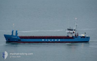
WILSON EMS
General Cargo
Current Trip
| Trip Time | 2 days |
|---|---|
| Trip Distance | 527.46 nm |
| AVG Speed | 10.2 Knots |
| MAX Speed | 11.9 Knots |
| Draught | 3.5 m |
| AVG Wind | 15.1 knots |
| MAX Wind | 28.4 knots |
| MIN Temp | 2.5°C / 36.5°F |
| MAX Temp | 8.6°C / 47.48°F |
| Position Received | 2 m ago |
Current Position
| Longitude | 5.13467° |
|---|---|
| Latitude | 61.93437° |
| Status | Moored |
| Speed | |
| Course | 149° |
| Area | Norwegian Sea |
| Station | T-AIS |
| Position Received | 2 m ago |
Info
Information
The current position of WILSON EMS is in Norwegian Sea with coordinates 61.93437° / 5.13467° as reported on 2024-04-19 19:56 by AIS to our vessel tracker app. The vessel's current speed is 0 Knots and is currently inside the port of DEKNEPOLLEN.
The vessel WILSON EMS (IMO: 9117117, MMSI: 314258000) is a General Cargo that was built in 1995 ( 29 years old ). It's sailing under the flag of [BB] Barbados.
In this page you can find informations about the vessels current position, last detected port calls, and current voyage information. If the vessels is not in coverage by AIS you will find the latest position.
The current position of WILSON EMS is detected by our AIS receivers and we are not responsible for the reliability of the data. The last position was recorded while the vessel was in Coverage by the Ais receivers of our vessel tracking app.
The current draught of WILSON EMS as reported by AIS is 3.5 meters
Weather
| Temperature | 2.9°C / 37.22°F |
|---|---|
| Wind Speed | 10 knots |
| Direction | 352° N |
| Pressure | 1013 hPa |
| Humidity | 98.6 % |
| Cloud Coverage | 100 % |
Featured Company
Last Port Calls
| Port | Arrival | Departure | Time In Port |
|---|---|---|---|
| 2024-04-19 14:28 | |||
| 2024-04-12 23:08 | 2024-04-16 20:01 | 3 d | |
| 2024-04-08 05:47 | 2024-04-08 12:23 | 6 h | |
| 2024-03-27 13:19 | 2024-03-28 16:24 | 1 d | |
| 2024-03-22 01:41 | 2024-03-25 10:49 | 3 d | |
| 2024-03-16 19:43 | 2024-03-20 13:38 | 3 d | |
| 2024-03-14 07:43 | 2024-03-15 19:43 | 1 d | |
| 2024-03-11 22:59 | 2024-03-12 15:40 | 16 h | |
| 2024-03-07 18:32 | 2024-03-09 04:27 | 1 d | |
| 2024-03-02 12:27 | 2024-03-04 15:15 | 2 d |
Last Trips
| Origin | Departure | Destination | Arrival | Distance | |
|---|---|---|---|---|---|
| 2024-04-16 21:01 | 2024-04-19 16:28 | 527.46 nm | |||
| 2024-04-08 13:23 | 2024-04-13 00:08 | 746.87 nm | |||
| 2024-03-28 17:24 | 2024-04-08 06:47 | 1147.18 nm | |||
| 2024-03-25 11:49 | 2024-03-27 14:19 | 465.43 nm | |||
| 2024-03-20 13:38 | 2024-03-22 02:41 | 388.96 nm | |||
| 2024-03-15 19:43 | 2024-03-16 19:43 | 232.49 nm | |||
| 2024-03-12 15:40 | 2024-03-14 07:43 | 196.89 nm | |||
| 2024-03-09 04:27 | 2024-03-11 22:59 | 153.40 nm | |||
| 2024-03-04 16:15 | 2024-03-07 18:32 | 289.63 nm | |||
| 2024-02-29 06:06 | 2024-03-02 13:27 | 319.99 nm |
Events
| Time | Event | Details | Position / Dest | Info |
|---|---|---|---|---|
| 2024-04-19 14:38 | Status Changed | Moored Under way using engine |
61.93437 / 5.13467
[NO] DEKNEPOLLEN
|
Speed: Course: 150° |
| 2024-04-19 14:30 | STOP Moving |
61.93437 / 5.13457
[NO] DEKNEPOLLEN
|
Speed: 0.1 kn Course: 148° |
|
| 2024-04-19 14:28 | PORT ARRIVAL |
|
61.93451 / 5.13439
[NO] DEKNEPOLLEN
|
Speed: 1.7 kn Course: 150° |
| 2024-04-19 07:10 | Change Sea Area | Norwegian part of the Norwegian Sea Norwegian part of the North Sea |
61.00113 / 4.29688
Norwegian Sea
NOMAY
|
Speed: 10.3 kn Course: 0.4° |
| 2024-04-18 17:07 | ETA Changed | 2024/04/19 18:00 2024/04/19 06:00 |
58.68625 / 4.04660
NOMAY
|
Speed: 11 kn Course: 52.6° |
| 2024-04-18 16:53 | Detected in Sea | Norwegian part of the North Sea |
58.66128 / 3.98544
North Sea
NOMAY
|
Speed: 11 kn Course: 52.1° |
| 2024-04-18 16:51 | IN Coverage |
58.66128 / 3.98544
North Sea
NOMAY
|
Speed: 11 kn Course: 52.1° |
|
| 2024-04-17 15:20 | Status Changed | Default Under way using engine |
56.19886 / -2.66946
NOMAY
|
Speed: 10.5 kn Course: 62.3° |
| 2024-04-17 15:18 | Status Changed | Under way using engine Default |
56.19604 / -2.67911
NOMAY
|
Speed: 10.3 kn Course: 62° |
| 2024-04-17 15:18 | OUT of Coverage |
56.19604 / -2.67911
North Sea
NOMAY
|
Speed: 10.5 kn Course: 62.3° |