
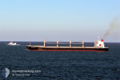
VMAS SUZHOU
Bulk Carrier
Current Trip
TABONEO
| Time Travelled | 6 h, 49 mins |
|---|---|
| Remaining Time | --- |
| Distance Travelled | 47.72 nm |
| Remaining Distance | --- |
| AVG Speed | 10.5 Knop |
| MAX Speed | 13.5 Knop |
| AVG Wind | 11.1 knots |
| MAX Wind | 15.3 knots |
| MIN Temp | 28.3°C / 82.94°F |
| MAX Temp | 30.3°C / 86.54°F |
| Djupgående | 6.2 m |
| Position mottagen | 5 h, 27 m sen |
Current Position
| Longitud | 107.03873° |
|---|---|
| Latitude | 10.37017° |
| Status | Under way using engine |
| Fart | 10.6 Knop |
| Kurs | 162° |
| Område | South China Sea |
| Station | T-AIS |
| Position mottagen | 5 h, 27 m sen |
Info
Information
The current position of VMAS SUZHOU is in South China Sea with coordinates 10.37017° / 107.03873° as reported on 2024-05-12 00:50 by AIS to our vessel tracker app. The vessel's current speed is 10.6 Knop
The vessel VMAS SUZHOU (IMO: 9322774, MMSI: 636018932) is a Bulk Carrier that was built in 2005 ( 19 År gammal ). It's sailing under the flag of [LR] Liberia.
In this page you can find informations about the vessels current position, last detected port calls, and current voyage information. If the vessels is not in coverage by AIS you will find the latest position.
The current position of VMAS SUZHOU is detected by our AIS receivers and we are not responsible for the reliability of the data. The last position was recorded while the vessel was in Coverage by the Ais receivers of our vessel tracking app.
The current draught of VMAS SUZHOU as reported by AIS is 6.2 meters
Weather
| Temperature | 30.1°C / 86.18°F |
|---|---|
| Wind Speed | 12 knots |
| Direction | 77° ENE |
| Pressure | 1011 hPa |
| Humidity | 75.5 % |
| Cloud Coverage | 45 % |
Featured Company
Last Port Calls
| Port | Arrival | Departure | Time In Port |
|---|---|---|---|
| 2024-05-10 03:16 | 2024-05-11 23:28 | 1 d | |
| 2024-05-04 13:23 | 2024-05-06 20:11 | 2 d | |
| 2024-04-25 06:48 | 2024-04-28 21:48 | 3 d | |
| 2024-04-08 03:44 | 2024-04-08 13:20 | 9 h | |
| 2024-03-20 11:40 | |||
| 2024-03-04 09:59 |
Most Visited Ports (Last year)
| Port | Arrivals | |
|---|---|---|
| 2 | ||
| 2 | ||
| 1 | ||
| 1 | ||
| 1 | ||
| 1 |
Events
| Tid | Event | Detaljer | Position / Dest | Information |
|---|---|---|---|---|
| 2024-05-12 00:57 | Status ändrad | Default Under way using engine |
10.35013 / 107.04400
TABONEO
|
Fart: 10.6 kn Kurs: 162° |
| 2024-05-12 00:50 | UTANFÖR täckningsområde |
10.37017 / 107.03873
South China Sea
TABONEO
|
Fart: 10.6 kn Kurs: 162° |
|
| 2024-05-11 23:28 | AVGÅTT HAMN |
|
10.56682 / 107.01482
TABONEO
|
Fart: 9.7 kn Kurs: 215° |
| 2024-05-11 23:21 | STARTAR förflyttning |
10.57930 / 107.02458
[VN] PHU MY
|
Fart: 5.3 kn Kurs: 217° |
|
| 2024-05-11 23:18 | Djupgående ändrat | 6.2 7.1 |
10.58173 / 107.02623
[VN] PHU MY
|
Fart: 1.4 kn Kurs: 216° |
| 2024-05-11 23:18 | Destination ändrad | TABONEO TANJUNG PRIOK |
10.58173 / 107.02623
[VN] PHU MY
|
Fart: 1.4 kn Kurs: 216° |
| 2024-05-11 23:18 | ETA ändrat | 2024/05/16 04:05 2024/05/03 23:30 |
10.58173 / 107.02623
[VN] PHU MY
|
Fart: 1.4 kn Kurs: 216° |
| 2024-05-11 23:18 | Status ändrad | Under way using engine Moored |
10.58173 / 107.02623
[VN] PHU MY
|
Fart: 0.6 kn Kurs: 286° |
| 2024-05-11 23:12 | Status ändrad | Moored Default |
10.58123 / 107.02717
[VN] PHU MY
|
Fart: Kurs: 18° |
| 2024-05-11 22:52 | I täckningsområde |
10.58127 / 107.02715
South China Sea
[VN] PHU MY
|
Fart: 0.4 kn Kurs: 313° |