
VICTOR
Wing in ground
Current Trip
SABAC
| Time Travelled | 26 days |
|---|---|
| Remaining Time | --- |
| Distance Travelled | 387.88 nm |
| Remaining Distance | --- |
| AVG Speed | 6.6 Knop |
| MAX Speed | 8.2 Knop |
| AVG Wind | 7.2 knots |
| MAX Wind | 15 knots |
| MIN Temp | 11.4°C / 52.52°F |
| MAX Temp | 19.7°C / 67.46°F |
| Djupgående | 2.6 m |
| Position mottagen | 1 m sen |
Current Position
| Longitud | 20.35767° |
|---|---|
| Latitude | 44.77337° |
| Status | Under way sailing |
| Fart | 7.9 Knop |
| Kurs | 42.3° |
| Område | Black Sea |
| Station | T-AIS |
| Position mottagen | 1 m sen |
Info
Information
The current position of VICTOR is in Black Sea with coordinates 44.77337° / 20.35767° as reported on 2024-05-23 14:05 by AIS to our vessel tracker app. The vessel's current speed is 7.9 Knop
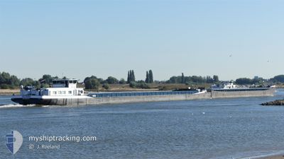
The vessel VICTOR (MMSI: 244670193) is a Wing in ground It's sailing under the flag of [NL] Netherlands.
In this page you can find informations about the vessels current position, last detected port calls, and current voyage information. If the vessels is not in coverage by AIS you will find the latest position.
The current position of VICTOR is detected by our AIS receivers and we are not responsible for the reliability of the data. The last position was recorded while the vessel was in Coverage by the Ais receivers of our vessel tracking app.
The current draught of VICTOR as reported by AIS is 2.6 meters
Weather
| Temperature | 19.6°C / 67.28°F |
|---|---|
| Wind Speed | 3 knots |
| Direction | 347° NNW |
| Pressure | 1015.5 hPa |
| Humidity | 62.6 % |
| Cloud Coverage | 100 % |
Featured Company
Events
| Tid | Event | Detaljer | Position / Dest | Information |
|---|---|---|---|---|
| 2024-05-23 13:48 | STARTAR förflyttning | 14.84 nm, South West of PANCEVO |
44.74709 / 20.32475
SABAC
|
Fart: 7.5 kn Kurs: 48.7° |
| 2024-05-23 13:37 | STOPPAR förflyttning | 15.07 nm, South West of PANCEVO |
44.74332 / 20.32140
SABAC
|
Fart: Kurs: 511° |
| 2024-05-23 12:18 | STARTAR förflyttning | 7.46 nm, West of PANCEVO |
44.83267 / 20.46526
SABAC
|
Fart: 6.9 kn Kurs: 272° |
| 2024-05-23 11:52 | STOPPAR förflyttning | 7.3 nm, West of PANCEVO |
44.83313 / 20.46880
SABAC
|
Fart: 0.3 kn Kurs: 511° |
| 2024-05-23 10:36 | STARTAR förflyttning | 14.83 nm, South West of PANCEVO |
44.74679 / 20.32532
SABAC
|
Fart: 7.4 kn Kurs: 49.6° |
| 2024-05-23 10:12 | STOPPAR förflyttning | 15.02 nm, South West of PANCEVO |
44.74379 / 20.32242
SABAC
|
Fart: Kurs: 511° |
| 2024-05-23 09:46 | I täckningsområde |
44.72697 / 20.30737
Black Sea
|
Fart: 7.8 kn Kurs: 10.8° |
|
| 2024-05-15 09:47 | UTANFÖR täckningsområde |
44.72551 / 20.30623
Black Sea
|
Fart: 5.2 kn Kurs: 180.7° |
|
| 2024-05-15 07:53 | STARTAR förflyttning | 7.37 nm, West of PANCEVO |
44.83266 / 20.46740
SABAC
|
Fart: 3.7 kn Kurs: 268° |
| 2024-05-15 07:36 | STOPPAR förflyttning | 7.23 nm, West of PANCEVO |
44.83246 / 20.47060
SABAC
|
Fart: 0.3 kn Kurs: 511° |