

VERTIGO
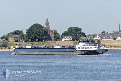
Tanker

Current Trip
LUDWIGSHAFEN
| Time Travelled | 15 h, 53 mins |
|---|---|
| Remaining Time | --- |
| Distance Travelled | 9.53 nm |
| Remaining Distance | --- |
| AVG Speed | 7 Knop |
| MAX Speed | 9.9 Knop |
| AVG Wind | 8.2 knots |
| MAX Wind | 8.9 knots |
| MIN Temp | -1.3°C / 29.66°F |
| MAX Temp | 0.8°C / 33.44°F |
| Djupgående | 2.1 m |
| Position mottagen | 6 m sen |
Current Position
| Longitud | --- |
|---|---|
| Latitude | --- |
| Status | Moored |
| Fart | |
| Kurs | --- |
| Område | North Sea |
| Station | T-AIS |
| Position mottagen | 6 m sen |
Information
The current position of VERTIGO is in North Sea with coordinates 49.49988° / 8.43932° as reported on 2025-02-19 10:59 by AIS to our vessel tracker app. The vessel's current speed is 0 Knop
The vessel VERTIGO (MMSI: 244180739) is a Tanker It's sailing under the flag of [NL] Netherlands.
In this page you can find informations about the vessels current position, last detected port calls, and current voyage information. If the vessels is not in coverage by AIS you will find the latest position.
The current position of VERTIGO is detected by our AIS receivers and we are not responsible for the reliability of the data. The last position was recorded while the vessel was in Coverage by the Ais receivers of our vessel tracking app.
The current draught of VERTIGO as reported by AIS is 2.1 meters
Weather
| Temperature | 1.9°C / 35.42°F |
|---|---|
| Wind Speed | 5 knots |
| Direction | 121° ESE |
| Pressure | 1025.8 hPa |
| Humidity | 35 % |
| Cloud Coverage | 88 % |


Featured Company
Last Port Calls
| Port | Arrival | Departure | Time In Port |
|---|---|---|---|
| 2025-02-18 19:56 | 2025-02-18 20:12 | 16 m | |
| 2025-02-18 05:48 | 2025-02-18 16:00 | 10 h | |
| 2025-02-18 04:28 | 2025-02-18 04:38 | 10 m | |
| 2025-02-15 19:48 | 2025-02-15 20:35 | 46 m | |
| 2025-02-12 15:10 | 2025-02-15 08:58 | 2 d | |
| 2025-02-12 01:41 | 2025-02-12 03:29 | 1 h | |
| 2025-02-10 21:01 | 2025-02-11 20:51 | 23 h | |
| 2025-02-05 10:46 | 2025-02-05 11:25 | 38 m | |
| 2025-02-05 02:24 | 2025-02-05 03:00 | 36 m | |
| 2025-02-02 16:39 | 2025-02-04 16:43 | 2 d |
Most Visited Ports (Last year)
| Port | Arrivals | |
|---|---|---|
| 48 | ||
| 28 | ||
| 12 | ||
| 12 | ||
| 10 | ||
| 7 |
Last Trips
| Origin | Departure | Destination | Arrival | Distance | |
|---|---|---|---|---|---|
| 2025-02-18 16:00 | 2025-02-18 19:56 | 20.60 nm | |||
| 2025-02-18 04:38 | 2025-02-18 05:48 | 5.93 nm | |||
| 2025-02-15 20:35 | 2025-02-18 04:28 | 219.14 nm | |||
| 2025-02-15 08:58 | 2025-02-15 19:48 | 74.40 nm | |||
| 2025-02-12 03:29 | 2025-02-12 15:10 | 19.74 nm | |||
| 2025-02-11 20:51 | 2025-02-12 01:41 | 32.38 nm | |||
| 2025-02-05 11:25 | 2025-02-10 21:01 | 541.44 nm | |||
| 2025-02-05 03:00 | 2025-02-05 10:46 | 49.26 nm | |||
| 2025-02-04 16:43 | 2025-02-05 02:24 | 44.38 nm | |||
| 2025-01-31 14:05 | 2025-02-02 16:39 | 317.86 nm |
Events
| Tid | Event | Detaljer | Position / Dest | Information |
|---|---|---|---|---|
| 2025-02-19 10:59 | I täckningsområde |
49.49988 / 8.43932
North Sea
|
Fart: Kurs: 511° |
|
| 2025-02-19 09:47 | UTANFÖR täckningsområde |
49.49988 / 8.43927
North Sea
|
Fart: Kurs: 511° |
|
| 2025-02-19 09:47 | I täckningsområde |
49.49988 / 8.43927
North Sea
|
Fart: Kurs: 511° |
|
| 2025-02-19 08:04 | UTANFÖR täckningsområde |
49.49988 / 8.43927
North Sea
|
Fart: Kurs: 511° |
|
| 2025-02-19 05:58 | Status ändrad | Moored Under way using engine |
49.49988 / 8.43927
LUDWIGSHAFEN
|
Fart: Kurs: 511° |
| 2025-02-19 05:39 | STOPPAR förflyttning | 0.71 nm, North West of MANNHEIM |
49.49981 / 8.43940
LUDWIGSHAFEN
|
Fart: 0.2 kn Kurs: 511° |
| 2025-02-19 05:22 | STARTAR förflyttning | 1.92 nm, North of MANNHEIM |
49.52058 / 8.43287
LUDWIGSHAFEN
|
Fart: 5.2 kn Kurs: 175.4° |
| 2025-02-19 05:20 | Status ändrad | Under way using engine Moored |
49.52220 / 8.43277
LUDWIGSHAFEN
|
Fart: Kurs: 511° |
| 2025-02-19 03:51 | I täckningsområde |
49.52254 / 8.43320
North Sea
|
Fart: Kurs: 511° |
|
| 2025-02-19 02:24 | UTANFÖR täckningsområde |
49.52254 / 8.43320
North Sea
|
Fart: Kurs: 511° |