
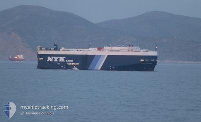
VEGA LEADER
Vehicles Carrier
Current Trip
| Time Travelled | 2 days |
|---|---|
| Remaining Time | 9 h, 58 mins |
| Distance Travelled | 830.67 nm |
| Remaining Distance | 139.61 nm |
| AVG Speed | 15.3 Knop |
| MAX Speed | 19.6 Knop |
| AVG Wind | 14.2 knots |
| MAX Wind | 29.3 knots |
| MIN Temp | 10.5°C / 50.9°F |
| MAX Temp | 15.3°C / 59.54°F |
| Djupgående | 9.1 m |
| Position mottagen | 1 m sen |
Current Position
| Longitud | --- |
|---|---|
| Latitude | --- |
| Status | Under way using engine |
| Fart | 14.5 Knop |
| Kurs | 31.2° |
| Område | Mediterranean Sea - Western Basin |
| Station | T-AIS |
| Position mottagen | 1 m sen |
Info
Information
The current position of VEGA LEADER is in Mediterranean Sea - Western Basin with coordinates 37.63037° / -0.44380° as reported on 2025-03-02 02:42 by AIS to our vessel tracker app. The vessel's current speed is 14.5 Knop and is heading at the port of SAGUNTO. The estimated time of arrival as calculated by MyShipTracking vessel tracking app is 2025-03-02 13:42 LT
The vessel VEGA LEADER (IMO: 9213818, MMSI: 355948000) is a Vehicles Carrier that was built in 2000 ( 25 År gammal ). It's sailing under the flag of [PA] Panama.
In this page you can find informations about the vessels current position, last detected port calls, and current voyage information. If the vessels is not in coverage by AIS you will find the latest position.
The current position of VEGA LEADER is detected by our AIS receivers and we are not responsible for the reliability of the data. The last position was recorded while the vessel was in Coverage by the Ais receivers of our vessel tracking app.
The current draught of VEGA LEADER as reported by AIS is 9.1 meters
Weather
| Temperature | 14.3°C / 57.74°F |
|---|---|
| Wind Speed | 26 knots |
| Direction | 49° NE |
| Pressure | 1015.8 hPa |
| Humidity | 74.5 % |
| Cloud Coverage | 100 % |
Featured Company
Last Port Calls
| Port | Arrival | Departure | Time In Port |
|---|---|---|---|
| 2025-02-27 10:33 | 2025-02-27 20:27 | 9 h | |
| 2025-02-22 00:18 | 2025-02-24 00:40 | 2 d | |
| 2025-02-12 21:03 | 2025-02-16 04:13 | 3 d | |
| 2025-02-12 05:35 | 2025-02-12 18:12 | 12 h | |
| 2025-02-09 16:41 | 2025-02-11 00:04 | 1 d | |
| 2025-02-08 19:39 | 2025-02-09 11:10 | 15 h | |
| 2025-01-27 18:20 | 2025-01-29 14:04 | 1 d | |
| 2025-01-25 07:06 | 2025-01-25 17:16 | 10 h | |
| 2025-01-21 07:07 | 2025-01-21 18:30 | 11 h | |
| 2025-01-18 05:32 | 2025-01-18 15:06 | 9 h |
Last Trips
| Origin | Departure | Destination | Arrival | Distance | |
|---|---|---|---|---|---|
| 2025-02-24 00:40 | 2025-02-27 10:33 | 815.21 nm | |||
| 2025-02-16 04:13 | 2025-02-22 00:18 | 877.90 nm | |||
| 2025-02-12 18:12 | 2025-02-12 21:03 | 21.65 nm | |||
| 2025-02-11 00:04 | 2025-02-12 05:35 | 315.53 nm | |||
| 2025-02-09 11:10 | 2025-02-09 16:41 | 68.63 nm | |||
| 2025-01-29 14:04 | 2025-02-08 19:39 | 3496.60 nm | |||
| 2025-01-25 17:16 | 2025-01-27 18:20 | 407.71 nm | |||
| 2025-01-21 18:30 | 2025-01-25 07:06 | 1270.12 nm | |||
| 2025-01-18 15:06 | 2025-01-21 07:07 | 972.46 nm | |||
| 2025-01-15 10:15 | 2025-01-18 05:32 | 723.83 nm |
Events
| Tid | Event | Detaljer | Position / Dest | Information |
|---|---|---|---|---|
| 2025-03-02 02:40 | ETA ändrat | 2025/03/02 12:00 2025/03/02 11:00 |
37.62357 / -.44926
ES VGO > ES SAG
|
Fart: 14.4 kn Kurs: 32.3° |
| 2025-03-02 02:15 | Status ändrad | Under way using engine Default |
37.54091 / -.51815
ES VGO > ES SAG
|
Fart: 13.9 kn Kurs: 43° |
| 2025-03-02 01:59 | I täckningsområde |
37.54740 / -.51194
Mediterranean Sea - Western Basin
ES VGO > ES SAG
|
Fart: 13.8 kn Kurs: 37.2° |
|
| 2025-03-02 01:08 | Status ändrad | Default Under way using engine |
37.36463 / -.75514
ES VGO > ES SAG
|
Fart: 13.9 kn Kurs: 49.2° |
| 2025-03-02 01:03 | Status ändrad | Under way using engine Default |
37.35197 / -.77318
ES VGO > ES SAG
|
Fart: 13.5 kn Kurs: 47° |
| 2025-03-02 01:03 | UTANFÖR täckningsområde |
37.35197 / -.77318
Mediterranean Sea - Western Basin
ES VGO > ES SAG
|
Fart: 13.9 kn Kurs: 49.2° |
|
| 2025-03-02 00:44 | Status ändrad | Default Under way using engine |
37.30125 / -.84392
ES VGO > ES SAG
|
Fart: 13.4 kn Kurs: 48° |
| 2025-03-02 00:36 | Status ändrad | Under way using engine Default |
37.28252 / -.86983
ES VGO > ES SAG
|
Fart: 13.5 kn Kurs: 48° |
| 2025-03-02 00:19 | Status ändrad | Default Under way using engine |
37.23941 / -.92996
ES VGO > ES SAG
|
Fart: 13.6 kn Kurs: 47.3° |
| 2025-03-02 00:08 | Byter havsområde | Spanish part of the Mediterranean Sea - Western Basin Spanish part of the Alboran Sea |
37.21079 / -.97054
Mediterranean Sea - Western Basin
ES VGO > ES SAG
|
Fart: 13.6 kn Kurs: 47.3° |