
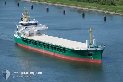
UNDEN
Cargo
Current Trip
| Time Travelled | 1 day |
|---|---|
| Remaining Time | 1 day |
| Distance Travelled | 376.15 nm |
| Remaining Distance | 390.72 nm |
| AVG Speed | 8.8 Knop |
| MAX Speed | 13.3 Knop |
| AVG Wind | 8.6 knots |
| MAX Wind | 21.9 knots |
| MIN Temp | 11.9°C / 53.42°F |
| MAX Temp | 20.5°C / 68.9°F |
| Djupgående | 5.9 m |
| Position mottagen | 1 h, 27 m sen |
Current Position
| Longitud | 8.21176° |
|---|---|
| Latitude | 54.02149° |
| Status | Under way using engine |
| Fart | 11.5 Knop |
| Kurs | 271.5° |
| Område | North Sea |
| Station | T-AIS |
| Position mottagen | 1 h, 27 m sen |
Info
Information
The current position of UNDEN is in North Sea with coordinates 54.02149° / 8.21176° as reported on 2024-06-29 08:59 by AIS to our vessel tracker app. The vessel's current speed is 11.5 Knop and is heading at the port of SHOREHAM. The estimated time of arrival as calculated by MyShipTracking vessel tracking app is 2024-06-30 16:07 LT
The vessel UNDEN (IMO: 9961910, MMSI: 218041490) is a Cargo It's sailing under the flag of [DE] Germany.
In this page you can find informations about the vessels current position, last detected port calls, and current voyage information. If the vessels is not in coverage by AIS you will find the latest position.
The current position of UNDEN is detected by our AIS receivers and we are not responsible for the reliability of the data. The last position was recorded while the vessel was in Coverage by the Ais receivers of our vessel tracking app.
The current draught of UNDEN as reported by AIS is 5.9 meters
Weather
| Temperature | 15.7°C / 60.26°F |
|---|---|
| Wind Speed | 8 knots |
| Direction | 207° SSW |
| Pressure | 1017.3 hPa |
| Humidity | 76.5 % |
| Cloud Coverage | 6 % |
Featured Company
Last Port Calls
| Port | Arrival | Departure | Time In Port |
|---|---|---|---|
| 2024-06-27 03:20 | 2024-06-27 18:49 | 15 h | |
| 2024-06-25 13:43 | 2024-06-26 12:11 | 22 h | |
| 2024-06-21 04:48 | 2024-06-22 02:09 | 21 h | |
| 2024-06-18 07:45 | 2024-06-20 21:20 | 2 d | |
| 2024-06-14 03:24 | 2024-06-14 18:19 | 14 h | |
| 2024-06-12 10:53 | 2024-06-13 13:47 | 1 d | |
| 2024-06-06 22:41 | 2024-06-08 15:26 | 1 d | |
| 2024-06-03 19:27 | 2024-06-06 09:30 | 2 d | |
| 2024-05-26 16:43 | 2024-05-27 14:00 | 21 h | |
| 2024-05-16 11:24 | 2024-05-17 15:06 | 1 d |
Last Trips
| Origin | Departure | Destination | Arrival | Distance | |
|---|---|---|---|---|---|
| 2024-06-26 14:11 | 2024-06-27 05:20 | 136.77 nm | |||
| 2024-06-22 04:09 | 2024-06-25 15:43 | 861.21 nm | |||
| 2024-06-20 22:20 | 2024-06-21 06:48 | 82.69 nm | |||
| 2024-06-14 20:19 | 2024-06-18 08:45 | 771.64 nm | |||
| 2024-06-13 15:47 | 2024-06-14 05:24 | 133.95 nm | |||
| 2024-06-08 16:26 | 2024-06-12 12:53 | 867.39 nm | |||
| 2024-06-06 10:30 | 2024-06-06 23:41 | 147.73 nm | |||
| 2024-05-27 16:00 | 2024-06-03 20:27 | 1172.96 nm | |||
| 2024-05-17 17:06 | 2024-05-26 18:43 | 1161.06 nm | |||
| 2024-05-15 12:42 | 2024-05-16 13:24 | 278.54 nm |
Events
| Tid | Event | Detaljer | Position / Dest | Information |
|---|---|---|---|---|
| 2024-06-29 08:59 | UTANFÖR täckningsområde |
54.02149 / 8.21176
North Sea
GBSHO
|
Fart: 11.5 kn Kurs: 271.5° |
|
| 2024-06-29 05:36 | STARTAR förflyttning | 0.87 nm, South West of BRUNSBUETTEL |
53.89112 / 9.14592
GBSHO
|
Fart: 3.1 kn Kurs: 215° |
| 2024-06-29 05:18 | STOPPAR förflyttning | 0.76 nm, South West of BRUNSBUETTEL |
53.89259 / 9.14797
GBSHO
|
Fart: 0.3 kn Kurs: 220° |
| 2024-06-29 05:16 | Byter havsområde | German part of the North Sea German part of the Baltic Sea |
53.89276 / 9.14821
North Sea
GBSHO
|
Fart: 0.7 kn Kurs: 225.1° |
| 2024-06-28 21:25 | STARTAR förflyttning | 1.44 nm, South West of STICKENHΟRN SPORT |
54.36588 / 10.13914
GBSHO
|
Fart: 3.1 kn Kurs: 283° |
| 2024-06-28 20:57 | STOPPAR förflyttning | 1.38 nm, South West of STICKENHΟRN SPORT |
54.36538 / 10.14229
GBSHO
|
Fart: 0.2 kn Kurs: 283° |
| 2024-06-28 18:43 | Byter havsområde | German part of the Baltic Sea Danish part of the Baltic Sea |
54.56397 / 10.56166
Baltic Sea
GBSHO
|
Fart: 10.9 kn Kurs: 249.3° |
| 2024-06-28 17:59 | Upptäckt i hav | Danish part of the Baltic Sea |
54.58240 / 10.78776
Baltic Sea
GBSHO
|
Fart: 10.7 kn Kurs: 265.6° |
| 2024-06-28 16:14 | Upptäckt i hav | German part of the Baltic Sea |
54.56480 / 11.32906
Baltic Sea
GBSHO
|
Fart: 11.4 kn Kurs: 295° |
| 2024-06-28 14:24 | Djupgående ändrat | 5.9 5 |
54.44502 / 11.85934
GBSHO
|
Fart: 10.6 kn Kurs: 271° |