
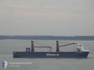
UHL FLAIR
Cargo C
Current Trip
| Time Travelled | 3 days |
|---|---|
| Remaining Time | --- |
| Distance Travelled | 1304.20 nm |
| Remaining Distance | --- |
| AVG Speed | 15.3 Knop |
| MAX Speed | 16.7 Knop |
| AVG Wind | 14.5 knots |
| MAX Wind | 19.9 knots |
| MIN Temp | 17.4°C / 63.32°F |
| MAX Temp | 25.5°C / 77.9°F |
| Djupgående | 6.9 m |
| Position mottagen | 3 d sen |
Current Position
| Longitud | --- |
|---|---|
| Latitude | --- |
| Status | Under way using engine |
| Fart | 14.9 Knop |
| Kurs | 200.1° |
| Område | North Atlantic Ocean |
| Station | T-AIS |
| Position mottagen | 3 d sen |
Information
The current position of UHL FLAIR is in North Atlantic Ocean with coordinates 25.92787° / -16.02503° as reported on 2025-02-10 23:01 by AIS to our vessel tracker app. The vessel's current speed is 14.9 Knop and is heading at the port of TAICHUNG. The estimated time of arrival as calculated by MyShipTracking vessel tracking app is 2025-03-16 01:00 LT
The vessel UHL FLAIR (IMO: 9897133, MMSI: 255806359) is a Cargo C It's sailing under the flag of [PT] Portugal.
In this page you can find informations about the vessels current position, last detected port calls, and current voyage information. If the vessels is not in coverage by AIS you will find the latest position.
The current position of UHL FLAIR is detected by our AIS receivers and we are not responsible for the reliability of the data. The last position was recorded while the vessel was in Coverage by the Ais receivers of our vessel tracking app.
The current draught of UHL FLAIR as reported by AIS is 6.9 meters
Weather
| Temperature | 25.5°C / 77.9°F |
|---|---|
| Wind Speed | 9 knots |
| Direction | 283° WNW |
| Pressure | 1010.7 hPa |
| Humidity | 72.8 % |
| Cloud Coverage | 100 % |
Featured Company
Last Port Calls
| Port | Arrival | Departure | Time In Port |
|---|---|---|---|
| 2025-02-10 03:51 | 2025-02-10 13:41 | 9 h | |
| 2025-01-28 06:59 | 2025-01-29 19:32 | 1 d | |
| 2025-01-10 00:37 | 2025-01-15 04:27 | 5 d |
Most Visited Ports (Last year)
| Port | Arrivals | |
|---|---|---|
| 2 | ||
| 2 | ||
| 2 | ||
| 2 | ||
| 1 | ||
| 1 |
Events
| Tid | Event | Detaljer | Position / Dest | Information |
|---|---|---|---|---|
| 2025-02-10 23:06 | Status ändrad | Default Under way using engine |
25.90536 / -16.03394
ES LPA>TW TXG
|
Fart: 14.9 kn Kurs: 200.1° |
| 2025-02-10 23:01 | UTANFÖR täckningsområde |
25.92787 / -16.02503
North Atlantic Ocean
|
Fart: 14.9 kn Kurs: 200.1° |
|
| 2025-02-10 22:17 | Status ändrad | Under way using engine Default |
26.10331 / -15.95936
ES LPA>TW TXG
|
Fart: 15.3 kn Kurs: 198° |
| 2025-02-10 22:15 | Status ändrad | Default Under way using engine |
26.10943 / -15.95718
ES LPA>TW TXG
|
Fart: 15.1 kn Kurs: 199.1° |
| 2025-02-10 22:06 | Status ändrad | Under way using engine Default |
26.14839 / -15.94287
ES LPA>TW TXG
|
Fart: 15.1 kn Kurs: 198° |
| 2025-02-10 21:46 | Status ändrad | Default Under way using engine |
26.22881 / -15.91246
ES LPA>TW TXG
|
Fart: 15.2 kn Kurs: 199.4° |
| 2025-02-10 21:41 | Status ändrad | Under way using engine Default |
26.24901 / -15.90507
ES LPA>TW TXG
|
Fart: 15.2 kn Kurs: 200° |
| 2025-02-10 21:31 | Status ändrad | Default Under way using engine |
26.28789 / -15.89051
ES LPA>TW TXG
|
Fart: 15.3 kn Kurs: 198.2° |
| 2025-02-10 21:16 | Upptäckt i hav | Western Saharan part of the North Atlantic Ocean |
26.35063 / -15.86689
North Atlantic Ocean
|
Fart: 15.4 kn Kurs: 199.4° |
| 2025-02-10 21:15 | Status ändrad | Under way using engine Default |
26.35470 / -15.86532
ES LPA>TW TXG
|
Fart: 15.4 kn Kurs: 199° |