
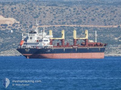
UGLJAN
Bulk Carrier
Current Trip
| Time Travelled | 23 h, 50 mins |
|---|---|
| Remaining Time | --- |
| Distance Travelled | 209.86 nm |
| Remaining Distance | --- |
| AVG Speed | 8.3 Knop |
| MAX Speed | 11.9 Knop |
| AVG Wind | 21.2 knots |
| MAX Wind | 37.4 knots |
| MIN Temp | 9.9°C / 49.82°F |
| MAX Temp | 18.9°C / 66.02°F |
| Djupgående | 10.3 m |
| Position mottagen | 1 m sen |
Current Position
| Longitud | --- |
|---|---|
| Latitude | --- |
| Status | Under way using engine |
| Fart | 9.3 Knop |
| Kurs | 200.1° |
| Område | Aegean Sea |
| Station | T-AIS |
| Position mottagen | 1 m sen |
Info
Information
The current position of UGLJAN is in Aegean Sea with coordinates 39.21165° / 25.48366° as reported on 2024-11-23 04:16 by AIS to our vessel tracker app. The vessel's current speed is 9.3 Knop and is heading at the port of ISKENDERUN. The estimated time of arrival as calculated by MyShipTracking vessel tracking app is 2024-11-25 15:00 LT
The vessel UGLJAN (IMO: 9412294, MMSI: 311000298) is a Bulk Carrier that was built in 2010 ( 14 År gammal ). It's sailing under the flag of [BS] Bahamas.
In this page you can find informations about the vessels current position, last detected port calls, and current voyage information. If the vessels is not in coverage by AIS you will find the latest position.
The current position of UGLJAN is detected by our AIS receivers and we are not responsible for the reliability of the data. The last position was recorded while the vessel was in Coverage by the Ais receivers of our vessel tracking app.
The current draught of UGLJAN as reported by AIS is 10.3 meters
Weather
| Temperature | 18.8°C / 65.84°F |
|---|---|
| Wind Speed | 24 knots |
| Direction | 204° SSW |
| Pressure | 1007.6 hPa |
| Humidity | 81 % |
| Cloud Coverage | 93 % |
Featured Company
Last Port Calls
| Port | Arrival | Departure | Time In Port |
|---|---|---|---|
| 2024-11-22 02:52 | 2024-11-22 04:28 | 1 h | |
| 2024-11-14 11:52 | 2024-11-19 15:06 | 5 d | |
| 2024-11-11 21:53 | 2024-11-11 23:39 | 1 h | |
| 2024-10-30 07:25 | 2024-11-05 17:40 | 6 d | |
| 2024-10-22 17:31 | 2024-10-26 09:06 | 3 d | |
| 2024-10-05 09:04 | 2024-10-14 20:28 | 9 d | |
| 2024-09-20 14:45 | 2024-09-26 05:58 | 5 d | |
| 2024-09-03 21:25 |
Most Visited Ports (Last year)
| Port | Arrivals | |
|---|---|---|
| 3 | ||
| 2 | ||
| 2 | ||
| 2 | ||
| 1 | ||
| 1 |
Last Trips
| Origin | Departure | Destination | Arrival | Distance | |
|---|---|---|---|---|---|
| 2024-11-19 17:06 | 2024-11-22 05:52 | 224.95 nm | |||
| 2024-11-12 02:39 | 2024-11-14 13:52 | 198.07 nm | |||
| 2024-11-05 18:40 | 2024-11-12 00:53 | 1191.40 nm | |||
| 2024-10-26 12:06 | 2024-10-30 08:25 | 979.39 nm | |||
| 2024-10-14 21:28 | 2024-10-22 20:31 | 950.37 nm | |||
| 2024-09-26 08:58 | 2024-10-05 10:04 | 1294.77 nm | |||
| 2024-09-03 22:25 | 2024-09-20 17:45 | 2949.26 nm |
Events
| Tid | Event | Detaljer | Position / Dest | Information |
|---|---|---|---|---|
| 2024-11-23 03:35 | Status ändrad | Under way using engine Default |
39.31154 / 25.53203
TRISK
|
Fart: 8.5 kn Kurs: 197° |
| 2024-11-23 03:10 | Status ändrad | Default Under way using engine |
39.36694 / 25.55584
TRISK
|
Fart: 8.8 kn Kurs: 199.5° |
| 2024-11-23 00:30 | Destination ändrad | TRISK TRCKZ |
39.69840 / 25.72551
TRISK
|
Fart: 8.1 kn Kurs: 197.4° |
| 2024-11-23 00:30 | ETA ändrat | 2024/11/25 15:00 2024/11/22 15:00 |
39.69840 / 25.72551
TRISK
|
Fart: 8.1 kn Kurs: 197.4° |
| 2024-11-22 23:32 | Upptäckt i hav | Greek part of the Aegean Sea |
39.81280 / 25.78461
Aegean Sea
|
Fart: 7 kn Kurs: 206° |
| 2024-11-22 23:32 | Status ändrad | Under way using engine Default |
39.81280 / 25.78461
TRCKZ
|
Fart: 7.2 kn Kurs: 201° |
| 2024-11-22 23:32 | I täckningsområde |
39.81280 / 25.78461
Aegean Sea
|
Fart: 7 kn Kurs: 206° |
|
| 2024-11-22 19:21 | Status ändrad | Default Under way using engine |
40.10189 / 26.33742
TRCKZ
|
Fart: 5.9 kn Kurs: 213.3° |
| 2024-11-22 19:09 | UTANFÖR täckningsområde |
40.12536 / 26.36566
Sea of Marmara
|
Fart: 5.9 kn Kurs: 213.3° |
|
| 2024-11-22 18:43 | Status ändrad | Under way using engine Default |
40.14379 / 26.38608
TRCKZ
|
Fart: 6.1 kn Kurs: 172° |