
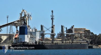
TRUST STAR
Bulk Carrier
Current Trip
PE CON
| Time Travelled | 2 days |
|---|---|
| Remaining Time | --- |
| Distance Travelled | 309.74 nm |
| Remaining Distance | --- |
| AVG Speed | 10.5 Knop |
| MAX Speed | 13.9 Knop |
| AVG Wind | 10.5 knots |
| MAX Wind | 20 knots |
| MIN Temp | 11.4°C / 52.52°F |
| MAX Temp | 13.9°C / 57.02°F |
| Djupgående | 6.1 m |
| Position mottagen | 10 d sen |
Current Position
| Longitud | -72.11272° |
|---|---|
| Latitude | -33.02754° |
| Status | Under way using engine |
| Fart | 12.4 Knop |
| Kurs | 157.5° |
| Område | South Pacific Ocean |
| Station | T-AIS |
| Position mottagen | 10 d sen |
Info
Information
The current position of TRUST STAR is in South Pacific Ocean with coordinates -33.02754° / -72.11272° as reported on 2024-05-17 18:40 by AIS to our vessel tracker app. The vessel's current speed is 12.4 Knop
The vessel TRUST STAR (IMO: 9610236, MMSI: 371416000) is a Bulk Carrier that was built in 2012 ( 12 År gammal ). It's sailing under the flag of [PA] Panama.
In this page you can find informations about the vessels current position, last detected port calls, and current voyage information. If the vessels is not in coverage by AIS you will find the latest position.
The current position of TRUST STAR is detected by our AIS receivers and we are not responsible for the reliability of the data. The last position was recorded while the vessel was in Coverage by the Ais receivers of our vessel tracking app.
The current draught of TRUST STAR as reported by AIS is 6.1 meters
Weather
| Temperature | 13°C / 55.4°F |
|---|---|
| Wind Speed | 4 knots |
| Direction | 272° W |
| Pressure | 1019.6 hPa |
| Humidity | 70.7 % |
| Cloud Coverage | 80 % |
Featured Company
Last Port Calls
| Port | Arrival | Departure | Time In Port |
|---|---|---|---|
| 2024-05-18 00:52 | 2024-05-24 21:57 | 6 d | |
| 2024-04-26 03:41 | 2024-04-29 21:25 | 3 d | |
| 2024-04-19 11:19 | 2024-04-21 19:58 | 2 d |
Most Visited Ports (Last year)
| Port | Arrivals | |
|---|---|---|
| 21 | ||
| 2 | ||
| 1 | ||
| 1 | ||
| 1 | ||
| 1 |
Last Trips
| Origin | Departure | Destination | Arrival | Distance | |
|---|---|---|---|---|---|
| 2024-04-29 21:25 | 2024-05-18 00:52 | 3633.90 nm | |||
| 2024-04-21 19:58 | 2024-04-26 03:41 | 436.67 nm | |||
| 2024-02-27 07:47 | 2024-04-19 11:19 | 10982.88 nm |
Events
| Tid | Event | Detaljer | Position / Dest | Information |
|---|---|---|---|---|
| 2024-05-27 21:25 | STOPPAR förflyttning | 2.12 nm, East of TALCAHUANO |
-36.70710 / -73.05828
PE CON
|
Fart: 0.3 kn Kurs: 287° |
| 2024-05-27 18:05 | STARTAR förflyttning | 19.26 nm, North West of TOME |
-36.34635 / -73.16640
PE CON
|
Fart: 3.3 kn Kurs: 165° |
| 2024-05-27 04:29 | STOPPAR förflyttning |
-36.22535 / -73.32983
PE CON
|
Fart: 0.3 kn Kurs: 205° |
|
| 2024-05-26 22:29 | STARTAR förflyttning | 16.76 nm, North West of TALCAHUANO |
-36.47387 / -73.29955
PE CON
|
Fart: 3.2 kn Kurs: 87° |
| 2024-05-26 05:29 | STOPPAR förflyttning |
-36.19832 / -73.31215
PE CON
|
Fart: 0.3 kn Kurs: 316° |
|
| 2024-05-25 22:23 | STARTAR förflyttning |
-36.21588 / -73.27964
PE CON
|
Fart: 4.2 kn Kurs: 279° |
|
| 2024-05-25 22:00 | STOPPAR förflyttning |
-36.21313 / -73.27673
PE CON
|
Fart: 0.3 kn Kurs: 301° |
|
| 2024-05-25 01:57 | AVGÅTT HAMN |
|
-33.58069 / -71.63816
PE CON
|
Fart: 4.2 kn Kurs: 280° |
| 2024-05-25 01:46 | STARTAR förflyttning |
-33.58532 / -71.62215
[CL] SAN ANTONIO
|
Fart: 4.1 kn Kurs: 300° |
|
| 2024-05-18 05:08 | STOPPAR förflyttning |
-33.59290 / -71.61755
[CL] SAN ANTONIO
|
Fart: 0.3 kn Kurs: 182° |