
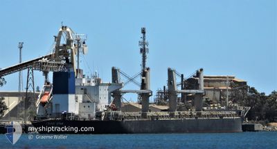
TRUST STAR
Bulk Carrier
Current Trip
PE CON
| Time Travelled | 8 days |
|---|---|
| Remaining Time | --- |
| Distance Travelled | 2273.05 nm |
| Remaining Distance | --- |
| AVG Speed | 12.1 Knots |
| MAX Speed | 14.7 Knots |
| AVG Wind | 8.7 knots |
| MAX Wind | 17.6 knots |
| MIN Temp | 18°C / 64.4°F |
| MAX Temp | 30.5°C / 86.9°F |
| Dybgang | 6.1 m |
| Position Modtaget | 44 m siden |
Current Position
| Longitude | -77.21581° |
|---|---|
| Latitude | -12.00053° |
| Status | At anchor |
| Fart | |
| Kurs | 185° |
| Område | South Pacific Ocean |
| Station | T-AIS |
| Position Modtaget | 44 m siden |
Info
Information
The current position of TRUST STAR is in South Pacific Ocean with coordinates -12.00053° / -77.21581° as reported on 2024-05-08 13:27 by AIS to our vessel tracker app. The vessel's current speed is 0 Knots
The vessel TRUST STAR (IMO: 9610236, MMSI: 371416000) is a Bulk Carrier that was built in 2012 ( 12 år gamle ). It's sailing under the flag of [PA] Panama.
In this page you can find informations about the vessels current position, last detected port calls, and current voyage information. If the vessels is not in coverage by AIS you will find the latest position.
The current position of TRUST STAR is detected by our AIS receivers and we are not responsible for the reliability of the data. The last position was recorded while the vessel was in Coverage by the Ais receivers of our vessel tracking app.
The current draught of TRUST STAR as reported by AIS is 6.1 meters
Weather
| Temperature | 18.1°C / 64.58°F |
|---|---|
| Wind Speed | 5 knots |
| Direction | 184° S |
| Pressure | 1012.7 hPa |
| Humidity | 93.8 % |
| Cloud Coverage | 55 % |
Featured Company
Last Port Calls
| Port | Arrival | Departure | Time In Port |
|---|---|---|---|
| 2024-04-26 09:41 | 2024-04-30 03:25 | 3 d | |
| 2024-04-19 17:19 | 2024-04-22 01:58 | 2 d |
Last Trips
| Origin | Departure | Destination | Arrival | Distance | |
|---|---|---|---|---|---|
| 2024-04-21 19:58 | 2024-04-26 03:41 | 436.67 nm | |||
| 2024-02-27 07:47 | 2024-04-19 11:19 | 10982.88 nm |
Events
| Tid | Hændelsen | Detaljer | Position / Dest | Info |
|---|---|---|---|---|
| 2024-05-08 13:33 | Status er ændret | Default At anchor |
-12.00052 / -77.21576
PE CON
|
Fart: Kurs: 185° |
| 2024-05-08 12:15 | Status er ændret | At anchor Default |
-12.00059 / -77.21572
PE CON
|
Fart: 0.1 kn Kurs: 184° |
| 2024-05-08 12:06 | Status er ændret | Default At anchor |
-12.00054 / -77.21584
PE CON
|
Fart: 0.1 kn Kurs: 189° |
| 2024-05-08 10:48 | Fundet i havområde | Peruvian (disputed - Peruvian point of view) part of the South Pacific Ocean |
-12.00048 / -77.21566
South Pacific Ocean
PE CON
|
Fart: 0.1 kn Kurs: 64.3° |
| 2024-05-08 10:48 | Status er ændret | At anchor Default |
-12.00048 / -77.21566
PE CON
|
Fart: 0.1 kn Kurs: 192° |
| 2024-05-08 10:47 | Dybgangen er ændret | 6.1 11.2 |
-12.00048 / -77.21566
PE CON
|
Fart: 0.1 kn Kurs: 192° |
| 2024-05-08 10:47 | Destination er ændret | PE CON CR CAL |
-12.00048 / -77.21566
PE CON
|
Fart: 0.1 kn Kurs: 192° |
| 2024-05-08 10:47 | ETA er ændret | 2024/05/08 08:30 2024/04/11 18:00 |
-12.00048 / -77.21566
PE CON
|
Fart: 0.1 kn Kurs: 192° |
| 2024-05-08 10:45 | Indenfor Dækning |
-12.00048 / -77.21566
South Pacific Ocean
PE CON
|
Fart: 0.1 kn Kurs: 64.3° |
|
| 2024-05-08 08:45 | STOP Sejllads | 4.85 nm, North West of CALLAO |
-12.00203 / -77.21720
CR CAL
|
Fart: 0.3 kn Kurs: 114° |