
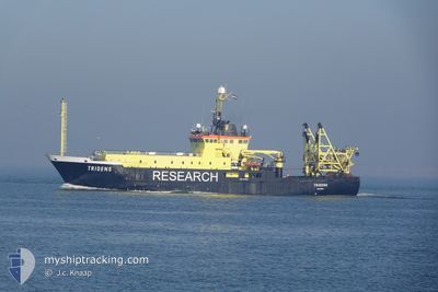
TRIDENS
Fishery Research Vessel
Current Trip
| Trip Time | 5 days |
|---|---|
| Trip Distance | 628.01 nm |
| AVG Speed | 10.6 Knop |
| MAX Speed | 17.1 Knop |
| Djupgående | 5.1 m |
| AVG Wind | 10.4 knots |
| MAX Wind | 26 knots |
| MIN Temp | 3.8°C / 38.84°F |
| MAX Temp | 9.5°C / 49.1°F |
| Position mottagen | 2 m sen |
Current Position
| Longitud | 4.26797° |
|---|---|
| Latitude | 52.10136° |
| Status | Moored |
| Fart | 0.1 Knop |
| Kurs | 311° |
| Område | North Sea |
| Station | T-AIS |
| Position mottagen | 2 m sen |
Info
Information
The current position of TRIDENS is in North Sea with coordinates 52.10136° / 4.26797° as reported on 2024-04-26 11:21 by AIS to our vessel tracker app. The vessel's current speed is 0.1 Knop and is currently inside the port of SCHEVENINGEN.
The vessel TRIDENS (IMO: 8821852, MMSI: 244033000) is a Fishery Research Vessel that was built in 1990 ( 34 År gammal ). It's sailing under the flag of [NL] Netherlands.
In this page you can find informations about the vessels current position, last detected port calls, and current voyage information. If the vessels is not in coverage by AIS you will find the latest position.
The current position of TRIDENS is detected by our AIS receivers and we are not responsible for the reliability of the data. The last position was recorded while the vessel was in Coverage by the Ais receivers of our vessel tracking app.
The current draught of TRIDENS as reported by AIS is 5.1 meters
Weather
| Temperature | 10.1°C / 50.18°F |
|---|---|
| Wind Speed | 7 knots |
| Direction | 282° WNW |
| Pressure | 1004 hPa |
| Humidity | 53.7 % |
| Cloud Coverage | 65 % |
Featured Company
Last Port Calls
| Port | Arrival | Departure | Time In Port |
|---|---|---|---|
| 2024-04-26 05:58 | |||
| 2024-04-19 06:04 | 2024-04-20 18:34 | 1 d | |
| 2024-04-04 13:43 | 2024-04-16 11:20 | 11 d | |
| 2024-03-15 09:29 | 2024-03-18 11:32 | 3 d | |
| 2024-03-15 08:51 | 2024-03-15 09:07 | 16 m | |
| 2024-03-11 15:34 | 2024-03-12 12:21 | 20 h | |
| 2024-03-05 12:11 | 2024-03-11 13:24 | 6 d | |
| 2024-02-22 17:44 | 2024-03-05 06:06 | 11 d | |
| 2024-02-17 08:34 | 2024-02-19 05:53 | 1 d | |
| 2024-02-08 05:00 | 2024-02-12 10:18 | 4 d |
Most Visited Ports (Last year)
| Port | Arrivals | |
|---|---|---|
| 24 | ||
| 3 | ||
| 3 | ||
| 3 | ||
| 3 | ||
| 2 |
Last Trips
| Origin | Departure | Destination | Arrival | Distance | |
|---|---|---|---|---|---|
| 2024-04-20 20:34 | 2024-04-26 07:58 | 628.01 nm | |||
| 2024-04-16 13:20 | 2024-04-19 08:04 | 400.98 nm | |||
| 2024-03-18 11:32 | 2024-04-04 15:43 | 1059.45 nm | |||
| 2024-03-15 09:07 | 2024-03-15 09:29 | 1.54 nm | |||
| 2024-03-12 13:21 | 2024-03-15 08:51 | 697.47 nm | |||
| 2024-03-11 14:24 | 2024-03-11 16:34 | 29.99 nm | |||
| 2024-03-05 07:06 | 2024-03-05 13:11 | 67.00 nm | |||
| 2024-02-19 05:53 | 2024-02-22 18:44 | 517.62 nm | |||
| 2024-02-12 11:18 | 2024-02-17 08:34 | 462.04 nm | |||
| 2024-02-01 00:42 | 2024-02-08 06:00 | 781.76 nm |
Events
| Tid | Event | Detaljer | Position / Dest | Information |
|---|---|---|---|---|
| 2024-04-26 06:12 | ETA ändrat | 2024/04/26 16:00 2024/04/25 16:00 |
52.10134 / 4.26800
[NL] SCHEVENINGEN
|
Fart: 0.1 kn Kurs: 309° |
| 2024-04-26 06:12 | Status ändrad | Moored Under way using engine |
52.10134 / 4.26800
[NL] SCHEVENINGEN
|
Fart: 0.1 kn Kurs: 312° |
| 2024-04-26 06:11 | STOPPAR förflyttning |
52.10137 / 4.26790
[NL] SCHEVENINGEN
|
Fart: 0.3 kn Kurs: 312° |
|
| 2024-04-26 05:58 | ANLÄNDER HAMN |
|
52.10384 / 4.25448
[NL] SCHEVENINGEN
|
Fart: 6.3 kn Kurs: 160.4° |
| 2024-04-26 01:25 | Byter havsområde | Dutch part of the North Sea Belgian part of the North Sea |
51.53779 / 3.13462
North Sea
|
Fart: 14.9 kn Kurs: 43° |
| 2024-04-25 21:09 | Status ändrad | Under way using engine Restricted manoeuverability |
51.73215 / 2.63533
MARINE SURVEY
|
Fart: 11.2 kn Kurs: 169.5° |
| 2024-04-25 20:50 | Status ändrad | Restricted manoeuverability Under way using engine |
51.75361 / 2.61599
MARINE SURVEY
|
Fart: 13.8 kn Kurs: 124.7° |
| 2024-04-25 20:26 | Byter havsområde | Belgian part of the North Sea United Kingdom part of the North Sea |
51.81120 / 2.49938
North Sea
MARINE SURVEY
|
Fart: 13.9 kn Kurs: 123.7° |
| 2024-04-25 19:10 | STARTAR förflyttning |
51.85993 / 2.21582
MARINE SURVEY
|
Fart: 3.3 kn Kurs: 156° |
|
| 2024-04-25 18:24 | STOPPAR förflyttning |
51.85971 / 2.22094
MARINE SURVEY
|
Fart: 0.3 kn Kurs: 210° |