
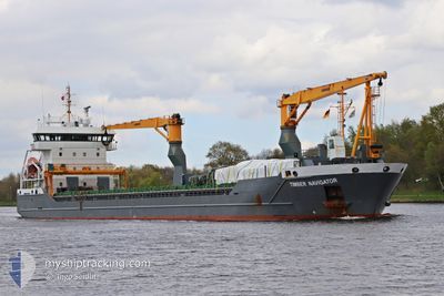
TIMBER NAVIGATOR
General Cargo
Current Trip
| Time Travelled | 21 h, 12 mins |
|---|---|
| Remaining Time | 1 day |
| Distance Travelled | 196.50 nm |
| Remaining Distance | 373.85 nm |
| AVG Speed | 10.9 Knop |
| MAX Speed | 11.8 Knop |
| AVG Wind | 12.3 knots |
| MAX Wind | 21.3 knots |
| MIN Temp | 15°C / 59°F |
| MAX Temp | 21.8°C / 71.24°F |
| Djupgående | 6.6 m |
| Position mottagen | 6 h, 25 m sen |
Current Position
| Longitud | 2.71351° |
|---|---|
| Latitude | 40.57517° |
| Status | Under way using engine |
| Fart | 10.9 Knop |
| Kurs | 54.4° |
| Område | Balearic Sea |
| Station | T-AIS |
| Position mottagen | 6 h, 25 m sen |
Info
Information
The current position of TIMBER NAVIGATOR is in Balearic Sea with coordinates 40.57517° / 2.71351° as reported on 2024-05-03 05:08 by AIS to our vessel tracker app. The vessel's current speed is 10.9 Knop and is heading at the port of GENOVA. The estimated time of arrival as calculated by MyShipTracking vessel tracking app is 2024-05-04 13:10 LT
The vessel TIMBER NAVIGATOR (IMO: 9532824, MMSI: 244909000) is a General Cargo that was built in 2011 ( 13 År gammal ). It's sailing under the flag of [NL] Netherlands.
In this page you can find informations about the vessels current position, last detected port calls, and current voyage information. If the vessels is not in coverage by AIS you will find the latest position.
The current position of TIMBER NAVIGATOR is detected by our AIS receivers and we are not responsible for the reliability of the data. The last position was recorded while the vessel was in Coverage by the Ais receivers of our vessel tracking app.
The current draught of TIMBER NAVIGATOR as reported by AIS is 6.6 meters
Weather
| Temperature | 15.4°C / 59.72°F |
|---|---|
| Wind Speed | 7 knots |
| Direction | 277° W |
| Pressure | 1018.4 hPa |
| Humidity | 64.9 % |
| Cloud Coverage | 2 % |
Featured Company
Last Port Calls
| Port | Arrival | Departure | Time In Port |
|---|---|---|---|
| 2024-05-01 16:33 | 2024-05-02 14:22 | 21 h | |
| 2024-04-30 04:30 | 2024-04-30 19:08 | 14 h | |
| 2024-04-18 05:41 | 2024-04-19 21:08 | 1 d | |
| 2024-04-14 08:54 | 2024-04-16 19:27 | 2 d | |
| 2024-04-12 10:21 | 2024-04-13 13:31 | 1 d | |
| 2024-04-11 10:02 | 2024-04-11 16:06 | 6 h | |
| 2024-04-07 05:41 | 2024-04-09 09:34 | 2 d | |
| 2024-04-02 14:19 | 2024-04-05 13:23 | 2 d | |
| 2024-03-08 09:34 | 2024-03-08 22:54 | 13 h | |
| 2024-03-03 22:11 | 2024-03-05 09:23 | 1 d |
Most Visited Ports (Last year)
| Port | Arrivals | |
|---|---|---|
| 4 | ||
| 3 | ||
| 3 | ||
| 2 | ||
| 2 | ||
| 2 |
Last Trips
| Origin | Departure | Destination | Arrival | Distance | |
|---|---|---|---|---|---|
| 2024-04-30 21:08 | 2024-05-01 18:33 | 222.36 nm | |||
| 2024-04-20 00:08 | 2024-04-30 06:30 | 2578.53 nm | |||
| 2024-04-16 22:27 | 2024-04-18 08:41 | 344.54 nm | |||
| 2024-04-13 16:31 | 2024-04-14 11:54 | 131.36 nm | |||
| 2024-04-11 19:06 | 2024-04-12 13:21 | 227.14 nm | |||
| 2024-04-09 11:34 | 2024-04-11 13:02 | 610.42 nm | |||
| 2024-04-05 15:23 | 2024-04-07 07:41 | 427.49 nm | |||
| 2024-03-09 01:54 | 2024-04-02 16:19 | 4201.05 nm | |||
| 2024-03-05 12:23 | 2024-03-08 12:34 | 82.61 nm | |||
| 2024-03-01 13:18 | 2024-03-04 01:11 | 349.09 nm |
Events
| Tid | Event | Detaljer | Position / Dest | Information |
|---|---|---|---|---|
| 2024-05-03 05:11 | Status ändrad | Default Under way using engine |
40.58106 / 2.72440
GENOVA
|
Fart: 10.9 kn Kurs: 54.4° |
| 2024-05-03 05:08 | UTANFÖR täckningsområde |
40.57517 / 2.71351
Balearic Sea
GENOVA
|
Fart: 10.9 kn Kurs: 54.4° |
|
| 2024-05-03 05:07 | Status ändrad | Under way using engine Default |
40.57342 / 2.71024
GENOVA
|
Fart: 10.9 kn Kurs: 55° |
| 2024-05-03 04:28 | Status ändrad | Default Under way using engine |
40.50563 / 2.58321
GENOVA
|
Fart: 10.8 kn Kurs: 56° |
| 2024-05-03 04:12 | Status ändrad | Under way using engine Default |
40.47917 / 2.53397
GENOVA
|
Fart: 11 kn Kurs: 55° |
| 2024-05-03 03:37 | Status ändrad | Default Under way using engine |
40.41273 / 2.41968
GENOVA
|
Fart: 11.8 kn Kurs: 52.9° |
| 2024-05-03 03:24 | Status ändrad | Under way using engine Default |
40.39007 / 2.37551
GENOVA
|
Fart: 11.7 kn Kurs: 53° |
| 2024-05-03 03:24 | I täckningsområde |
40.39236 / 2.37960
Balearic Sea
GENOVA
|
Fart: 11.8 kn Kurs: 52.9° |
|
| 2024-05-02 23:06 | Status ändrad | Default Under way using engine |
39.90794 / 1.51824
GENOVA
|
Fart: 11.5 kn Kurs: 59° |
| 2024-05-02 23:01 | UTANFÖR täckningsområde |
39.89859 / 1.49898
Balearic Sea
GENOVA
|
Fart: 11.5 kn Kurs: 59° |