
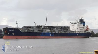
THE CHIEF
Asphalt/Bitumen Tanker
Current Trip
| Time Travelled | 10 days |
|---|---|
| Remaining Time | 1 day |
| Distance Travelled | 2502.37 nm |
| Remaining Distance | 759.81 nm |
| AVG Speed | 10.2 Knop |
| MAX Speed | 14.9 Knop |
| AVG Wind | 12.3 knots |
| MAX Wind | 29.8 knots |
| MIN Temp | 10.3°C / 50.54°F |
| MAX Temp | 21.5°C / 70.7°F |
| Djupgående | 5.8 m |
| Position mottagen | 7 h, 56 m sen |
Current Position
| Longitud | 12.01738° |
|---|---|
| Latitude | 37.32049° |
| Status | Under way using engine |
| Fart | 11.7 Knop |
| Kurs | 115.2° |
| Område | Mediterranean Sea - Eastern Basin |
| Station | T-AIS |
| Position mottagen | 7 h, 56 m sen |
Info
Information
The current position of THE CHIEF is in Mediterranean Sea - Eastern Basin with coordinates 37.32049° / 12.01738° as reported on 2024-05-21 00:29 by AIS to our vessel tracker app. The vessel's current speed is 11.7 Knop and is heading at the port of TARANTO. The estimated time of arrival as calculated by MyShipTracking vessel tracking app is 2024-05-22 15:03 LT
The vessel THE CHIEF (IMO: 9492361, MMSI: 538005036) is a Asphalt/Bitumen Tanker that was built in 2013 ( 11 År gammal ). It's sailing under the flag of [MH] Marshall Is.
In this page you can find informations about the vessels current position, last detected port calls, and current voyage information. If the vessels is not in coverage by AIS you will find the latest position.
The current position of THE CHIEF is detected by our AIS receivers and we are not responsible for the reliability of the data. The last position was recorded while the vessel was in Coverage by the Ais receivers of our vessel tracking app.
The current draught of THE CHIEF as reported by AIS is 5.8 meters
Weather
| Temperature | 18.3°C / 64.94°F |
|---|---|
| Wind Speed | 19 knots |
| Direction | 296° WNW |
| Pressure | 1013 hPa |
| Humidity | 89.6 % |
| Cloud Coverage | 100 % |
Featured Company
Last Port Calls
| Port | Arrival | Departure | Time In Port |
|---|---|---|---|
| 2024-05-08 22:23 | 2024-05-10 23:32 | 2 d | |
| 2024-04-19 11:26 | 2024-04-21 15:04 | 2 d | |
| 2024-04-14 12:14 | 2024-04-16 01:13 | 1 d | |
| 2024-04-02 19:19 | 2024-04-04 22:35 | 2 d | |
| 2024-03-16 15:33 | 2024-03-18 05:37 | 1 d | |
| 2024-03-03 18:31 | 2024-03-07 11:48 | 3 d |
Last Trips
| Origin | Departure | Destination | Arrival | Distance | |
|---|---|---|---|---|---|
| 2024-04-21 11:04 | 2024-05-08 23:23 | 3968.87 nm | |||
| 2024-04-15 21:13 | 2024-04-19 07:26 | 412.77 nm | |||
| 2024-04-04 18:35 | 2024-04-14 08:14 | 1889.17 nm | |||
| 2024-03-18 01:37 | 2024-04-02 15:19 | 2221.53 nm | |||
| 2024-03-07 07:48 | 2024-03-16 11:33 | 1772.86 nm | |||
| 2024-02-13 18:45 | 2024-03-03 14:31 | 2806.77 nm |
Events
| Tid | Event | Detaljer | Position / Dest | Information |
|---|---|---|---|---|
| 2024-05-21 00:31 | Status ändrad | Default Under way using engine |
37.31718 / 12.02596
ITTAR
|
Fart: 11.7 kn Kurs: 115.2° |
| 2024-05-21 00:29 | UTANFÖR täckningsområde |
37.32049 / 12.01738
Mediterranean Sea - Eastern Basin
ITTAR
|
Fart: 11.7 kn Kurs: 115.2° |
|
| 2024-05-21 00:13 | Byter havsområde | Italian part of the Mediterranean Sea - Eastern Basin Algerian part of the Mediterranean Sea - Western Basin |
37.34239 / 11.95923
Mediterranean Sea - Eastern Basin
ITTAR
|
Fart: 12 kn Kurs: 114.7° |
| 2024-05-21 00:13 | Status ändrad | Under way using engine Default |
37.34263 / 11.95858
ITTAR
|
Fart: 12.4 kn Kurs: 116° |
| 2024-05-21 00:01 | I täckningsområde |
37.34239 / 11.95923
Mediterranean Sea - Eastern Basin
ITTAR
|
Fart: 12 kn Kurs: 114.7° |
|
| 2024-05-18 22:58 | Status ändrad | Default Under way using engine |
36.78791 / .43153
ITTAR
|
Fart: 11.4 kn Kurs: 80.7° |
| 2024-05-18 22:54 | Status ändrad | Under way using engine Default |
36.78609 / .41728
ITTAR
|
Fart: 11.4 kn Kurs: 79° |
| 2024-05-18 22:54 | UTANFÖR täckningsområde |
36.78609 / .41728
Mediterranean Sea - Western Basin
ITTAR
|
Fart: 11.4 kn Kurs: 80.7° |
|
| 2024-05-18 22:46 | Status ändrad | Default Under way using engine |
36.78217 / .38690
ITTAR
|
Fart: 11.4 kn Kurs: 77.4° |
| 2024-05-18 22:34 | Djupgående ändrat | 5.8 5 |
36.77313 / .33730
ITTAR
|
Fart: 10.9 kn Kurs: 77° |