
TAHO AMERICA
Cargo
Current Trip
| Time Travelled | 1 day |
|---|---|
| Remaining Time | --- |
| Distance Travelled | 387.86 nm |
| Remaining Distance | --- |
| AVG Speed | 10.7 Knop |
| MAX Speed | 12 Knop |
| AVG Wind | 5.5 knots |
| MAX Wind | 10.9 knots |
| MIN Temp | 14°C / 57.2°F |
| MAX Temp | 21.3°C / 70.34°F |
| Djupgående | 13.2 m |
| Position mottagen | 1 d sen |
Current Position
| Longitud | 152.90504° |
|---|---|
| Latitude | -32.47087° |
| Status | Under way using engine |
| Fart | 11.3 Knop |
| Kurs | 45° |
| Område | Tasman Sea |
| Station | T-AIS |
| Position mottagen | 1 d sen |
Info
Information
The current position of TAHO AMERICA is in Tasman Sea with coordinates -32.47087° / 152.90504° as reported on 2024-06-05 06:32 by AIS to our vessel tracker app. The vessel's current speed is 11.3 Knop and is heading at the port of DONG GUAN. The estimated time of arrival as calculated by MyShipTracking vessel tracking app is 2024-06-21 00:01 LT
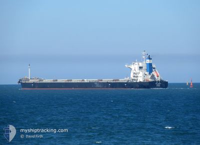
The vessel TAHO AMERICA (IMO: 9846055, MMSI: 636019305) is a Cargo It's sailing under the flag of [LR] Liberia.
In this page you can find informations about the vessels current position, last detected port calls, and current voyage information. If the vessels is not in coverage by AIS you will find the latest position.
The current position of TAHO AMERICA is detected by our AIS receivers and we are not responsible for the reliability of the data. The last position was recorded while the vessel was in Coverage by the Ais receivers of our vessel tracking app.
The current draught of TAHO AMERICA as reported by AIS is 13.2 meters
Weather
| Temperature | 20.7°C / 69.26°F |
|---|---|
| Wind Speed | 3 knots |
| Direction | 275° W |
| Pressure | 1016.2 hPa |
| Humidity | 52.7 % |
| Cloud Coverage | --- |
Featured Company
Events
| Tid | Event | Detaljer | Position / Dest | Information |
|---|---|---|---|---|
| 2024-06-05 06:37 | Status ändrad | Default Under way using engine |
-32.45917 / 152.91852
DONG GUAN CN
|
Fart: 11.3 kn Kurs: 45° |
| 2024-06-05 06:32 | UTANFÖR täckningsområde |
-32.47087 / 152.90504
Tasman Sea
DONG GUAN CN
|
Fart: 11.3 kn Kurs: 45° |
|
| 2024-06-05 06:25 | Status ändrad | Under way using engine Default |
-32.48611 / 152.88699
DONG GUAN CN
|
Fart: 11.1 kn Kurs: 46° |
| 2024-06-05 06:07 | Status ändrad | Default Under way using engine |
-32.52660 / 152.83942
DONG GUAN CN
|
Fart: 10.8 kn Kurs: 43.9° |
| 2024-06-05 00:15 | AVGÅTT HAMN |
|
-32.91154 / 151.80562
DONG GUAN CN
|
Fart: 8.6 kn Kurs: 70° |
| 2024-06-04 23:29 | STARTAR förflyttning |
-32.88789 / 151.76180
[AU] NEWCASTLE
|
Fart: 3.1 kn Kurs: 120° |
|
| 2024-06-04 23:04 | Status ändrad | Under way using engine Moored |
-32.88008 / 151.75005
[AU] NEWCASTLE
|
Fart: 0.1 kn Kurs: 121° |
| 2024-06-04 22:27 | Status ändrad | Moored Default |
-32.88005 / 151.75003
[AU] NEWCASTLE
|
Fart: Kurs: 121° |
| 2024-06-04 22:24 | Status ändrad | Default Moored |
-32.88005 / 151.75001
[AU] NEWCASTLE
|
Fart: Kurs: 121° |
| 2024-06-04 21:39 | Djupgående ändrat | 13.2 7.3 |
-32.88009 / 151.75003
[AU] NEWCASTLE
|
Fart: Kurs: 121° |