

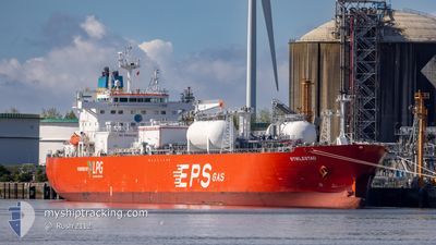
STIKLESTAD
Tanker

Current Trip
| Time Travelled | 1 day |
|---|---|
| Remaining Time | 12 h, 4 mins |
| Distance Travelled | 370.59 nm |
| Remaining Distance | 295.62 nm |
| AVG Speed | 12.9 Knop |
| MAX Speed | 14.4 Knop |
| AVG Wind | 18.7 knots |
| MAX Wind | 26.5 knots |
| MIN Temp | 5.7°C / 42.26°F |
| MAX Temp | 7.8°C / 46.04°F |
| Djupgående | 9.9 m |
| Position mottagen | 9 h, 31 m sen |
Current Position
| Longitud | --- |
|---|---|
| Latitude | --- |
| Status | Under way using engine |
| Fart | 13.4 Knop |
| Kurs | 187.9° |
| Område | North Sea |
| Station | T-AIS |
| Position mottagen | 9 h, 31 m sen |
Information
The current position of STIKLESTAD is in North Sea with coordinates 55.23243° / 5.64671° as reported on 2025-03-28 07:37 by AIS to our vessel tracker app. The vessel's current speed is 13.4 Knop and is heading at the port of ANTWERP. The estimated time of arrival as calculated by MyShipTracking vessel tracking app is 2025-03-29 06:12 LT
The vessel STIKLESTAD (IMO: 9914644, MMSI: 636021570) is a Tanker It's sailing under the flag of [LR] Liberia.
In this page you can find informations about the vessels current position, last detected port calls, and current voyage information. If the vessels is not in coverage by AIS you will find the latest position.
The current position of STIKLESTAD is detected by our AIS receivers and we are not responsible for the reliability of the data. The last position was recorded while the vessel was in Coverage by the Ais receivers of our vessel tracking app.
The current draught of STIKLESTAD as reported by AIS is 9.9 meters
Weather
| Temperature | 7.6°C / 45.68°F |
|---|---|
| Wind Speed | 10 knots |
| Direction | 281° W |
| Pressure | 1009 hPa |
| Humidity | 84.3 % |
| Cloud Coverage | 94 % |


Featured Company
Last Port Calls
| Port | Arrival | Departure | Time In Port |
|---|---|---|---|
| 2025-03-25 23:13 | 2025-03-27 04:24 | 1 d | |
| 2025-03-20 13:06 | 2025-03-21 08:25 | 19 h | |
| 2025-03-14 13:14 | 2025-03-15 16:33 | 1 d | |
| 2025-03-06 18:47 | 2025-03-07 16:19 | 21 h | |
| 2025-03-04 03:58 | 2025-03-05 17:00 | 1 d | |
| 2025-02-26 19:22 | 2025-02-27 19:02 | 23 h | |
| 2025-02-19 20:05 | 2025-02-22 19:52 | 2 d | |
| 2025-02-07 21:02 | 2025-02-09 01:26 | 1 d | |
| 2025-01-27 17:55 | 2025-01-29 01:25 | 1 d | |
| 2025-01-11 20:31 | 2025-01-12 22:26 | 1 d |
Most Visited Ports (Last year)
| Port | Arrivals | |
|---|---|---|
| 14 | ||
| 12 | ||
| 8 | ||
| 5 | ||
| 5 | ||
| 5 |
Last Trips
| Origin | Departure | Destination | Arrival | Distance | |
|---|---|---|---|---|---|
| 2025-03-21 08:25 | 2025-03-25 23:13 | 582.43 nm | |||
| 2025-03-15 16:33 | 2025-03-20 13:06 | 1051.99 nm | |||
| 2025-03-07 16:19 | 2025-03-14 13:14 | 1159.99 nm | |||
| 2025-03-05 17:00 | 2025-03-06 18:47 | 314.37 nm | |||
| 2025-02-27 19:02 | 2025-03-04 03:58 | 323.21 nm | |||
| 2025-02-22 19:52 | 2025-02-26 19:22 | 1072.84 nm | |||
| 2025-02-09 01:26 | 2025-02-19 20:05 | 1503.74 nm | |||
| 2025-01-29 01:25 | 2025-02-07 21:02 | 578.16 nm | |||
| 2025-01-12 22:26 | 2025-01-27 17:55 | 4098.38 nm | |||
| 2024-12-27 13:45 | 2025-01-11 20:31 | 4111.49 nm |
Events
| Tid | Event | Detaljer | Position / Dest | Information |
|---|---|---|---|---|
| 2025-03-28 07:40 | Status ändrad | Default Under way using engine |
55.22151 / 5.64255
BEANR
|
Fart: 13.4 kn Kurs: 187.9° |
| 2025-03-28 07:37 | UTANFÖR täckningsområde |
55.23243 / 5.64671
North Sea
BEANR
|
Fart: 13.4 kn Kurs: 187.9° |
|
| 2025-03-28 06:44 | Byter havsområde | German part of the North Sea Danish part of the North Sea |
55.43354 / 5.65148
North Sea
BEANR
|
Fart: 13.5 kn Kurs: 179° |
| 2025-03-28 03:12 | Status ändrad | Under way using engine Default |
56.21638 / 5.64584
BEANR
|
Fart: 13 kn Kurs: 175° |
| 2025-03-28 02:52 | Status ändrad | Default Under way using engine |
56.28788 / 5.63907
BEANR
|
Fart: 12.9 kn Kurs: 178.5° |
| 2025-03-28 02:46 | Status ändrad | Under way using engine Default |
56.31188 / 5.63715
BEANR
|
Fart: 13.1 kn Kurs: 176° |
| 2025-03-28 02:37 | Status ändrad | Default Under way using engine |
56.34265 / 5.63406
BEANR
|
Fart: 13.1 kn Kurs: 177.4° |
| 2025-03-28 00:49 | Byter havsområde | Danish part of the North Sea Norwegian part of the North Sea |
56.73289 / 5.55236
North Sea
BEANR
|
Fart: 13 kn Kurs: 167.9° |
| 2025-03-28 00:09 | Status ändrad | Under way using engine Default |
56.87434 / 5.49701
BEANR
|
Fart: 13.5 kn Kurs: 159° |
| 2025-03-27 23:32 | Status ändrad | Default Under way using engine |
57.00750 / 5.42849
BEANR
|
Fart: 13.5 kn Kurs: 159.5° |