
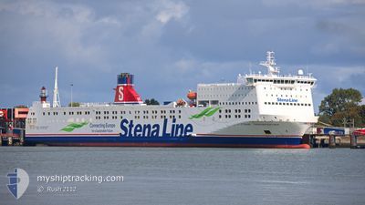
STENA TRANSPORTER
Ro-Ro/Passenger Ship
Current Trip
| Time Travelled | 11 h, 20 mins |
|---|---|
| Remaining Time | 26 mins |
| Distance Travelled | 181.48 nm |
| Remaining Distance | 11.22 nm |
| AVG Speed | 16.4 Knop |
| MAX Speed | 19.9 Knop |
| AVG Wind | 7.1 knots |
| MAX Wind | 13 knots |
| MIN Temp | 9.5°C / 49.1°F |
| MAX Temp | 11.9°C / 53.42°F |
| Djupgående | 5.8 m |
| Position mottagen | Nu |
Current Position
| Longitud | 3.94959° |
|---|---|
| Latitude | 52.01265° |
| Status | Under way using engine |
| Fart | 16.8 Knop |
| Kurs | 111.7° |
| Område | North Sea |
| Station | T-AIS |
| Position mottagen | Nu |
Info
Information
The current position of STENA TRANSPORTER is in North Sea with coordinates 52.01265° / 3.94959° as reported on 2024-05-07 06:31 by AIS to our vessel tracker app. The vessel's current speed is 16.8 Knop and is heading at the port of HOEK VAN HOLLAND. The estimated time of arrival as calculated by MyShipTracking vessel tracking app is 2024-05-07 06:58 LT
The vessel STENA TRANSPORTER (IMO: 9469376, MMSI: 246762000) is a Ro-Ro/Passenger Ship that was built in 2011 ( 13 År gammal ). It's sailing under the flag of [NL] Netherlands.
In this page you can find informations about the vessels current position, last detected port calls, and current voyage information. If the vessels is not in coverage by AIS you will find the latest position.
The current position of STENA TRANSPORTER is detected by our AIS receivers and we are not responsible for the reliability of the data. The last position was recorded while the vessel was in Coverage by the Ais receivers of our vessel tracking app.
The current draught of STENA TRANSPORTER as reported by AIS is 5.8 meters
Weather
| Temperature | 11.8°C / 53.24°F |
|---|---|
| Wind Speed | 11 knots |
| Direction | 42° NE |
| Pressure | 1016.9 hPa |
| Humidity | 84.2 % |
| Cloud Coverage | 100 % |
Featured Company
Last Port Calls
| Port | Arrival | Departure | Time In Port |
|---|---|---|---|
| 2024-05-06 05:00 | 2024-05-06 19:12 | 14 h | |
| 2024-04-18 03:29 | 2024-05-04 15:32 | 16 d | |
| 2024-04-16 06:43 | 2024-04-16 19:33 | 12 h | |
| 2024-04-14 05:03 | 2024-04-14 18:09 | 13 h | |
| 2024-04-12 05:02 | 2024-04-12 19:14 | 14 h | |
| 2024-04-10 06:06 | 2024-04-10 19:22 | 13 h | |
| 2024-04-08 05:00 | 2024-04-08 19:09 | 14 h | |
| 2024-04-06 05:13 | 2024-04-06 19:46 | 14 h | |
| 2024-04-04 05:16 | 2024-04-04 19:08 | 13 h | |
| 2024-04-02 05:13 | 2024-04-02 19:01 | 13 h |
Most Visited Ports (Last year)
| Port | Arrivals | |
|---|---|---|
| 182 | ||
| 1 | ||
| 1 | ||
| 1 |
Last Trips
| Origin | Departure | Destination | Arrival | Distance | |
|---|---|---|---|---|---|
| 2024-05-04 17:32 | 2024-05-06 06:00 | 446.68 nm | |||
| 2024-04-16 20:33 | 2024-04-18 05:29 | 407.21 nm | |||
| 2024-04-14 19:09 | 2024-04-16 07:43 | 385.05 nm | |||
| 2024-04-12 20:14 | 2024-04-14 06:03 | 385.16 nm | |||
| 2024-04-10 20:22 | 2024-04-12 06:02 | 384.63 nm | |||
| 2024-04-08 20:09 | 2024-04-10 07:06 | 384.80 nm | |||
| 2024-04-06 20:46 | 2024-04-08 06:00 | 386.98 nm | |||
| 2024-04-04 20:08 | 2024-04-06 06:13 | 385.55 nm | |||
| 2024-04-02 20:01 | 2024-04-04 06:16 | 382.98 nm | |||
| 2024-03-31 19:39 | 2024-04-02 06:13 | 384.96 nm |
Events
| Tid | Event | Detaljer | Position / Dest | Information |
|---|---|---|---|---|
| 2024-05-07 04:51 | Status ändrad | Under way using engine Default |
52.22870 / 3.24910
NLHVH
|
Fart: 17.5 kn Kurs: 130° |
| 2024-05-07 04:41 | Status ändrad | Default Under way using engine |
52.26485 / 3.17780
NLHVH
|
Fart: 17.5 kn Kurs: 129.4° |
| 2024-05-07 04:21 | Status ändrad | Under way using engine Default |
52.32147 / 3.06712
NLHVH
|
Fart: 17.7 kn Kurs: 130° |
| 2024-05-07 04:20 | Status ändrad | Default Under way using engine |
52.32483 / 3.06052
NLHVH
|
Fart: 17.6 kn Kurs: 129.2° |
| 2024-05-07 04:16 | Byter havsområde | Dutch part of the North Sea United Kingdom part of the North Sea |
52.33952 / 3.03148
North Sea
NLHVH
|
Fart: 17.6 kn Kurs: 129.2° |
| 2024-05-07 03:47 | Status ändrad | Under way using engine Default |
52.43179 / 2.85836
NLHVH
|
Fart: 17.4 kn Kurs: 135° |
| 2024-05-07 03:40 | Status ändrad | Default Under way using engine |
52.45318 / 2.82310
NLHVH
|
Fart: 17.1 kn Kurs: 133.8° |
| 2024-05-07 03:34 | Status ändrad | Under way using engine Default |
52.47390 / 2.78838
NLHVH
|
Fart: 17 kn Kurs: 134° |
| 2024-05-07 03:28 | Status ändrad | Default Under way using engine |
52.49326 / 2.75533
NLHVH
|
Fart: 17 kn Kurs: 129° |
| 2024-05-07 03:03 | Status ändrad | Under way using engine Default |
52.57002 / 2.60468
NLHVH
|
Fart: 16.9 kn Kurs: 129° |