
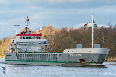
STEENBANK
General Cargo
Current Trip
| Time Travelled | 1 day |
|---|---|
| Remaining Time | 3 days |
| Distance Travelled | 449.66 nm |
| Remaining Distance | 915.47 nm |
| AVG Speed | 8.2 Knop |
| MAX Speed | 13.1 Knop |
| AVG Wind | 7 knots |
| MAX Wind | 14 knots |
| MIN Temp | 7.6°C / 45.68°F |
| MAX Temp | 14.1°C / 57.38°F |
| Djupgående | 6 m |
| Position mottagen | Nu |
Current Position
| Longitud | 10.75499° |
|---|---|
| Latitude | 54.56120° |
| Status | Under way using engine |
| Fart | 11.1 Knop |
| Kurs | 82.6° |
| Område | Baltic Sea |
| Station | T-AIS |
| Position mottagen | Nu |
Info
Information
The current position of STEENBANK is in Baltic Sea with coordinates 54.56120° / 10.75499° as reported on 2024-04-28 06:42 by AIS to our vessel tracker app. The vessel's current speed is 11.1 Knop and is heading at the port of ROYTTA. The estimated time of arrival as calculated by MyShipTracking vessel tracking app is 2024-05-01 18:17 LT
The vessel STEENBANK (IMO: 9313876, MMSI: 246125000) is a General Cargo that was built in 2005 ( 19 År gammal ). It's sailing under the flag of [NL] Netherlands.
In this page you can find informations about the vessels current position, last detected port calls, and current voyage information. If the vessels is not in coverage by AIS you will find the latest position.
The current position of STEENBANK is detected by our AIS receivers and we are not responsible for the reliability of the data. The last position was recorded while the vessel was in Coverage by the Ais receivers of our vessel tracking app.
The current draught of STEENBANK as reported by AIS is 6 meters
Weather
| Temperature | 9.8°C / 49.64°F |
|---|---|
| Wind Speed | 14 knots |
| Direction | 141° SE |
| Pressure | 1009.5 hPa |
| Humidity | 83.4 % |
| Cloud Coverage | 90 % |
Featured Company
Last Port Calls
| Port | Arrival | Departure | Time In Port |
|---|---|---|---|
| 2024-04-24 18:33 | 2024-04-26 07:18 | 1 d | |
| 2024-04-21 03:36 | 2024-04-22 12:33 | 1 d | |
| 2024-04-16 11:15 | 2024-04-17 10:19 | 23 h | |
| 2024-04-09 19:24 | 2024-04-13 15:54 | 3 d | |
| 2024-03-28 20:57 | 2024-03-29 23:27 | 1 d | |
| 2024-03-26 03:19 | 2024-03-26 04:53 | 1 h | |
| 2024-03-22 02:44 | 2024-03-26 02:12 | 3 d | |
| 2024-03-22 00:52 | 2024-03-22 02:01 | 1 h | |
| 2024-03-18 16:43 | |||
| 2024-03-10 09:41 | 2024-03-13 05:20 | 2 d |
Last Trips
| Origin | Departure | Destination | Arrival | Distance | |
|---|---|---|---|---|---|
| 2024-04-22 14:33 | 2024-04-24 20:33 | 604.82 nm | |||
| 2024-04-17 13:19 | 2024-04-21 05:36 | 975.96 nm | |||
| 2024-04-13 18:54 | 2024-04-16 14:15 | 189.26 nm | |||
| 2024-03-30 00:27 | 2024-04-09 22:24 | 1315.01 nm | |||
| 2024-03-26 05:53 | 2024-03-28 21:57 | 128.17 nm | |||
| 2024-03-26 03:12 | 2024-03-26 04:19 | 4.81 nm | |||
| 2024-03-22 03:01 | 2024-03-22 03:44 | 2.40 nm | |||
| 2024-03-18 18:43 | 2024-03-22 01:52 | 804.40 nm | |||
| 2024-03-06 15:36 | 2024-03-10 10:41 | 604.31 nm | |||
| 2024-03-01 04:02 | 2024-03-05 06:12 | 1011.49 nm |
Events
| Tid | Event | Detaljer | Position / Dest | Information |
|---|---|---|---|---|
| 2024-04-28 06:16 | Byter havsområde | Danish part of the Baltic Sea German part of the Baltic Sea |
54.55098 / 10.61900
Baltic Sea
TORNIO
|
Fart: 11 kn Kurs: 82.6° |
| 2024-04-28 05:02 | Byter havsområde | German part of the Baltic Sea German part of the North Sea |
54.45977 / 10.26896
Baltic Sea
TORNIO
|
Fart: 11.2 kn Kurs: 39° |
| 2024-04-28 04:16 | STARTAR förflyttning | 1.38 nm, South West of STICKENHΟRN SPORT |
54.36571 / 10.14199
TORNIO
|
Fart: 3.2 kn Kurs: 108° |
| 2024-04-28 02:15 | STOPPAR förflyttning | 1.72 nm, South West of STICKENHΟRN SPORT |
54.36729 / 10.12669
TORNIO
|
Fart: 0.2 kn Kurs: 111° |
| 2024-04-27 18:45 | STARTAR förflyttning | 2.07 nm, North East of OSTERMOOR |
53.94456 / 9.22798
TORNIO
|
Fart: 3.9 kn Kurs: 31° |
| 2024-04-27 18:08 | STOPPAR förflyttning | 1.77 nm, North East of OSTERMOOR |
53.94076 / 9.22265
TORNIO
|
Fart: 0.3 kn Kurs: 49° |
| 2024-04-27 17:24 | STARTAR förflyttning | 0.67 nm, South West of BRUNSBUETTEL |
53.89362 / 9.14993
TORNIO
|
Fart: 3.9 kn Kurs: 40° |
| 2024-04-27 17:04 | STOPPAR förflyttning | 0.8 nm, South West of BRUNSBUETTEL |
53.89191 / 9.14757
TORNIO
|
Fart: 0.2 kn Kurs: 37° |
| 2024-04-27 14:23 | Status ändrad | Under way using engine Default |
53.96884 / 8.52982
TORNIO
|
Fart: 11.3 kn Kurs: 100° |
| 2024-04-27 14:12 | I täckningsområde |
53.96884 / 8.52982
North Sea
TORNIO
|
Fart: 11.3 kn Kurs: 102.8° |