

STAR
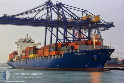
Container Ship

Current Trip
| Time Travelled | 12 days |
|---|---|
| Remaining Time | 3 days |
| Distance Travelled | 4338.52 nm |
| Remaining Distance | 1518.34 nm |
| AVG Speed | 15.1 Knop |
| MAX Speed | 18.6 Knop |
| AVG Wind | 9.4 knots |
| MAX Wind | 27.3 knots |
| MIN Temp | 17.6°C / 63.68°F |
| MAX Temp | 29.4°C / 84.92°F |
| Djupgående | 12.5 m |
| Position mottagen | 3 d sen |
Current Position
| Longitud | --- |
|---|---|
| Latitude | --- |
| Status | Under way using engine |
| Fart | 14 Knop |
| Kurs | 294.1° |
| Område | Laccadive Sea |
| Station | T-AIS |
| Position mottagen | 3 d sen |
Information
The current position of STAR is in Laccadive Sea with coordinates 6.72229° / 77.22380° as reported on 2025-02-20 22:05 by AIS to our vessel tracker app. The vessel's current speed is 14 Knop and is heading at the port of JEDDAH. The estimated time of arrival as calculated by MyShipTracking vessel tracking app is 2025-02-27 23:35 LT
The vessel STAR (IMO: 9436484, MMSI: 636020787) is a Container Ship that was built in 2009 ( 16 År gammal ). It's sailing under the flag of [LR] Liberia.
In this page you can find informations about the vessels current position, last detected port calls, and current voyage information. If the vessels is not in coverage by AIS you will find the latest position.
The current position of STAR is detected by our AIS receivers and we are not responsible for the reliability of the data. The last position was recorded while the vessel was in Coverage by the Ais receivers of our vessel tracking app.
The current draught of STAR as reported by AIS is 12.5 meters
Weather
| Temperature | 24.9°C / 76.82°F |
|---|---|
| Wind Speed | 10 knots |
| Direction | 66° ENE |
| Pressure | 1015.1 hPa |
| Humidity | 76.5 % |
| Cloud Coverage | 97 % |


Featured Company
Last Port Calls
| Port | Arrival | Departure | Time In Port |
|---|---|---|---|
| 2025-02-11 12:09 | 2025-02-11 23:45 | 11 h | |
| 2025-02-06 10:57 | 2025-02-08 00:09 | 1 d | |
| 2025-02-03 04:49 | 2025-02-03 20:44 | 15 h | |
| 2025-01-30 18:59 | 2025-01-31 12:34 | 17 h | |
| 2025-01-09 12:19 | 2025-01-12 13:04 | 3 d | |
| 2024-12-20 04:05 | 2024-12-20 19:26 | 15 h | |
| 2024-12-17 18:24 | 2024-12-18 10:41 | 16 h | |
| 2024-12-14 13:53 | 2024-12-15 03:12 | 13 h | |
| 2024-12-10 00:25 | 2024-12-11 06:05 | 1 d | |
| 2024-12-02 19:06 | 2024-12-03 04:53 | 9 h |
Most Visited Ports (Last year)
| Port | Arrivals | |
|---|---|---|
| 7 | ||
| 6 | ||
| 5 | ||
| 4 | ||
| 4 | ||
| 3 |
Last Trips
| Origin | Departure | Destination | Arrival | Distance | |
|---|---|---|---|---|---|
| 2025-02-08 08:09 | 2025-02-11 20:09 | 845.02 nm | |||
| 2025-02-04 04:44 | 2025-02-06 18:57 | 504.88 nm | |||
| 2025-01-31 21:34 | 2025-02-03 12:49 | 590.80 nm | |||
| 2025-01-12 05:04 | 2025-01-31 03:59 | 6459.28 nm | |||
| 2024-12-21 04:26 | 2025-01-09 04:19 | 6281.34 nm | |||
| 2024-12-18 18:41 | 2024-12-20 13:05 | 578.51 nm | |||
| 2024-12-15 11:12 | 2024-12-18 02:24 | 518.92 nm | |||
| 2024-12-11 14:05 | 2024-12-14 21:53 | 339.60 nm | |||
| 2024-12-03 13:53 | 2024-12-10 08:25 | 641.69 nm | |||
| 2024-11-15 18:48 | 2024-12-03 04:06 | 6212.10 nm |
Events
| Tid | Event | Detaljer | Position / Dest | Information |
|---|---|---|---|---|
| 2025-02-20 22:10 | Status ändrad | Default Under way using engine |
6.72972 / 77.20702
SAJED
|
Fart: 14 kn Kurs: 294.1° |
| 2025-02-20 22:05 | UTANFÖR täckningsområde |
6.72229 / 77.22380
Laccadive Sea
SAJED
|
Fart: 14 kn Kurs: 294.1° |
|
| 2025-02-20 19:33 | Status ändrad | Under way using engine Default |
6.47578 / 77.76581
SAJED
|
Fart: 14.2 kn Kurs: 292° |
| 2025-02-20 19:11 | Status ändrad | Default Under way using engine |
6.43957 / 77.84595
SAJED
|
Fart: 14.1 kn Kurs: 292° |
| 2025-02-20 18:36 | Status ändrad | Under way using engine Default |
6.38684 / 77.97446
SAJED
|
Fart: 14.3 kn Kurs: 292° |
| 2025-02-20 18:26 | Status ändrad | Default Under way using engine |
6.37122 / 78.01313
SAJED
|
Fart: 14.2 kn Kurs: 292.4° |
| 2025-02-20 18:04 | Byter havsområde | Indian part of the Laccadive Sea Sri Lankan part of the Laccadive Sea |
6.33841 / 78.09188
Laccadive Sea
SAJED
|
Fart: 14.3 kn Kurs: 296.7° |
| 2025-02-20 17:51 | Djupgående ändrat | 12.5 12.7 |
6.31434 / 78.14214
SAJED
|
Fart: 14.4 kn Kurs: 295.9° |
| 2025-02-20 17:43 | Status ändrad | Under way using engine Default |
6.30086 / 78.17050
SAJED
|
Fart: 14.3 kn Kurs: 294° |
| 2025-02-20 17:38 | Status ändrad | Default Under way using engine |
6.29218 / 78.18886
SAJED
|
Fart: 14.4 kn Kurs: 293.8° |